 |
|
| Ellington Airport |
| IATA: K7B9 – ICAO: 7B9 – FAA LID: 7B9 |
| Summary |
| Airport type |
Privately-owned |
| Owner |
J.L.M. Associates |
| Operator |
Larry Durocher |
| Location |
Ellington, Connecticut |
| Elevation AMSL |
253 ft / 77 m |
| Coordinates |
41°55′25.5″N 72°27′24.6″W / 41.92375°N 72.456833°W / 41.92375; -72.456833Coordinates: 41°55′25.5″N 72°27′24.6″W / 41.92375°N 72.456833°W / 41.92375; -72.456833 |
| Website |
http://www.ellingtonairport.com |
| Runways |
| Direction |
Length |
Surface |
| ft |
m |
| 1/19 |
1,800 |
50 |
Asphalt |
Ellington Airport (IATA: 7B9, ICAO: K7B9, FAA LID: 7B9) is a privately-owned and -operated airport located Ellington, Connecticut, a town in Tolland County, Connecticut.
The airport, which is open to the public,is one of two Connecticut airports that is state certified as a parachute jump zone. Connecticut Parachutists Inc. has its home base at the airport.
For the 12-month period ending July 31, 2008, the airport averaged 80 aircraft operations per day: 99% general aviation, 1% air taxi and 1% transient general aviation. There are 36 aircraft based at this airport: 20 single engine, 8 ultralights and 8 helicopters.
The above content comes from Wikipedia and is published under free licenses – click here to read more.
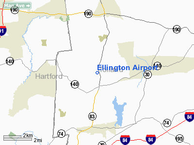
Location
& QuickFacts
|
FAA
Information Effective: |
2006-09-28 |
|
Airport
Identifier: |
7B9 |
|
Longitude/Latitude: |
072-27-25.3030W/41-55-28.3490N
-72.457029/41.924541 (Estimated) |
|
Elevation: |
253 ft / 77.11 m (Estimated) |
|
Land: |
15 acres |
|
From
nearest city: |
2 nautical miles N of Ellington, CT |
|
Location: |
Tolland County, CT |
|
Magnetic Variation: |
15W (1985) |
Owner
& Manager
|
Ownership: |
Privately owned |
|
Owner: |
J.l.m. Assoc |
|
Address: |
73 Sergeant St
Holyoke, MA 01040 |
|
Phone
number: |
413-539-9861 |
|
Manager: |
Larry Durocher |
|
Address: |
P.o. Box 13
Southwick, MA 01077 |
|
Phone number: |
413-569-3928 |
Airport
Operations and Facilities
|
Airport
Use: |
Open to public |
|
Wind
indicator: |
Yes |
|
Segmented
Circle: |
No |
|
Control
Tower: |
No |
|
Attendance
Schedule: |
ALL/ALL/0800-1800 |
|
Lighting
Schedule: |
DUSK-2400
NSTD LIRL RY 01/19 OPERATES DUSK - 0000; AFTER 0000 FOR
NSTD LIRL RY 01/19 CALL 860-871-2054. |
|
Sectional
chart: |
New York |
|
Region: |
ANE - New England |
|
Traffic
Pattern Alt: |
1000 ft |
|
Boundary
ARTCC: |
ZBW - Boston |
|
Tie-in
FSS: |
BDR - Bridgeport |
|
FSS
Phone: |
866-293-5149 |
|
FSS
Toll Free: |
1-800-WX-BRIEF |
|
NOTAMs
Facility: |
BDR (NOTAM-d service avaliable) |
Airport
Communications
|
CTAF: |
123.000 |
|
Unicom: |
123.000 |
Airport
Services
|
Fuel
available: |
100LL |
|
Airframe
Repair: |
MAJOR |
|
Power
Plant Repair: |
MAJOR |
|
Runway Information
Runway 01/19
|
Dimension: |
1800 x 50 ft / 548.6 x 15.2 m |
|
Surface: |
ASPH, Fair Condition |
|
Weight
Limit: |
Single wheel: 9000 lbs. |
|
Edge
Lights: |
Non-standard lighting system
NSTD LIRL DUE TO SPACING AND COLOR VARIATION. |
|
|
Runway 01 |
Runway 19 |
|
Traffic
Pattern: |
Left |
Left |
|
Markings: |
Numbers only, Fair Condition |
Numbers only, Fair Condition |
|
Obstruction: |
33 ft trees, 440.0 ft from runway, 60 ft left
of centerline, 7:1 slope to clear
+25 FT BRUSH 25 FT FROM THLD; 93 FT LEFT; 8 FT SEASONAL CORN
CROP 150 FT FROM THLD ACROSS RY. +8 FT BRUSH 52 FT FROM THLD. |
67 ft trees, 1400.0 ft from runway, 240 ft
left of centerline, 17:1 slope to clear
+10 FT BRUSH 50 FT FROM THLD 20 FT RIGHT; +5 FT BRUSH 50 FT
FROM THLD. |
|
Radio Navigation
Aids
|
ID |
Type |
Name |
Ch |
Freq |
Var |
Dist |
|
GBR |
FAN MARKER |
Sheffield |
|
|
13W |
42.3 nm |
|
PSF |
FAN MARKER |
Abyss |
|
|
13W |
46.4 nm |
|
HF |
NDB |
Lomis |
|
244.00 |
15W |
18.9 nm |
|
MMK |
NDB |
Meriden |
|
238.00 |
14W |
29.9 nm |
|
TBY |
NDB |
Waterbury |
|
257.00 |
14W |
38.9 nm |
|
ORE |
NDB |
Orange |
|
205.00 |
15W |
39.5 nm |
|
SFZ |
NDB |
Central |
|
241.00 |
15W |
43.3 nm |
|
GBR |
NDB |
Great Barrington |
|
395.00 |
14W |
45.0 nm |
|
DXT |
NDB |
Dalton |
|
370.00 |
15W |
45.7 nm |
|
FIT |
NDB |
Fitchburg |
|
365.00 |
15W |
48.9 nm |
|
HFD |
VOR/DME |
Hartford |
096X |
114.90 |
13W |
17.5 nm |
|
PUT |
VOR/DME |
Putnam |
121X |
117.40 |
14W |
27.5 nm |
|
ORW |
VOR/DME |
Norwich |
037X |
110.00 |
14W |
30.2 nm |
|
CTR |
VOR/DME |
Chester |
098X |
115.10 |
13W |
31.1 nm |
|
MAD |
VOR/DME |
Madison |
041X |
110.40 |
13W |
38.2 nm |
|
GON |
VOR/DME |
Groton |
45Y |
110.85 |
14W |
40.1 nm |
|
HVN |
VOR/DME |
New Haven |
035X |
109.80 |
13W |
44.2 nm |
|
BDL |
VORTAC |
Bradley |
027X |
109.00 |
14W |
10.4 nm |
|
CEF |
VORTAC |
Westover |
87X |
114.00 |
14W |
16.7 nm |
|
BAF |
VORTAC |
Barnes |
077X |
113.00 |
14W |
18.4 nm |
|
GDM |
VORTAC |
Gardner |
043X |
110.60 |
14W |
41.4 nm |
|
PVD |
VORTAC |
Providence |
103X |
115.60 |
14W |
47.6 nm |
|
BDL |
VOT |
Bradley Intl |
|
111.40 |
|
10.2 nm |
|
HFD |
VOT |
Hartford |
|
108.20 |
|
14.3 nm |
|
ORH |
VOT |
Worcester |
|
108.20 |
|
33.4 nm |
|
GON |
VOT |
Groton |
|
110.25 |
|
40.4 nm |
|
PVD |
VOT |
Providence |
|
108.20 |
|
47.7 nm |
Remarks
- EXTENSIVE
HELICOPTER TRNG OPS.
- NON-STD
THR LGTS.
- EXTENSIVE
PARACHUTE JUMPING ACTVTY FRI/SAT/SUN AND OCCASIONAL WEEKDAYS.
- HANGARS
EAST OF RUNWAY PENETRATE PART 77 SURFACES (7:1 SIDE SLOPES) RWY 19 APPROACH
END
- VFR
USE ONLY.
Based Aircraft
|
Aircraft
based on field: |
36 |
|
Single
Engine Airplanes: |
20 |
|
Helicopters: |
8 |
|
Ultralights: |
8 |
Operational Statistics
|
Aircraft
Operations: |
80/Day |
|
Air Taxi: |
0.1% |
|
General
Aviation Local: |
98.9% |
|
General
Aviation Itinerant: |
1.0% |
Ellington Airport
Address:
Tolland County, CT
Tel:
413-539-9861,
413-569-3928
Images
and information placed above are from
http://www.airport-data.com/airport/7B9/
We
thank them for the data!
| General
Info |
| Country |
United
States |
| State |
CONNECTICUT
|
| FAA ID |
7B9
|
| Latitude |
41-55-28.349N
|
| Longitude |
072-27-25.303W
|
| Elevation |
253 feet
|
| Near City |
ELLINGTON
|
We don't guarantee the information is fresh and accurate. The data may
be wrong or outdated.
For more up-to-date information please refer to other sources.
|
|


