 |
|
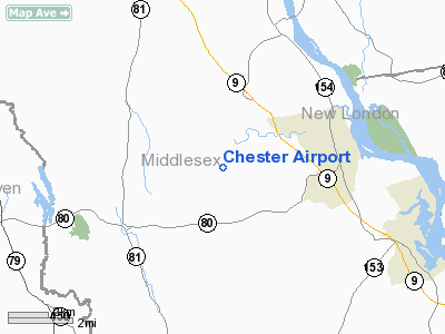
| Chester Airport |
| IATA: none – ICAO: KSNC – FAA LID: SNC |
| Summary |
| Airport type |
Public |
| Owner |
Whelen Aviation |
| Location |
Chester, Connecticut |
| Elevation AMSL |
416 ft / 127 m |
| Coordinates |
41°23′02″N 072°30′21″W / 41.38389°N 72.50583°W / 41.38389; -72.50583 |
| Runways |
| Direction |
Length |
Surface |
| ft |
m |
| 17/35 |
2,566 |
782 |
Asphalt |
| Statistics (2000) |
| Aircraft operations |
20,800 |
| Based aircraft |
115 |
| Source: Federal Aviation Administration |
Chester Airport (ICAO: KSNC, FAA LID: SNC) is a public use airport located three miles (5 km) southwest of the central business district of Chester, a town in Middlesex County, Connecticut, United States. It is privately owned by Whelen Aviation.
Although most U.S. airports use the same three-letter location identifier for the FAA and IATA, Chester Airport is assigned SNC by the FAA but has no designation from the IATA (which assigned SNC to General Ulpiano Paez Airport in Salinas, Ecuador).
Facilities and aircraft
Chester Airport covers an area of 146 acres (59 ha) which contains one asphalt paved runway (17/35) measuring 2,566 x 50 ft (782 x 15 m).
For the 12-month period ending August 21, 2000, the airport had 20,800 aircraft operations, an average of 56 per day: 80% general aviation and 20% air taxi. There are 115 aircraft based at this airport: 87% single engine, 9% multi-engine, 3% helicopters and 2% ultralights.
The above content comes from Wikipedia and is published under free licenses – click here to read more.
Location
& QuickFacts
|
FAA
Information Effective: |
2006-09-28 |
|
Airport
Identifier: |
SNC |
|
Longitude/Latitude: |
072-30-21.2200W/41-23-02.0570N
-72.505894/41.383905 (Estimated) |
|
Elevation: |
416 ft / 126.80 m (Surveyed) |
|
Land: |
146 acres |
|
From
nearest city: |
3 nautical miles SW of Chester, CT |
|
Location: |
Middlesex County, CT |
|
Magnetic Variation: |
14W (1985) |
Owner
& Manager
|
Ownership: |
Privately owned |
|
Owner: |
Whelen Aviation |
|
Address: |
Winthrop Road
Chester, CT 06412 |
|
Phone number: |
860-526-4321 |
|
Manager: |
James Olson |
|
Address: |
Winthrop Road
Chester, CT 06412 |
|
Phone number: |
860-526-4321 |
Airport
Operations and Facilities
|
Airport
Use: |
Open to public |
|
Wind
indicator: |
Yes |
|
Segmented
Circle: |
No |
|
Control
Tower: |
No |
|
Attendance
Schedule: |
APR-OCT/ALL/0800-2000,NOV-MAR/ALL/0800-1800 |
|
Lighting
Schedule: |
DUSK-DAWN |
|
Beacon
Color: |
Clear (unlighted land airport)
ROTG BCN IS CLEAR STROBE. |
|
Sectional
chart: |
New York |
|
Region: |
ANE - New England |
|
Boundary
ARTCC: |
ZBW - Boston |
|
Responsible
ARTCC: |
ZNY - New York |
|
Tie-in
FSS: |
BDR - Bridgeport |
|
FSS
on Airport: |
No |
|
FSS
Phone: |
866-293-5149 |
|
FSS
Toll Free: |
1-800-WX-BRIEF |
|
NOTAMs
Facility: |
SNC (NOTAM-d service avaliable) |
|
Federal Agreements: |
N |
Airport
Communications
|
CTAF: |
122.725 |
|
Unicom: |
122.725 |
Airport
Services
|
Fuel
available: |
100LL80 A |
|
Airframe
Repair: |
MAJOR |
|
Power
Plant Repair: |
MAJOR |
|
Bottled
Oxygen: |
NONE |
|
Bulk
Oxygen: |
NONE |
|
Runway Information
Runway 17/35
|
Dimension: |
2566 x 50 ft / 782.1 x 15.2 m |
|
Surface: |
ASPH, Good Condition |
|
Weight
Limit: |
Single wheel: 8500 lbs. |
|
Edge
Lights: |
Non-standard lighting system
NSTD MIRL; NO THLD LGTS. |
|
|
Runway 17 |
Runway 35 |
|
Longitude: |
072-30-26.6980W |
072-30-15.6570W |
|
Latitude: |
41-23-14.0580N |
41-22-50.1100N |
|
Elevation: |
395.00 ft |
408.00 ft |
|
Alignment: |
127 |
127 |
|
Traffic
Pattern: |
Left |
Left |
|
Markings: |
Nonstandard, Fair Condition
/35 UNICOM FREQ MARKED ON RY. |
Nonstandard, Fair Condition |
|
Displaced
threshold: |
559.00 ft
DSPLCD THR MARKED BUT NOT LGTD; DSPLCD THR 5 FT HIGHER THAN
END OF RY. |
0.00
ft |
|
Runway
End Identifier: |
Yes |
Yes |
|
Centerline
Lights: |
No |
No |
|
Touchdown
Lights: |
No |
No |
|
Obstruction: |
33 ft trees, 200.0 ft from runway, 60 ft right
of centerline
+38 FT TREE, DIST 609 FT, 180 FT L, 15:1 BASED ON DSPLCD THLD.
+4
FT FENCE & BRUSH AT RY END. |
15 ft trees, 255.0 ft from runway, 3:1 slope
to clear
+3 FT BRUSH 20 FT FROM THR 15 FT L. |
|
Radio Navigation
Aids
|
ID |
Type |
Name |
Ch |
Freq |
Var |
Dist |
|
HF |
NDB |
Lomis |
|
244.00 |
15W |
16.1 nm |
|
MMK |
NDB |
Meriden |
|
238.00 |
14W |
16.4 nm |
|
TBY |
NDB |
Waterbury |
|
257.00 |
14W |
30.0 nm |
|
OP |
NDB |
Old Field Point Light |
|
316.00 |
13W |
37.0 nm |
|
FOK |
TACAN |
Suffolk Co |
047X |
|
13W |
33.3 nm |
|
MAD |
VOR/DME |
Madison |
041X |
110.40 |
13W |
9.4 nm |
|
HFD |
VOR/DME |
Hartford |
096X |
114.90 |
13W |
15.6 nm |
|
HVN |
VOR/DME |
New Haven |
035X |
109.80 |
13W |
18.6 nm |
|
GON |
VOR/DME |
Groton |
45Y |
110.85 |
14W |
20.7 nm |
|
ORW |
VOR/DME |
Norwich |
037X |
110.00 |
14W |
25.1 nm |
|
CCC |
VOR/DME |
Calverton |
119X |
117.20 |
13W |
30.4 nm |
|
BDR |
VOR/DME |
Bridgeport |
25X |
108.80 |
12W |
31.0 nm |
|
SEY |
VOR/DME |
Sandy Point |
125X |
117.80 |
15W |
44.0 nm |
|
PUT |
VOR/DME |
Putnam |
121X |
117.40 |
14W |
45.4 nm |
|
CMK |
VOR/DME |
Carmel |
113X |
116.60 |
12W |
48.9 nm |
|
HTO |
VORTAC |
Hampton |
083X |
113.60 |
13W |
29.2 nm |
|
BDL |
VORTAC |
Bradley |
027X |
109.00 |
14W |
34.5 nm |
|
BAF |
VORTAC |
Barnes |
077X |
113.00 |
14W |
47.7 nm |
|
CEF |
VORTAC |
Westover |
87X |
114.00 |
14W |
48.9 nm |
|
GON |
VOT |
Groton |
|
110.25 |
|
20.8 nm |
|
HFD |
VOT |
Hartford |
|
108.20 |
|
22.1 nm |
|
BDR |
VOT |
Bridgeport |
|
109.25 |
|
31.0 nm |
|
BDL |
VOT |
Bradley Intl |
|
111.40 |
|
34.3 nm |
|
ISP |
VOT |
Long Island Mac Arthur |
|
109.40 |
|
44.6 nm |
Remarks
Based Aircraft
|
Aircraft
based on field: |
115 |
|
Single
Engine Airplanes: |
100 |
|
Multi
Engine Airplanes: |
10 |
|
Helicopters: |
3 |
|
Ultralights: |
2 |
Operational Statistics
|
Aircraft
Operations: |
57/Day |
|
Air Taxi: |
19.7% |
|
General
Aviation Local: |
39.2% |
|
General
Aviation Itinerant: |
41.1% |
Chester Airport
Address:
Middlesex County, CT
Tel:
860-526-4321
Images
and information placed above are from
http://www.airport-data.com/airport/SNC/
We
thank them for the data!
| General
Info |
| Country |
United
States |
| State |
CONNECTICUT
|
| FAA ID |
SNC
|
| Time |
UTC-5(-4DT)
|
| Latitude |
41.383903
41� 23' 02.05" N |
| Longitude |
-72.505894
072� 30' 21.22" W |
| Elevation |
416 feet
127 meters |
| Type |
Civil
|
| Magnetic
Variation |
014� W
(01/06) |
| Beacon |
Yes
|
| Operating
Agency |
PRIVATE
|
| Operating
Hours |
SEE REMARKS
FOR OPERATING HOURS OR COMMUNICATIONS FOR POSSIBLE HOURS |
| Daylight
Savings Time |
First
Sunday in April at 0200 to last Sunday in October at 0200 local time
(Exception Arizona and that portion of Indiana in the Eastern Time
Zone) |
We don't guarantee the information is fresh and accurate. The data may
be wrong or outdated.
For more up-to-date information please refer to other sources.
|
|


