|
|
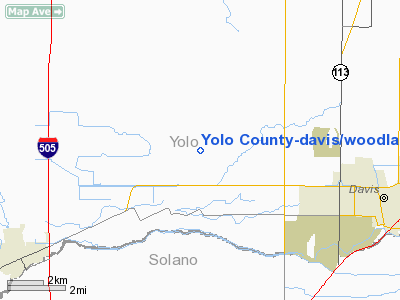
Yolo County-davis (woodland) winters Airport |
| Yolo County Airport |
| IATA: none – ICAO: KDWA – FAA LID: DWA |
| Summary |
| Airport type |
Public |
| Owner |
Yolo County |
| Serves |
Davis / Woodland / Winters, California |
| Elevation AMSL |
100 ft / 30 m |
| Coordinates |
38°34′46″N 121°51′25″W / 38.57944°N 121.85694°W / 38.57944; -121.85694 |
| Website |
www.yolocounty.org/... |
| Runways |
| Direction |
Length |
Surface |
| ft |
m |
| 16/34 |
6,000 |
1,829 |
Asphalt |
| Statistics (2002) |
| Aircraft operations |
60,360 |
| Based aircraft |
67 |
| Source: Federal Aviation Administration |
Yolo County Airport (ICAO: KDWA, FAA LID: DWA, formerly 2Q3) is a county-owned public-use airport located six miles (9.7 km) northeast of Winters, five miles (8 km) northwest of Davis and five miles (8 km) southwest of Woodland, all cities located in Yolo County, California, USA. The center of the runway is exactly 15sm, 20 degrees TC, from the freeway Y where I-505 heads due north and I-80 continues on to Sacramento on a TC of 45 degrees. Magnetic variation is 16E.
Although many U.S. airports use the same three-letter location identifier for the FAA and IATA, this facility is assigned DWA by the FAA but has no designation from the IATA.
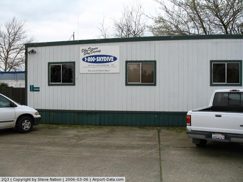
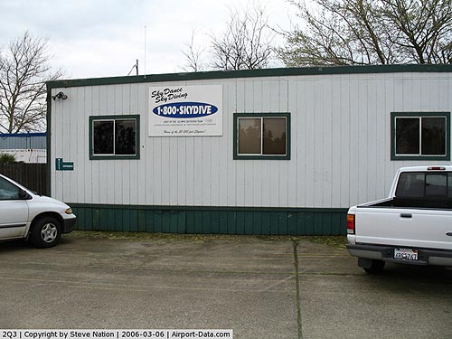
The airport is mostly used for general aviation; many flights are recreational or farm-related, with few commercial flights. The airport has an active skydiving community and is home to Skydance. The airport grounds are also home to the Yolo Sportsman Association. The YSA facility has pistol, shotgun, and rifle ranges as well as small fishable lakes. Solono Targetmasters conducts training and competitions for IDPA, and USPSA Practical shooters. The YSA clubhouse has a kitchen, vending machines, bathrooms, and a hall with seating for over 100 persons. Expect loud reports from shotguns during daylight hours.
This area is extremely flat, floods, and is very prone to fog in winter months. Expect winds from the west of 10-25kts starting 2 hours before sundown, lasting for several hours from June through September. These winds are known locally as "The Delta Breeze" and will result in temperatures dropping by up to 50 degrees before dying completely by morning. Dust and smoke picked up by these winds can reduce visibility dramatically at times. History
The airport was built by the United States Army Air Force about 1941, and was known as Winters-Davis Flight Strip. It was an emergency landing airfield for military aircraft on training flights. During the spring of 1942, the runway at Yolo was painted to represent an aircraft deck as Doolittle's Raiders used the airport to practice takeoffs. It was closed after World War II, and was turned over for local government use by the War Assets Administration (WAA).
Facilities and aircraft
Yolo County Airport, with the official Sectional Chart name of Davis/Woodland/Winters (KDWA), covers an area of 498 acres (202 ha) and has one runway at an elevation of 100 feet (30 m) above mean sea level. It has one runway designated 16/34 with an asphalt surface measuring 6,000 by 100 feet (1,829 x 30 m).
- Obstructions - Rwy 16; NONE
- Obstructions - Rwy 34: 110 ft (34 m). trees, 3,500 ft (1,100 m). from runway, 30:1 slope to clear
- REIL lights: NO
- VSI:2-light PAPI on left (3.00 degrees glide path)
- Fuel 24 hours100LL JET-A
- Parking:tiedowns
- Airframe service:MAJOR
- Powerplant service:MAJOR
For the 12-month period ending December 31, 2002, the airport had 60,360 aircraft operations, an average of 165 per day: 99% general aviation and 1% air taxi. At that time there were 67 aircraft based at this airport: 85% single-engine, 10% multi-engine, 2% jet and 3% helicopter.
The above content comes from Wikipedia and is published under free licenses – click here to read more.
|
 |
(Click on the photo to enlarge) |
Location
& QuickFacts
|
FAA
Information Effective: |
2006-09-28 |
|
Airport
Identifier: |
2Q3 |
|
Longitude/Latitude: |
121-51-23.8760W/38-34-44.6610N
-121.856632/38.579072 (Estimated) |
|
Elevation: |
98 ft / 29.87 m (Surveyed) |
|
Land: |
498 acres |
|
From
nearest city: |
6 nautical miles NE of Davis/woodland/winters,
CA |
|
Location: |
Yolo County, CA |
|
Magnetic Variation: |
16E (2000) |
Owner
& Manager
|
Ownership: |
Publicly owned |
|
Owner: |
Yolo County |
|
Address: |
625 Court St
Woodland, CA 95695 |
|
Phone
number: |
530-666-8115 |
|
Manager: |
David Daly
DAVID MORISON, ASST DIR - (530) 666-8041. |
|
Address: |
625 Court St
Woodland, CA 95695 |
|
Phone number: |
530-666-8115 |
Airport
Operations and Facilities
|
Airport
Use: |
Open to public |
|
Wind
indicator: |
Yes |
|
Segmented
Circle: |
Yes |
|
Control
Tower: |
No |
|
Attendance
Schedule: |
ALL/ALL/0800-1700
ARPT ATTENDANCE SPORADIC DURG POOR WX OCT 15 THRU MAR 15. |
|
Lighting
Schedule: |
DUSK-DAWN
MIRL RY 16/34 PRESET LOW INTST; TO INCR INTST AND ACTVT
PAPI RYS 16 & 34 - CTAF. |
|
Beacon
Color: |
Clear-Green (lighted land airport) |
|
Landing
fee charge: |
No |
|
Sectional
chart: |
San Francisco |
|
Region: |
AWP - Western-Pacific |
|
Traffic
Pattern Alt: |
1000 ft |
|
Boundary
ARTCC: |
ZOA - Oakland |
|
Tie-in
FSS: |
RIU - Rancho Murieta |
|
FSS
on Airport: |
No |
|
FSS
Phone: |
916-354-0161 |
|
FSS
Toll Free: |
1-800-WX-BRIEF |
|
NOTAMs
Facility: |
RIU (NOTAM-d service avaliable) |
|
Federal Agreements: |
NGPY |
Airport
Communications
|
CTAF: |
123.000 |
|
Unicom: |
123.000 |
Airport
Services
|
Fuel
available: |
100LLA MOGAS
FUEL AVBL 24 HRS. |
|
Airframe
Repair: |
MAJOR |
|
Power
Plant Repair: |
MAJOR |
|
Bottled
Oxygen: |
NONE |
|
Bulk
Oxygen: |
NONE |
|
Runway Information
Runway 16/34
|
Dimension: |
6000 x 100 ft / 1828.8 x 30.5 m |
|
Surface: |
ASPH, Good Condition |
|
Weight
Limit: |
Single wheel: 30000 lbs.
Dual wheel: 36000 lbs. |
|
Edge
Lights: |
Medium |
|
|
Runway 16 |
Runway 34 |
|
Longitude: |
121-51-23.8000W |
121-51-24.2000W |
|
Latitude: |
38-35-14.0500N |
38-34-14.7500N |
|
Elevation: |
96.00 ft |
98.00 ft |
|
Alignment: |
127 |
0 |
|
Traffic
Pattern: |
Right |
Left |
|
Markings: |
Basic, Fair Condition |
Basic, Fair Condition |
|
Crossing
Height: |
40.00 ft |
40.00 ft |
|
VASI: |
2-light PAPI on left side |
2-light PAPI on left side |
|
Visual
Glide Angle: |
3.00� |
3.00� |
|
Runway
End Identifier: |
No |
No |
|
Centerline
Lights: |
No |
No |
|
Touchdown
Lights: |
No |
No |
|
Obstruction: |
, 50:1 slope to clear |
110 ft trees, 3500.0 ft from runway, 30:1 slope
to clear |
|
Radio Navigation
Aids
|
ID |
Type |
Name |
Ch |
Freq |
Var |
Dist |
|
MY |
NDB |
Halow |
|
222.00 |
16E |
37.3 nm |
|
SUU |
TACAN |
Travis |
113X |
|
17E |
20.5 nm |
|
BAB |
TACAN |
Beale |
023X |
|
16E |
38.7 nm |
|
TZZ |
VOR |
Travis |
|
116.40 |
17E |
14.3 nm |
|
MCC |
VOR/DME |
Mc Clellan |
029X |
109.20 |
17E |
21.9 nm |
|
CCR |
VOR/DME |
Concord |
117X |
117.00 |
17E |
33.3 nm |
|
MYV |
VOR/DME |
Marysville |
045X |
110.80 |
16E |
33.9 nm |
|
STS |
VOR/DME |
Santa Rosa |
077X |
113.00 |
16E |
45.1 nm |
|
SAC |
VORTAC |
Sacramento |
099X |
115.20 |
17E |
16.5 nm |
|
ILA |
VORTAC |
Williams |
091X |
114.40 |
18E |
30.6 nm |
|
SGD |
VORTAC |
Scaggs Island |
058X |
112.10 |
17E |
34.2 nm |
|
MXW |
VORTAC |
Maxwell |
037X |
110.00 |
18E |
47.6 nm |
|
SMF |
VOT |
Sacramento Metropolitan |
|
111.40 |
|
14.2 nm |
|
SAC |
VOT |
Sacramento Executive |
|
111.40 |
|
17.3 nm |
Remarks
-
NO MID-FIELD TKOFS.
-
NO TGL 2200 TO 0600.
-
RY 34 CALM WIND RY.
-
NOISE ABATEMENT: NO DEP
TRUNS BLO 500 FT AGL OR BEFORE ARPT BOUNDARY ROADS 1/4 MILE BYD RY 16
& RY 34. STRAIGHT OUT DEP FOR 2 MILES BEFORE TURN RY 16 & RY
34. CROSSWIND/DOWNWIND DEP TO WEST RY 16 & RY 34.
-
LIMITED STOP & GO
LNDGS 2200 TO 0600.
-
RY 16/34 +40 FT TO +120
FT TREES & +40 FT POWER LINES UNLIGHTED; PARALLEL RY 550 FT W OF
RY CNTRLN.
Based Aircraft
|
Aircraft
based on field: |
70 |
|
Single
Engine Airplanes: |
57 |
|
Multi
Engine Airplanes: |
10 |
|
Jet Engine
Airplanes: |
3 |
Operational Statistics
|
Aircraft
Operations: |
166/Day |
|
Air Taxi: |
0.6% |
|
General
Aviation Local: |
49.7% |
|
General
Aviation Itinerant: |
49.7% |
Yolo County-davis/woodland/winters Airport
Address:
Yolo County, CA
Tel:
530-666-811
Images
and information placed above are from
http://www.airport-data.com/airport/2Q3/
We
thank them for the data!
| General
Info |
| Country |
United
States |
| State |
CALIFORNIA
|
| FAA ID |
2Q3
|
| Latitude |
38-34-44.661N
|
| Longitude |
121-51-23.876W
|
| Elevation |
98 feet
|
| Near City |
DAVIS/WOODLAND/WINTERS
|
We don't guarantee the information is fresh and accurate. The data may
be wrong or outdated.
For more up-to-date information please refer to other sources.
|
|