 |
|
| Woodlake Airport |
| IATA: none – ICAO: none – FAA LID: O42 |
| Summary |
| Airport type |
Public |
| Operator |
City of Woodlake |
| Location |
Woodlake, California |
| Elevation AMSL |
425 ft / 129.5 m |
| Coordinates |
36°23′56″N 119°06′26″W / 36.39889°N 119.10722°W / 36.39889; -119.10722Coordinates: 36°23′56″N 119°06′26″W / 36.39889°N 119.10722°W / 36.39889; -119.10722 |
| Runways |
| Direction |
Length |
Surface |
| ft |
m |
| 7/25 |
3,320 |
1,012 |
Asphalt/Gravel |
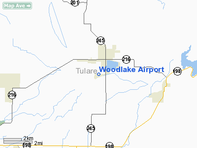
Woodlake Airport (FAA LID: O42) is a public airport located two miles (3.2 km) south of Woodlake, serving Tulare County, California, USA. This general aviation airport covers 88 acres (360,000 m) and has one runway.
The above content comes from Wikipedia and is published under free licenses – click here to read more.
Location
& QuickFacts
|
FAA
Information Effective: |
2006-09-28 |
|
Airport
Identifier: |
O42 |
|
Longitude/Latitude: |
119-06-26.3840W/36-23-55.8180N
-119.107329/36.398838 (Estimated) |
|
Elevation: |
425 ft / 129.54 m (Estimated) |
|
Land: |
88 acres |
|
From
nearest city: |
2 nautical miles S of Woodlake, CA |
|
Location: |
Tulare County, CA |
|
Magnetic Variation: |
15E (1985) |
Owner
& Manager
|
Ownership: |
Publicly owned |
|
Owner: |
City Of Woodlake |
|
Address: |
350 North Valencia Boulevard
Woodlake, CA 93286 |
|
Phone
number: |
559-564-8055 |
|
Manager: |
William Lewis
OR MIKE GIGGY 559-564-3244/ CELL-559-805-6534 FOR MAINTENANCE
MATTERS. |
|
Address: |
350 North Valencia Boulevard
Woodlake, CA 93286 |
|
Phone number: |
559-564-8055 |
Airport
Operations and Facilities
|
Airport
Use: |
Open to public |
|
Wind
indicator: |
Yes |
|
Segmented
Circle: |
Yes |
|
Control
Tower: |
No |
|
Attendance
Schedule: |
UNATTND |
|
Lighting
Schedule: |
DUSK-DAWN |
|
Beacon
Color: |
Clear-Green (lighted land airport) |
|
Landing
fee charge: |
No |
|
Sectional
chart: |
San Francisco |
|
Region: |
AWP - Western-Pacific |
|
Traffic
Pattern Alt: |
800 ft |
|
Boundary
ARTCC: |
ZOA - Oakland |
|
Tie-in
FSS: |
RIU - Rancho Murieta |
|
FSS
on Airport: |
No |
|
FSS
Phone: |
916-354-0161 |
|
FSS
Toll Free: |
1-800-WX-BRIEF |
|
NOTAMs
Facility: |
RIU (NOTAM-d service avaliable) |
|
Federal Agreements: |
N |
Airport
Communications
Airport
Services
|
Fuel
available: |
100LL |
|
Airframe
Repair: |
NONE |
|
Power
Plant Repair: |
NONE |
|
Bottled
Oxygen: |
NONE |
|
Bulk
Oxygen: |
NONE |
|
Runway Information
Runway 07/25
|
Dimension: |
3320 x 50 ft / 1011.9 x 15.2 m |
|
Surface: |
ASPH-GRVL, Poor Condition
OUTER 10 FT OF EACH SIDE OF RY IS ROUGH; CRACKED & DETERIORATING. |
|
Edge
Lights: |
Low
RY 07/25 ONLY 2,720 FT BETWEEN RY 25 DSPLCD THLD AND WEST END LGTD.
RY
07/25 LIRL OTS INDEFLY. |
|
|
Runway 07 |
Runway 25 |
|
Elevation: |
422.00 ft |
425.00 ft |
|
Traffic
Pattern: |
Left |
Left |
|
Markings: |
Basic, Poor Condition
RY 07 PAVEMENT MARKINGS FADED AND ERODED IN PLACES. |
Basic, Poor Condition
RY 25 PAVEMENT MARKINGS FADED AND ERODED IN PLACES. |
|
Displaced
threshold: |
525.00 ft
RY 07 DSPLCD SFC IS GRVL WITH UNSAFE POTHOLES UNSUITABLE FOR
USE. |
600.00 ft |
|
Runway
End Identifier: |
No |
No |
|
Centerline
Lights: |
No |
No |
|
Touchdown
Lights: |
No |
No |
|
Obstruction: |
85 ft trees, 536.0 ft from runway, 30 ft left
of centerline, 3:1 slope to clear
RWY 07 APCH RATIO 20:1 TO DSPLCD THLD; APCH RATIO TO DSPLCD
THLD OVER +30 FT POLE-LINE 155 FT L 300 FT FM DSPLCD THLD
10:1.
5 FT FENCE 35 FT FM RY END 125 FT LEFT TO 125 FT RIGHT. |
15 ft road, 200.0 ft from runway, 10 ft right
of centerline
RWY 25 APCH RATIO 50:1 TO DSPLCD THLD; APCH RATIO TO DSPLCD
THLD OVER +38 FT PWR POLES 155 FT R 300 FT FM DSPLCD THLD
7:1.
PRIVATE ROAD 0-70' FROM RWY END, 0'LEFT TO 125' RIGHT.
+3'
ROAD 100-200' FROM RWY END 125' LEFT-10'RIGHT. |
|
Radio Navigation
Aids
|
ID |
Type |
Name |
Ch |
Freq |
Var |
Dist |
|
COR |
NDB |
Salyer Farms |
|
205.00 |
16E |
28.9 nm |
|
CUK |
NDB |
Academy |
|
266.00 |
14E |
32.4 nm |
|
FCH |
NDB |
Chandler |
|
344.00 |
15E |
40.1 nm |
|
NLC |
TACAN |
Lemoore |
080X |
|
16E |
41.7 nm |
|
VIS |
VOR/DME |
Visalia |
031X |
109.40 |
16E |
18.2 nm |
|
TTE |
VOR/DME |
Tule |
029X |
109.20 |
16E |
29.5 nm |
|
CZQ |
VORTAC |
Clovis |
076X |
112.90 |
15E |
44.9 nm |
|
FRA |
VORTAC |
Friant |
103X |
115.60 |
17E |
48.5 nm |
Remarks
-
TRANSITIONAL
SFC OBSTRUCTIONS; +20' PLINE 150' N OF W END.
-
AIRPORT
NOT APPROVED FOR NIGHT-USE.
Based Aircraft
|
Aircraft
based on field: |
21 |
|
Single
Engine Airplanes: |
19 |
|
Ultralights: |
2 |
Operational Statistics
|
Aircraft
Operations: |
231/Week |
|
General
Aviation Local: |
33.3% |
|
General
Aviation Itinerant: |
66.7% |
Woodlake Airport
Address:
Tulare County, CA
Tel:
559-564-8055
Images
and information placed above are from
http://www.airport-data.com/airport/O42/
We
thank them for the data!
| General
Info |
| Country |
United
States |
| State |
CALIFORNIA
|
| FAA ID |
O42
|
| Latitude |
36-23-55.818N
|
| Longitude |
119-06-26.384W
|
| Elevation |
425 feet
|
| Near City |
WOODLAKE
|
We don't guarantee the information is fresh and accurate. The data may
be wrong or outdated.
For more up-to-date information please refer to other sources.
|
|


