 |
|
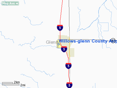
Willows-glenn County Airport |
| Willows-Glenn County Airport |
| IATA: WLW – ICAO: KWLW – FAA LID: WLW |
| Summary |
| Airport type |
Public |
| Operator |
County of Glenn |
| Location |
Willows, California |
| Elevation AMSL |
139 ft / 42.4 m |
| Coordinates |
39°30′59″N 122°13′03″W / 39.51639°N 122.2175°W / 39.51639; -122.2175Coordinates: 39°30′59″N 122°13′03″W / 39.51639°N 122.2175°W / 39.51639; -122.2175 |
| Runways |
| Direction |
Length |
Surface |
| ft |
m |
| 13/31 |
3,770 |
1,149 |
Asphalt |
| 16/34 |
4,120 |
1,255 |
Asphalt |
| Helipads |
| Number |
Length |
Surface |
| ft |
m |
| H1 |
60 |
18 |
Concrete |
Willows-Glenn County Airport (IATA: WLW, ICAO: KWLW, FAA LID: WLW), also known as Willows-Glenn Airport, is a public airport located one mile (1.6 km) south of Willows, serving Glenn County, California, USA. The general aviation airport covers 320 acres (129 ha) and has two runways and one helipad.
The above content comes from Wikipedia and is published under free licenses – click here to read more.
Location
& QuickFacts
|
FAA
Information Effective: |
2006-09-28 |
|
Airport
Identifier: |
WLW |
|
Longitude/Latitude: |
122-13-03.0380W/39-30-58.8740N
-122.217511/39.516354 (Estimated) |
|
Elevation: |
139 ft / 42.37 m (Surveyed) |
|
Land: |
320 acres |
|
From
nearest city: |
1 nautical miles W of Willows, CA |
|
Location: |
Glenn County, CA |
|
Magnetic Variation: |
17E (1985) |
Owner
& Manager
|
Ownership: |
Publicly owned |
|
Owner: |
County Of Glenn |
|
Address: |
777 N Colusa St
Willows, CA 95988 |
|
Phone
number: |
530-934-6530 |
|
Manager: |
Thomas J Tinsley
COUNTY PUBLIC WORKS DIRECTOR. |
|
Address: |
777 N Colusa St
Willows, CA 95988 |
|
Phone
number: |
530-934-6530
OFC LCTD AT COUNTY OFC IN WILLOWS ARPT PHONE (530) 934-6489. |
Airport
Operations and Facilities
|
Airport
Use: |
Open to public |
|
Wind
indicator: |
Yes |
|
Segmented
Circle: |
Yes |
|
Control
Tower: |
No |
|
Attendance
Schedule: |
ALL/ALL/0830-1630
PHONE NO. FOR ATTENDANT AFT HRS LCTD AT FUEL STN; SVC CHARGE
RQRD. |
|
Lighting
Schedule: |
DUSK-DAWN
ACTVT MIRL RY 16/34 & VASI RY 34 - CTAF. |
|
Beacon
Color: |
Clear-Green (lighted land airport) |
|
Sectional
chart: |
San Francisco |
|
Region: |
AWP - Western-Pacific |
|
Traffic
Pattern Alt: |
1000 ft |
|
Boundary
ARTCC: |
ZOA - Oakland |
|
Tie-in
FSS: |
RIU - Rancho Murieta |
|
FSS
on Airport: |
No |
|
FSS
Phone: |
916-354-0161 |
|
FSS
Toll Free: |
1-800-WX-BRIEF |
|
NOTAMs
Facility: |
RIU (NOTAM-d service avaliable) |
|
Federal Agreements: |
NGY3 |
Airport
Communications
|
CTAF: |
122.800 |
|
Unicom: |
122.800 |
Airport
Services
|
Fuel
available: |
100LL |
|
Bottled
Oxygen: |
NONE |
|
Bulk
Oxygen: |
NONE |
|
Runway Information
Runway 13/31
|
Dimension: |
4210 x 100 ft / 1283.2 x 30.5 m |
|
Surface: |
ASPH, Fair Condition |
|
Weight
Limit: |
Single wheel: 12000 lbs. |
|
|
Runway 13 |
Runway 31 |
|
Longitude: |
122-13-11.1140W |
122-12-38.7950W |
|
Latitude: |
39-31-16.3780N |
39-30-40.6000N |
|
Elevation: |
138.00 ft |
129.00 ft |
|
Alignment: |
127 |
127 |
|
Traffic
Pattern: |
Right |
Left |
|
Markings: |
Basic, Good Condition |
Basic, Good Condition |
|
Runway
End Identifier: |
No |
No |
|
Centerline
Lights: |
No |
No |
|
Touchdown
Lights: |
No |
No |
|
Obstruction: |
50 ft trees, 1000.0 ft from runway, 100 ft right
of centerline, 16:1 slope to clear |
, 50:1 slope to clear |
|
Runway 16/34
|
Dimension: |
4506 x 100 ft / 1373.4 x 30.5 m |
|
Surface: |
ASPH, Good Condition |
|
Weight
Limit: |
Single wheel: 38000 lbs.
Dual wheel: 53000 lbs. |
|
Edge
Lights: |
Medium
PERIMETER LGTS. |
|
|
Runway 16 |
Runway 34 |
|
Longitude: |
122-13-11.9200W |
122-13-10.1010W |
|
Latitude: |
39-31-21.6010N |
39-30-37.0860N |
|
Elevation: |
139.00 ft |
134.00 ft |
|
Alignment: |
127 |
127 |
|
Traffic
Pattern: |
Right |
Left |
|
Markings: |
Basic, Good Condition |
Nonstandard, Good Condition
NON-PRECISION INSTRUMENT MARKINGS MISSING AIM POINT MARKING. |
|
Crossing
Height: |
0.00 ft |
31.00 ft |
|
VASI: |
|
4-box on left side |
|
Visual
Glide Angle: |
0.00� |
3.00� |
|
Runway
End Identifier: |
No |
|
|
Centerline
Lights: |
No |
No |
|
Touchdown
Lights: |
No |
No |
|
Obstruction: |
15 ft road, 550.0 ft from runway, 23:1 slope to
clear |
, 50:1 slope to clear |
|
Helipad H1
|
Dimension: |
60 x 60 ft / 18.3 x 18.3 m |
|
Surface: |
CONC, Good Condition |
|
|
Runway H1 |
Runway |
|
Traffic
Pattern: |
Left |
Left |
|
Markings: |
Basic, Good Condition |
,
NON-PRECISION INSTRUMENT MARKINGS MISSING AIM POINT MARKING. |
|
Radio Navigation
Aids
|
ID |
Type |
Name |
Ch |
Freq |
Var |
Dist |
|
OVE |
NDB |
Oroville |
|
212.00 |
16E |
27.6 nm |
|
MY |
NDB |
Halow |
|
222.00 |
16E |
35.1 nm |
|
PBT |
NDB |
Proberta |
|
338.00 |
16E |
35.9 nm |
|
LOP |
NDB |
Lampson |
|
217.00 |
16E |
44.1 nm |
|
BAB |
TACAN |
Beale |
023X |
|
16E |
42.8 nm |
|
CIC |
VOR/DME |
Chico |
035X |
109.80 |
16E |
23.7 nm |
|
MYV |
VOR/DME |
Marysville |
045X |
110.80 |
16E |
39.1 nm |
|
MXW |
VORTAC |
Maxwell |
037X |
110.00 |
18E |
11.9 nm |
|
ILA |
VORTAC |
Williams |
091X |
114.40 |
18E |
28.2 nm |
|
RBL |
VORTAC |
Red Bluff |
104X |
115.70 |
18E |
35.0 nm |
Remarks
Based Aircraft
|
Aircraft
based on field: |
59 |
|
Single
Engine Airplanes: |
57 |
|
Helicopters: |
2 |
Operational Statistics
|
Aircraft
Operations: |
92/Day |
|
Air Taxi: |
1.5% |
|
General
Aviation Local: |
59.1% |
|
General
Aviation Itinerant: |
39.4% |
Willows-glenn County Airport
Address:
Glenn County, CA
Tel:
530-934-6530
Images
and information placed above are from
http://www.airport-data.com/airport/WLW/
We
thank them for the data!
| General
Info |
| Country |
United
States |
| State |
CALIFORNIA
|
| FAA ID |
WLW
|
| Latitude |
39-30-58.874N
|
| Longitude |
122-13-03.038W
|
| Elevation |
139 feet
|
| Near City |
WILLOWS
|
We don't guarantee the information is fresh and accurate. The data may
be wrong or outdated.
For more up-to-date information please refer to other sources.
|
|


