 |
|
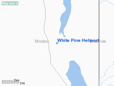
Location
& QuickFacts
|
FAA
Information Effective: |
2006-09-28 |
|
Airport
Identifier: |
6CL2 |
|
Longitude/Latitude: |
120-05-50.7900W/41-19-49.6300N
-120.097442/41.330453 (Estimated) |
|
Elevation: |
4550 ft / 1386.84 m (Estimated) |
|
Land: |
1 acres |
|
From
nearest city: |
3 nautical miles NE of Eagleville, CA |
|
Location: |
Modoc County, CA |
|
Magnetic Variation: |
17E (1990) |
Owner
& Manager
|
Ownership: |
Privately owned |
|
Owner: |
White Pine Ranch |
|
Address: |
2500 Spinnaker Rd
Reno, NV 89509 |
|
Address: |
|
Airport
Operations and Facilities
|
Airport
Use: |
Private |
|
Segmented
Circle: |
No |
|
Control
Tower: |
No |
|
Attendance
Schedule: |
UNATNDD |
|
Sectional
chart: |
Klamath Falls |
|
Region: |
AWP - Western-Pacific |
|
Boundary
ARTCC: |
ZSE - Seattle |
|
Tie-in
FSS: |
RNO - Reno |
|
FSS
on Airport: |
No |
|
FSS
Phone: |
775-858-1300 |
|
FSS
Toll Free: |
1-800-WX-BRIEF |
|
Runway Information
Helipad H1
|
Dimension: |
25 x 25 ft / 7.6 x 7.6 m |
|
Surface: |
TURF, |
|
|
Runway H1 |
Runway |
|
Traffic
Pattern: |
Left |
Left |
|
Radio Navigation
Aids
|
ID |
Type |
Name |
Ch |
Freq |
Var |
Dist |
|
ARU |
NDB |
Alturas |
|
215.00 |
18E |
22.4 nm |
Remarks
White Pine Heliport
Address:
Modoc County, CA
Tel:
Images
and information placed above are from
http://www.airport-data.com/airport/6CL2/
We
thank them for the data!
| General
Info |
| Country |
United
States |
| State |
CALIFORNIA
|
| FAA ID |
6CL2
|
| Latitude |
41-19-49.630N
|
| Longitude |
120-05-50.790W
|
| Elevation |
4550 feet
|
| Near City |
EAGLEVILLE
|
We don't guarantee the information is fresh and accurate. The data may
be wrong or outdated.
For more up-to-date information please refer to other sources.
|
|


