 |
|
West Side Hospital Heliport |
|
|
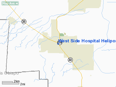
Location
& QuickFacts
|
FAA
Information Effective: |
2006-09-28 |
|
Airport
Identifier: |
07CA |
|
Longitude/Latitude: |
119-27-03.4270W/35-08-19.8810N
-119.450952/35.138856 (Estimated) |
|
Elevation: |
850 ft / 259.08 m (Estimated) |
|
Land: |
0 acres |
|
From
nearest city: |
1 nautical miles S of Taft, CA |
|
Location: |
Kern County, CA |
|
Magnetic Variation: |
14E (1985) |
Owner
& Manager
|
Ownership: |
Privately owned |
|
Owner: |
West Side Hospital District |
|
Address: |
110 E. North St
Taft, CA 93268 |
|
Phone
number: |
805-763-4211 |
|
Manager: |
West Side Hospital District |
|
Address: |
110 E. North St
Taft, CA 93268 |
|
Phone number: |
805-763-4211 |
Airport
Operations and Facilities
|
Airport
Use: |
Private
MEDICAL. |
|
Wind
indicator: |
Yes |
|
Segmented
Circle: |
No |
|
Control
Tower: |
No |
|
Attendance
Schedule: |
ALL/ALL/ALL |
|
Lighting
Schedule: |
PHONE REQ
FOR PERIMETER LGTS CALL 805-763-4211. |
|
Landing fee charge: |
No |
|
Sectional chart: |
Los Angeles |
|
Region: |
AWP - Western-Pacific |
|
Boundary ARTCC: |
ZLA - Los Angeles |
|
Tie-in FSS: |
RIU - Rancho Murieta |
|
FSS on Airport: |
No |
|
FSS Phone: |
916-354-0161 |
|
FSS Toll Free: |
1-800-WX-BRIEF |
Airport
Communications
|
Runway Information
Helipad H1
|
Dimension: |
40 x 40 ft / 12.2 x 12.2 m |
|
Surface: |
CONC, |
|
|
Runway H1 |
Runway |
|
Traffic
Pattern: |
Left |
Left |
|
Radio Navigation
Aids
|
ID |
Type |
Name |
Ch |
Freq |
Var |
Dist |
|
FLW |
VORTAC |
Fellows |
122X |
117.50 |
16E |
20.6 nm |
|
EHF |
VORTAC |
Shafter |
101X |
115.40 |
14E |
27.1 nm |
|
GMN |
VORTAC |
Gorman |
108X |
116.10 |
16E |
35.3 nm |
|
AVE |
VORTAC |
Avenal |
118X |
117.10 |
16E |
40.0 nm |
|
RZS |
VORTAC |
San Marcus |
096X |
114.90 |
14E |
41.0 nm |
|
GVO |
VORTAC |
Gaviota |
085X |
113.80 |
16E |
48.3 nm |
|
BFL |
VOT |
Bakersfield |
|
111.20 |
|
26.2 nm |
Remarks
West Side Hospital Heliport
Address:
Kern County, CA
Tel:
805-763-4211
Images
and information placed above are from
http://www.airport-data.com/airport/07CA/
We
thank them for the data!
| General
Info |
| Country |
United
States |
| State |
CALIFORNIA
|
| FAA ID |
07CA
|
| Latitude |
35-08-19.881N
|
| Longitude |
119-27-03.427W
|
| Elevation |
850 feet
|
| Near City |
TAFT
|
We don't guarantee the information is fresh and accurate. The data may
be wrong or outdated.
For more up-to-date information please refer to other sources.
|
|


