 |
|
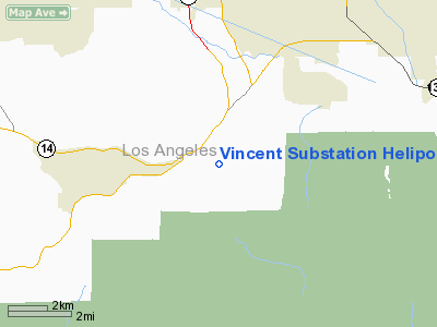
Vincent Substation Heliport |
|
|
Location
& QuickFacts
|
FAA
Information Effective: |
2006-09-28 |
|
Airport
Identifier: |
26CN |
|
Longitude/Latitude: |
118-06-57.2600W/34-29-09.9770N
-118.115906/34.486105 (Estimated) |
|
Elevation: |
3244 ft / 988.77 m (Estimated) |
|
Land: |
0 acres |
|
From
nearest city: |
3 nautical miles E of Acton, CA |
|
Location: |
Los Angeles County, CA |
|
Magnetic Variation: |
14E (1985) |
Owner
& Manager
|
Ownership: |
Privately owned |
|
Owner: |
Southern California Edison Co |
|
Address: |
33301 East Angeles Forest Hwy
Palmdale, CA 93550 |
|
Phone
number: |
661-575-2910 |
|
Manager: |
Art Bradbury |
|
Address: |
2161 East Avion St
Ontario, CA 91761 |
|
Phone number: |
909-974-4691 |
Airport
Operations and Facilities
|
Airport Use: |
Private |
|
Wind indicator: |
Yes |
|
Segmented Circle: |
No |
|
Control Tower: |
No |
|
Attendance Schedule: |
UNATNDD |
|
Landing fee charge: |
No |
|
Sectional chart: |
Los Angeles |
|
Region: |
AWP - Western-Pacific |
|
Boundary ARTCC: |
ZLA - Los Angeles |
|
Tie-in FSS: |
RAL - Riverside |
|
FSS on Airport: |
No |
|
FSS Phone: |
951-351-3020 |
|
FSS Toll Free: |
1-800-WX-BRIEF |
Airport
Services
|
Airframe
Repair: |
NONE |
|
Power
Plant Repair: |
NONE |
|
Runway Information
Helipad H1
|
Dimension: |
20
x 20 ft / 6.1 x 6.1 m |
|
Surface: |
CONC, |
|
|
Runway H1 |
Runway |
|
Traffic
Pattern: |
Left |
Left |
|
Radio Navigation
Aids
|
ID |
Type |
Name |
Ch |
Freq |
Var |
Dist |
|
GWF |
NDB |
Gen William J Fox |
|
282.00 |
15E |
16.0 nm |
|
PAI |
NDB |
Pacoima |
|
370.00 |
15E |
20.1 nm |
|
EMT |
NDB |
El Monte |
|
359.00 |
15E |
24.3 nm |
|
CPM |
NDB |
Compton |
|
378.00 |
15E |
36.5 nm |
|
SB |
NDB |
Petis |
|
397.00 |
14E |
45.3 nm |
|
RAL |
VOR |
Riverside |
|
112.40 |
15E |
46.1 nm |
|
VNY |
VOR/DME |
Van Nuys |
078X |
113.10 |
15E |
24.4 nm |
|
SMO |
VOR/DME |
Santa Monica |
045X |
110.80 |
15E |
33.2 nm |
|
VCV |
VOR/DME |
Victorville |
031X |
109.40 |
14E |
36.5 nm |
|
PMD |
VORTAC |
Palmdale |
092X |
114.50 |
15E |
9.1 nm |
|
LHS |
VORTAC |
Lake Hughes |
021X |
108.40 |
15E |
25.7 nm |
|
POM |
VORTAC |
Pomona |
041X |
110.40 |
15E |
29.5 nm |
|
EDW |
VORTAC |
Edwards |
111X |
116.40 |
15E |
35.3 nm |
|
LAX |
VORTAC |
Los Angeles |
083X |
113.60 |
15E |
36.8 nm |
|
FIM |
VORTAC |
Fillmore |
072X |
112.50 |
15E |
38.7 nm |
|
GMN |
VORTAC |
Gorman |
108X |
116.10 |
16E |
41.5 nm |
|
SLI |
VORTAC |
Seal Beach |
104X |
115.70 |
15E |
42.4 nm |
|
PDZ |
VORTAC |
Paradise |
059X |
112.20 |
15E |
44.9 nm |
|
LAX |
VOT |
San Pedro Hill |
|
113.90 |
|
45.8 nm |
Remarks
-
REQUEST;
APCH COURSE USE 360/180 DEG & FOR DEPARTURE COURSE 180/360 DEG.
Vincent Substation Heliport
Address:
Los Angeles County, CA
Tel:
661-575-2910,
909-974-4691
Images
and information placed above are from
http://www.airport-data.com/airport/26CN/
We
thank them for the data!
| General
Info |
| Country |
United
States |
| State |
CALIFORNIA
|
| FAA ID |
26CN
|
| Latitude |
34-29-09.977N
|
| Longitude |
118-06-57.260W
|
| Elevation |
3244 feet
|
| Near City |
ACTON
|
We don't guarantee the information is fresh and accurate. The data may
be wrong or outdated.
For more up-to-date information please refer to other sources.
|
|


