 |
|
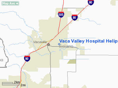
Vaca Valley Hospital Heliport |
|
|
Location
& QuickFacts
|
FAA
Information Effective: |
2006-09-28 |
|
Airport
Identifier: |
CL96 |
|
Longitude/Latitude: |
121-57-04.8760W/38-21-20.6780N
-121.951354/38.355744 (Estimated) |
|
Elevation: |
110 ft / 33.53 m (Estimated) |
|
Land: |
0 acres |
|
From
nearest city: |
2 nautical miles E of Vacaville, CA |
|
Location: |
Solano County, CA |
|
Magnetic Variation: |
16E (1985) |
Owner
& Manager
|
Ownership: |
Privately owned |
|
Owner: |
Vaca Valley Hospital |
|
Address: |
1000 Nut Tree Road
Vacaville, CA 95687 |
|
Phone
number: |
707-446-4000 |
|
Manager: |
Pamela A. Molano |
|
Address: |
1000 Nut Tree Road
Vacaville, CA 95687 |
|
Phone number: |
707-446-5716 |
Airport
Operations and Facilities
|
Airport
Use: |
Private
MEDICAL |
|
Wind
indicator: |
Yes |
|
Segmented
Circle: |
No |
|
Control
Tower: |
No |
|
Attendance
Schedule: |
ALL/ALL/ALL |
|
Lighting
Schedule: |
PHONE REQ
FOR PERIMETER LGTS CALL 707-446-5710. |
|
Sectional
chart: |
San Francisco |
|
Region: |
AWP - Western-Pacific |
|
Boundary
ARTCC: |
ZOA - Oakland |
|
Tie-in
FSS: |
RIU - Rancho Murieta |
|
FSS
Phone: |
916-354-0161 |
|
FSS
Toll Free: |
1-800-WX-BRIEF |
|
Runway Information
Helipad H1
|
Dimension: |
40 x 40 ft / 12.2 x 12.2 m |
|
Surface: |
CONC, |
|
|
Runway H1 |
Runway |
|
Traffic
Pattern: |
Left |
Left |
|
Radio Navigation
Aids
|
ID |
Type |
Name |
Ch |
Freq |
Var |
Dist |
|
LV |
NDB |
Reiga |
|
374.00 |
16E |
41.8 nm |
|
TCY |
NDB |
Tracy |
|
203.00 |
15E |
46.5 nm |
|
SUU |
TACAN |
Travis |
113X |
|
17E |
6.6 nm |
|
TZZ |
VOR |
Travis |
|
116.40 |
17E |
6.7 nm |
|
CCR |
VOR/DME |
Concord |
117X |
117.00 |
17E |
19.2 nm |
|
MCC |
VOR/DME |
Mc Clellan |
029X |
109.20 |
17E |
31.8 nm |
|
STS |
VOR/DME |
Santa Rosa |
077X |
113.00 |
16E |
41.5 nm |
|
MYV |
VOR/DME |
Marysville |
045X |
110.80 |
16E |
48.0 nm |
|
SFO |
VOR/DME |
San Francisco |
105X |
115.80 |
17E |
48.6 nm |
|
SAC |
VORTAC |
Sacramento |
099X |
115.20 |
17E |
19.6 nm |
|
SGD |
VORTAC |
Scaggs Island |
058X |
112.10 |
17E |
22.6 nm |
|
OAK |
VORTAC |
Oakland |
115X |
116.80 |
17E |
40.0 nm |
|
SAU |
VORTAC |
Sausalito |
109X |
116.20 |
17E |
40.4 nm |
|
ILA |
VORTAC |
Williams |
091X |
114.40 |
18E |
43.1 nm |
|
PYE |
VORTAC |
Point Reyes |
084X |
113.70 |
17E |
46.4 nm |
|
LIN |
VORTAC |
Linden |
095X |
114.80 |
17E |
47.8 nm |
|
ECA |
VORTAC |
Manteca |
107X |
116.00 |
17E |
48.4 nm |
|
SAC |
VOT |
Sacramento Executive |
|
111.40 |
|
23.4 nm |
|
SMF |
VOT |
Sacramento Metropolitan |
|
111.40 |
|
26.3 nm |
|
SFO |
VOT |
San Francisco Intl |
|
111.00 |
|
48.6 nm |
Remarks
-
PRVDD VFR/PVT
USE ONLY; HELIPAD LOCATED ON SITE OR ELEVATED SO AS TO PROVIDE OBSTRUCTION
FREE APCH & TRANSITIONAL SFC AS RECOMMENDED IN AC 150/5390-1B.
Vaca Valley Hospital Heliport
Address: Sitka
County, AK
Tel:
707-446-4000,
707-446-5716
Images
and information placed above are from
http://www.airport-data.com/airport/CL96/
We
thank them for the data!
| General
Info |
| Country |
United
States |
| State |
CALIFORNIA
|
| FAA ID |
CL96
|
| Latitude |
38-21-20.678N
|
| Longitude |
121-57-04.876W
|
| Elevation |
110 feet
|
| Near City |
VACAVILLE
|
We don't guarantee the information is fresh and accurate. The data may
be wrong or outdated.
For more up-to-date information please refer to other sources.
|
|


