 |
|
|
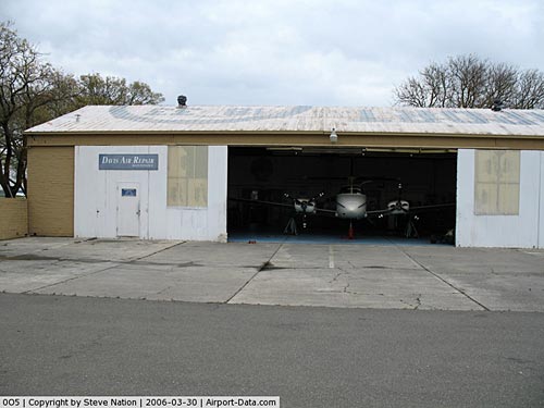 |
(Click on the photo to enlarge) |
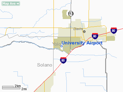
Location
& QuickFacts
|
FAA
Information Effective: |
2006-09-28 |
|
Airport
Identifier: |
0O5 |
|
Longitude/Latitude: |
121-47-11.3660W/38-31-53.2640N
-121.786491/38.531462 (Estimated) |
|
Elevation: |
68 ft / 20.73 m (Surveyed) |
|
Land: |
95 acres |
|
From
nearest city: |
2 nautical miles W of Davis, CA |
|
Location: |
Yolo County, CA |
|
Magnetic Variation: |
16E (1985) |
Owner
& Manager
|
Ownership: |
Publicly owned |
|
Owner: |
University Of California |
|
Address: |
Business & Finance - Tb206
Davis, CA 95616 |
|
Phone
number: |
530-752-6608 |
|
Manager: |
Clifford Contreras |
|
Address: |
Transp. & Parking Services, 1 Shields
Ave
Davis, CA 95616 |
|
Phone number: |
530-752-5435 |
Airport
Operations and Facilities
|
Airport
Use: |
Open to public |
|
Wind
indicator: |
Yes |
|
Segmented
Circle: |
Yes |
|
Control
Tower: |
No |
|
Attendance
Schedule: |
ALL/MON-FRI/0800-1700,ALL/SAT-SUN/0700-1600
FEE FOR SERVICES AFTER HOURS. CLSD
DEC 25 & JAN 1. |
|
Lighting
Schedule: |
DUSK-DAWN
FOR VASI RY 34 KEY 122.8 4 TIMES. SAVASI
RY 16 ON 24 HRS. |
|
Beacon
Color: |
Clear-Green (lighted land airport) |
|
Landing
fee charge: |
No |
|
Sectional
chart: |
San Francisco |
|
Region: |
AWP - Western-Pacific |
|
Traffic
Pattern Alt: |
800 ft |
|
Boundary
ARTCC: |
ZOA - Oakland |
|
Tie-in
FSS: |
RIU - Rancho Murieta |
|
FSS
on Airport: |
No |
|
FSS
Phone: |
916-354-0161 |
|
FSS
Toll Free: |
1-800-WX-BRIEF |
|
NOTAMs
Facility: |
RIU (NOTAM-d service avaliable) |
|
Federal Agreements: |
NGY |
Airport
Communications
|
CTAF: |
122.800 |
|
Unicom: |
122.800 |
Airport
Services
|
Fuel
available: |
100LL |
|
Airframe
Repair: |
MAJOR |
|
Power
Plant Repair: |
MAJOR |
|
Bottled
Oxygen: |
NONE |
|
Bulk
Oxygen: |
NONE |
|
Runway Information
Runway 16/34
|
Dimension: |
3185 x 50 ft / 970.8 x 15.2 m |
|
Surface: |
ASPH, Good Condition |
|
Edge
Lights: |
Non-standard lighting system
NSTD MIRL 35 FT FM EDGE OF RY. |
|
|
Runway 16 |
Runway 34 |
|
Longitude: |
121-47-11.0490W |
121-47-11.5960W |
|
Latitude: |
38-32-08.9610N |
38-31-37.5560N |
|
Elevation: |
56.00 ft |
63.00 ft |
|
Alignment: |
127 |
0 |
|
Traffic
Pattern: |
Left |
Left |
|
Markings: |
Basic, Good Condition |
Basic, Good Condition |
|
Crossing
Height: |
25.00 ft |
68.00 ft |
|
VASI: |
2-box SAVASI on left side |
2-box on left side |
|
Visual
Glide Angle: |
4.00� |
3.75� |
|
Runway
End Identifier: |
No |
No |
|
Centerline
Lights: |
No |
No |
|
Touchdown
Lights: |
No |
No |
|
Obstruction: |
35 ft tree, 1050.0 ft from runway, 210 ft left
of centerline, 23:1 slope to clear |
65 ft trees, 1400.0 ft from runway, 18:1 slope
to clear |
|
Radio Navigation
Aids
|
ID |
Type |
Name |
Ch |
Freq |
Var |
Dist |
|
MY |
NDB |
Halow |
|
222.00 |
16E |
39.2 nm |
|
SUU |
TACAN |
Travis |
113X |
|
17E |
18.7 nm |
|
BAB |
TACAN |
Beale |
023X |
|
16E |
39.7 nm |
|
TZZ |
VOR |
Travis |
|
116.40 |
17E |
11.3 nm |
|
MCC |
VOR/DME |
Mc Clellan |
029X |
109.20 |
17E |
19.7 nm |
|
CCR |
VOR/DME |
Concord |
117X |
117.00 |
17E |
31.7 nm |
|
MYV |
VOR/DME |
Marysville |
045X |
110.80 |
16E |
35.5 nm |
|
STS |
VOR/DME |
Santa Rosa |
077X |
113.00 |
16E |
48.2 nm |
|
SAC |
VORTAC |
Sacramento |
099X |
115.20 |
17E |
12.2 nm |
|
ILA |
VORTAC |
Williams |
091X |
114.40 |
18E |
34.3 nm |
|
SGD |
VORTAC |
Scaggs Island |
058X |
112.10 |
17E |
34.8 nm |
|
LIN |
VORTAC |
Linden |
095X |
114.80 |
17E |
46.0 nm |
|
SMF |
VOT |
Sacramento Metropolitan |
|
111.40 |
|
13.3 nm |
|
SAC |
VOT |
Sacramento Executive |
|
111.40 |
|
13.6 nm |
Remarks
-
65 FT TREES
LCTD SOUTH SIDE OF CREEK AT END OF RY 34.
-
TREES +30
TO 60 FEET, EAST SIDE OF RUNWAY NEAR RWY 34 THRESHOLD
-
TREES +30
TO 60 FEET, WEST SIDE OF RUNWAY NEAR RWY 16 THRESHOLD
-
ESTABD PRIOR TO 15 MAY
59.
Based Aircraft
|
Aircraft
based on field: |
62 |
|
Single
Engine Airplanes: |
60 |
|
Multi
Engine Airplanes: |
2 |
Operational Statistics
|
Aircraft
Operations: |
68/Day |
|
Air Taxi: |
10.0% |
|
General
Aviation Local: |
49.0% |
|
General
Aviation Itinerant: |
40.8% |
|
Military: |
0.2% |
University Airport
Address:
Yolo County, CA
Tel:
530-752-6608,
530-752-543
Images
and information placed above are from
http://www.airport-data.com/airport/0O5/
We
thank them for the data!
| General
Info |
| Country |
United
States |
| State |
CALIFORNIA
|
| FAA ID |
0O5 |
| Latitude |
38-31-53.264N
|
| Longitude |
121-47-11.366W
|
| Elevation |
68 feet
|
| Near City |
DAVIS
|
We don't guarantee the information is fresh and accurate. The data may
be wrong or outdated.
For more up-to-date information please refer to other sources.
|
|


