 |
|
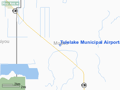
Tulelake Municipal Airport |
| Tulelake Municipal Airport |
| IATA: none – ICAO: none – FAA LID: O81 |
| Summary |
| Airport type |
Public |
| Operator |
City of Tulelake |
| Location |
Tulelake, California |
| Elevation AMSL |
4,044 ft / 1,232.6 m |
| Coordinates |
41°53′15″N 121°21′34″W / 41.8875°N 121.35944°W / 41.8875; -121.35944Coordinates: 41°53′15″N 121°21′34″W / 41.8875°N 121.35944°W / 41.8875; -121.35944 |
| Runways |
| Direction |
Length |
Surface |
| ft |
m |
| 11/29 |
3,577 |
1,090 |
Asphalt |
Tulelake Municipal Airport (FAA LID: O81) is a public airport located seven miles (11 km) southeast of Tulelake, serving Siskiyou County, California, USA. This general aviation airport covers 358 acres (145 ha) and has one runway.
The airport is located on the site of the Tule Lake War Relocation Center.
The above content comes from Wikipedia and is published under free licenses – click here to read more.
Location
& QuickFacts
|
FAA
Information Effective: |
2006-09-28 |
|
Airport
Identifier: |
O81 |
|
Longitude/Latitude: |
121-21-33.9590W/41-53-14.5680N
-121.359433/41.887380 (Estimated) |
|
Elevation: |
4044 ft / 1232.61 m (Surveyed) |
|
Land: |
358 acres |
|
From
nearest city: |
7 nautical miles SE of Tulelake, CA |
|
Location: |
Modoc County, CA |
|
Magnetic Variation: |
17E (1985) |
Owner
& Manager
|
Ownership: |
Publicly owned |
|
Owner: |
City Of Tulelake
LEASED TO AND MAINTAINED BY COUNTY OF MODOC. |
|
Address: |
202 W 4th St
Alturas, CA 96101 |
|
Phone
number: |
530-233-6403 |
|
Manager: |
Thomas Tracy
AIRPORT CONTACT RICK HIRONYMOUS AT 530-233-6403.
FBO
AT ARPT 530-664-2661. |
|
Address: |
202 W 4th St
Alturas, CA 96101 |
|
Phone
number: |
530-233-6403
DIR PUBLIC WORKS OFFICE ALTURAS. |
Airport
Operations and Facilities
|
Airport
Use: |
Open to public |
|
Wind
indicator: |
Yes |
|
Segmented
Circle: |
No |
|
Control
Tower: |
No |
|
Attendance
Schedule: |
JUN-AUG/ALL/0600-1700,SEP-MAY/MON-FRI/0800-1700,SEP-MAY/SAT-SUN/ON
CALL |
|
Lighting
Schedule: |
DUSK-DAWN
ACTVT MIRL RY 11/29 - 122.8. |
|
Beacon
Color: |
Clear-Green (lighted land airport) |
|
Landing
fee charge: |
No |
|
Sectional
chart: |
Klamath Falls |
|
Region: |
AWP - Western-Pacific |
|
Traffic
Pattern Alt: |
800 ft |
|
Boundary
ARTCC: |
ZSE - Seattle |
|
Tie-in
FSS: |
RIU - Rancho Murieta |
|
FSS
on Airport: |
No |
|
FSS
Phone: |
916-354-0161 |
|
FSS
Toll Free: |
1-800-WX-BRIEF |
|
NOTAMs
Facility: |
RIU (NOTAM-d service avaliable) |
|
Federal Agreements: |
NS1 |
Airport
Communications
Airport
Services
|
Fuel
available: |
100LL
FOR FUEL CALL (530) 664-2661. |
|
Airframe
Repair: |
MINOR |
|
Power
Plant Repair: |
MINOR |
|
Bottled
Oxygen: |
NONE |
|
Bulk
Oxygen: |
NONE |
|
Runway Information
Runway 11/29
|
Dimension: |
3577 x 44 ft / 1090.3 x 13.4 m |
|
Surface: |
ASPH, Good Condition |
|
Weight
Limit: |
Single wheel: 12500 lbs. |
|
Edge
Lights: |
Medium |
|
|
Runway 11 |
Runway 29 |
|
Elevation: |
4044.00 ft |
4048.00 ft |
|
Traffic
Pattern: |
Left |
Right |
|
Markings: |
Basic, Fair Condition
MARKINGS FADED |
Basic, Fair Condition
MARKINGS FADED, SOLID CENTERLINE STRIPE |
|
Runway
End Identifier: |
No |
No |
|
Centerline
Lights: |
No |
No |
|
Touchdown
Lights: |
No |
No |
|
Obstruction: |
15 ft road, 650.0 ft from runway, 170 ft right
of centerline, 30:1 slope to clear |
, 50:1 slope to clear |
|
Radio Navigation
Aids
|
ID |
Type |
Name |
Ch |
Freq |
Var |
Dist |
|
LFA |
NDB |
Merrill |
|
347.00 |
17E |
14.0 nm |
|
ARU |
NDB |
Alturas |
|
215.00 |
18E |
43.8 nm |
|
LMT |
VORTAC |
Klamath Falls |
106X |
115.90 |
17E |
22.9 nm |
Remarks
-
ESTBD PRIOR TO MAY 15
1959.
Based Aircraft
|
Aircraft
based on field: |
14 |
|
Single
Engine Airplanes: |
14 |
Operational Statistics
|
Aircraft
Operations: |
252/Week |
|
Air Taxi: |
3.8% |
|
General
Aviation Local: |
71.8% |
|
General
Aviation Itinerant: |
24.4% |
Tulelake Municipal Airport
Address:
Modoc County, CA
Tel:
530-233-6403
Images
and information placed above are from
http://www.airport-data.com/airport/O81/
We
thank them for the data!
| General
Info |
| Country |
United
States |
| State |
CALIFORNIA
|
| FAA ID |
O81
|
| Latitude |
41-53-14.568N
|
| Longitude |
121-21-33.959W
|
| Elevation |
4044 feet
|
| Near City |
TULELAKE
|
We don't guarantee the information is fresh and accurate. The data may
be wrong or outdated.
For more up-to-date information please refer to other sources.
|
|


