 |
|
Location
& QuickFacts
|
FAA
Information Effective: |
2006-09-28 |
|
Airport
Identifier: |
0CL8 |
|
Longitude/Latitude: |
117-38-01.2230W/35-35-28.8450N
-117.633673/35.591346 (Estimated) |
|
Elevation: |
2510 ft / 765.05 m (Estimated) |
|
Land: |
110 acres |
|
From
nearest city: |
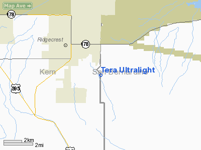
2 nautical miles SE of Ridgecrest, CA |
|
Location: |
Kern County, CA |
|
Magnetic Variation: |
14E (1985) |
Owner
& Manager
|
Ownership: |
Privately owned |
|
Owner: |
Donald H. Mills |
|
Address: |
1710 San Bernardino Blvd
Ridgecrest, CA 93555 |
|
Phone
number: |
619-384-4113 |
|
Manager: |
Donald H. Mills |
|
Address: |
1710 San Bernardino Blvd
Ridgecrest, CA 93555 |
|
Phone number: |
619-384-4113 |
Airport
Operations and Facilities
|
Airport
Use: |
Private |
|
Segmented
Circle: |
No |
|
Control
Tower: |
No |
|
Attendance
Schedule: |
ALL/ALL/DALGT |
|
Sectional
chart: |
Las Vegas |
|
Region: |
AWP - Western-Pacific |
|
Boundary
ARTCC: |
ZLA - Los Angeles |
|
Tie-in
FSS: |
RAL - Riverside |
|
FSS
Phone: |
951-351-3020 |
|
FSS
Toll Free: |
1-800-WX-BRIEF |
|
Runway Information
Runway 06/24
|
Dimension: |
3500 x 80 ft / 1066.8 x 24.4 m |
|
Surface: |
TURF, |
|
|
Runway 06 |
Runway 24 |
|
Traffic
Pattern: |
Right |
Left |
|
Displaced
threshold: |
0.00
ft |
800.00 ft |
|
Helipad H1
|
Dimension: |
80 x 80 ft / 24.4 x 24.4 m |
|
Surface: |
SAND, |
|
|
Runway H1 |
Runway |
|
Traffic
Pattern: |
Left |
Left |
|
Radio Navigation
Aids
|
ID |
Type |
Name |
Ch |
Freq |
Var |
Dist |
|
NID |
TACAN |
China Lake |
053X |
|
16E |
6.4 nm |
|
EDW |
VORTAC |
Edwards |
111X |
116.40 |
15E |
36.9 nm |
Top
Remarks
- ULTRALIGHT
AND SAILPLANE/GLIDER ACTVITY ON AND INVOF ARPT.
- FM
FLYING NORTH OF SOUTHERN CAL-EDISION POWER LINES, IF GOING TO-FM ARPT
ALL APCH & DEP ARE TO THE EAST, SOUTH. IF TO WEST DEP AT 1000 FT
AGL MIN ALT DUE TO HOUSING AREA 2 MILES WEST OF ARPT.
- PRVDD
VFR/PVT USE.
Based Aircraft
|
Aircraft
based on field: |
1 |
|
Ultralights: |
1 |
Tera Ultralight
Address:
Kern County, CA
Tel:
619-384-4113
Images
and information placed above are from
http://www.airport-data.com/airport/0CL8/
We
thank them for the data!
| General
Info |
| Country |
United
States |
| State |
CALIFORNIA
|
| FAA ID |
0CL8
|
| Latitude |
35-35-28.845N
|
| Longitude |
117-38-01.223W
|
| Elevation |
2510 feet
|
| Near City |
RIDGECREST
|
We don't guarantee the information is fresh and accurate. The data may
be wrong or outdated.
For more up-to-date information please refer to other sources.
|
|


