 |
|
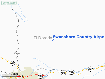
Swansboro Country Airport |
|
|
Location
& QuickFacts
|
FAA
Information Effective: |
2006-09-28 |
|
Airport
Identifier: |
01CL |
|
Longitude/Latitude: |
120-44-03.7520W/38-47-59.6480N
-120.734376/38.799902 (Estimated) |
|
Elevation: |
2594 ft / 790.65 m (Estimated) |
|
Land: |
9 acres |
|
From
nearest city: |
4 nautical miles NE of Placerville, CA |
|
Location: |
El Dorado County, CA |
|
Magnetic Variation: |
16E (1985) |
Owner
& Manager
|
Ownership: |
Privately owned |
|
Owner: |
Swansboro Cty Property Owners Assn |
|
Address: |
6770 Sluice Street
Placerville, CA 95667 |
|
Phone
number: |
530-621-0309 |
|
Manager: |
Swansboro Cty Property Owners Assn |
|
Address: |
6770 Sluice Street
Placerville, CA 95667 |
|
Phone number: |
530-621-0309 |
Airport
Operations and Facilities
|
Airport
Use: |
Private |
|
Wind
indicator: |
Yes |
|
Segmented
Circle: |
No |
|
Control
Tower: |
No |
|
Attendance
Schedule: |
UNATNDD |
|
Lighting
Schedule: |
RDO-CTL
ACTVT LIRL RY 09/27 AND NSTD VASI RY 09 - 122.9. |
|
Landing fee charge: |
No |
|
Sectional chart: |
San Francisco |
|
Region: |
AWP - Western-Pacific |
|
Boundary ARTCC: |
ZOA - Oakland |
|
Tie-in FSS: |
RIU - Rancho Murieta |
|
FSS on Airport: |
No |
|
FSS Phone: |
916-354-0161 |
|
FSS Toll Free: |
1-800-WX-BRIEF |
Airport
Services
|
Airframe
Repair: |
NONE |
|
Power
Plant Repair: |
NONE |
|
Runway Information
Runway 09/27
|
Dimension: |
3100 x 50 ft / 944.9 x 15.2 m |
|
Surface: |
ASPH-TRTD,
SLURRY SEAL> |
|
Edge
Lights: |
Low |
|
|
Runway 09 |
Runway 27 |
|
Traffic
Pattern: |
Left |
Left |
|
Displaced
threshold: |
500.00 ft |
0.00
ft |
|
Obstruction: |
100 ft hill, 1320.0 ft from runway |
|
|
Radio Navigation
Aids
|
ID |
Type |
Name |
Ch |
Freq |
Var |
Dist |
|
MY |
NDB |
Halow |
|
222.00 |
16E |
46.5 nm |
|
BAB |
TACAN |
Beale |
023X |
|
16E |
38.7 nm |
|
HNW |
VOR/DME |
Hangtown |
102X |
115.50 |
17E |
4.6 nm |
|
SWR |
VOR/DME |
Squaw Valley |
079X |
113.20 |
16E |
31.5 nm |
|
MCC |
VOR/DME |
Mc Clellan |
029X |
109.20 |
17E |
32.4 nm |
|
MYV |
VOR/DME |
Marysville |
045X |
110.80 |
16E |
43.1 nm |
|
SAC |
VORTAC |
Sacramento |
099X |
115.20 |
17E |
43.9 nm |
|
LIN |
VORTAC |
Linden |
095X |
114.80 |
17E |
45.4 nm |
|
SAC |
VOT |
Sacramento Executive |
|
111.40 |
|
39.8 nm |
|
SMF |
VOT |
Sacramento Metropolitan |
|
111.40 |
|
40.7 nm |
Remarks
- NGT
LNDG AUTHORIZED ON RWY 09 ONLY.
- RY
09 2 BAR VASI.
- FAA
FORM 7480-1 FILED FOR RECORD KEEPING.
Based Aircraft
|
Aircraft
based on field: |
25 |
|
Single
Engine Airplanes: |
21 |
|
Multi
Engine Airplanes: |
3 |
|
Helicopters: |
1 |
Swansboro Country Airport
Address:
El Dorado County, CA
Tel:
530-621-0309
Images
and information placed above are from
http://www.airport-data.com/airport/01CL/
We
thank them for the data!
| General
Info |
| Country |
United
States |
| State |
CALIFORNIA
|
| FAA ID |
01CL
|
| Latitude |
38-47-59.648N
|
| Longitude |
120-44-03.752W
|
| Elevation |
2594 feet
|
| Near City |
PLACERVILLE
|
We don't guarantee the information is fresh and accurate. The data may
be wrong or outdated.
For more up-to-date information please refer to other sources.
|
|


