|
|
| Sutter County Airport |
| IATA: none – ICAO: none – FAA LID: O52 |
| Summary |
| Airport type |
Public |
| Operator |
County of Sutter |
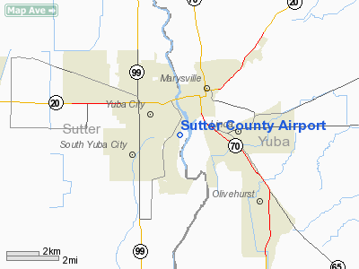
| Location |
Yuba City, California |
| Elevation AMSL |
58 ft / 17.7 m |
| Coordinates |
39°07′25″N 121°36′19″W / 39.12361°N 121.60528°W / 39.12361; -121.60528Coordinates: 39°07′25″N 121°36′19″W / 39.12361°N 121.60528°W / 39.12361; -121.60528 |
| Runways |
| Direction |
Length |
Surface |
| ft |
m |
| 17/35 |
3,045 |
928 |
Asphalt |
Sutter County Airport (FAA LID: O52) is a public airport located one mile (1.6 km) south of Yuba City, serving Sutter County, California, USA. This general aviation airport covers 170 acres (69 ha) and has one runway.
The above content comes from Wikipedia and is published under free licenses – click here to read more.
|
 |
(Click on the photo to enlarge) |
Location
& QuickFacts
|
FAA
Information Effective: |
2006-09-28 |
|
Airport
Identifier: |
O52 |
|
Longitude/Latitude: |
121-36-19.3000W/39-07-25.2000N
-121.605361/39.123667 (Estimated) |
|
Elevation: |
58 ft / 17.68 m (Surveyed) |
|
Land: |
170 acres |
|
From
nearest city: |
1 nautical miles S of Yuba City, CA |
|
Location: |
Sutter County, CA |
|
Magnetic Variation: |
16E (1985) |
Owner
& Manager
|
Ownership: |
Publicly owned |
|
Owner: |
County Of Sutter |
|
Address: |
1130 Civic Center Blvd
Yuba City, CA 95993 |
|
Phone
number: |
530-822-7450 |
|
Manager: |
Walter Cassi
DIRECTOR OF PUBLIC WORKS. |
|
Address: |
1130 Civic Center Blvd
Yuba City, CA 95993 |
|
Phone number: |
530-822-7450
ARPT PHONE 530-674-9645. |
Airport
Operations and Facilities
|
Airport
Use: |
Open to public |
|
Wind
indicator: |
Yes |
|
Segmented
Circle: |
Yes |
|
Control
Tower: |
No |
|
Attendance
Schedule: |
ALL/ALL/0800-1700 |
|
Lighting
Schedule: |
DUSK-DAWN
ACTVT MIRL RY 17/35 - CTAF. |
|
Beacon
Color: |
Clear-Green (lighted land airport) |
|
Landing
fee charge: |
No |
|
Sectional
chart: |
San Francisco |
|
Region: |
AWP - Western-Pacific |
|
Traffic
Pattern Alt: |
1000 ft |
|
Boundary
ARTCC: |
ZOA - Oakland |
|
Tie-in
FSS: |
RIU - Rancho Murieta |
|
FSS
on Airport: |
No |
|
FSS
Phone: |
916-354-0161 |
|
FSS
Toll Free: |
1-800-WX-BRIEF |
|
NOTAMs
Facility: |
RIU (NOTAM-d service avaliable) |
|
Federal Agreements: |
NGY |
Airport
Communications
|
CTAF: |
122.700 |
|
Unicom: |
122.700 |
Airport
Services
|
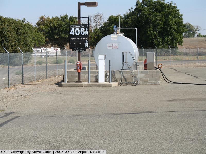
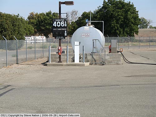
Fuel
available: |
100LL
FUEL AVBL BY CREDIT CARD. |
|
Airframe
Repair: |
MAJOR |
|
Power
Plant Repair: |
MAJOR |
|
Bottled
Oxygen: |
NONE |
|
Bulk
Oxygen: |
NONE |
|
Runway Information
Runway 17/35
|
Dimension: |
3045 x 75 ft / 928.1 x 22.9 m |
|
Surface: |
ASPH, Good Condition |
|
Edge
Lights: |
Medium |
|
|
Runway 17 |
Runway 35 |
|
Longitude: |
121-36-16.8282W |
121-36-21.8161W |
|
Latitude: |
39-07-40.1437N |
39-07-10.2952N |
|
Elevation: |
60.00 ft |
58.00 ft |
|
Traffic
Pattern: |
Right |
Left |
|
Markings: |
Basic, Good Condition |
Basic, Good Condition |
|
Crossing
Height: |
10.00
ft |
0.00
ft |
|
VASI: |
tri-color on left side |
|
|
Visual
Glide Angle: |
3.00� |
0.00� |
|
Runway
End Identifier: |
No |
No |
|
Centerline
Lights: |
No |
No |
|
Touchdown
Lights: |
No |
No |
|
Obstruction: |
75 ft tree, 1500.0 ft from runway, 230 ft right
of centerline, 17:1 slope to clear |
20 ft trees, 540.0 ft from runway, 135 ft left
of centerline, 17:1 slope to clear |
|
Radio Navigation
Aids
|
ID |
Type |
Name |
Ch |
Freq |
Var |
Dist |
|
MY |
NDB |
Halow |
|
222.00 |
16E |
2.8 nm |
|
OVE |
NDB |
Oroville |
|
212.00 |
16E |
22.3 nm |
|
BAB |
TACAN |
Beale |
023X |
|
16E |
7.7 nm |
|
TZZ |
VOR |
Travis |
|
116.40 |
17E |
47.8 nm |
|
MYV |
VOR/DME |
Marysville |
045X |
110.80 |
16E |
2.1 nm |
|
MCC |
VOR/DME |
Mc Clellan |
029X |
109.20 |
17E |
29.0 nm |
|
CIC |
VOR/DME |
Chico |
035X |
109.80 |
16E |
41.6 nm |
|
HNW |
VOR/DME |
Hangtown |
102X |
115.50 |
17E |
46.7 nm |
|
ILA |
VORTAC |
Williams |
091X |
114.40 |
18E |
19.9 nm |
|
MXW |
VORTAC |
Maxwell |
037X |
110.00 |
18E |
31.0 nm |
|
SAC |
VORTAC |
Sacramento |
099X |
115.20 |
17E |
41.0 nm |
|
SMF |
VOT |
Sacramento Metropolitan |
|
111.40 |
|
26.0 nm |
|
SAC |
VOT |
Sacramento Executive |
|
111.40 |
|
37.0 nm |
Remarks
- ULTRALIGHTS
PROHIBITED.
- AGRICULTURAL
ACFT FLY NON STANDARD TFC PATTERN.
Based Aircraft
|
Aircraft
based on field: |
94 |
|
Single
Engine Airplanes: |
92 |
|
Helicopters: |
2 |
Operational Statistics
|
Aircraft
Operations: |
55/Day |
|
Air Taxi: |
2.5% |
|
General
Aviation Local: |
60.0% |
|
General
Aviation Itinerant: |
37.5% |
Sutter County Airport
Address:
Sutter County, CA
Tel:
530-822-745
Images
and information placed above are from
http://www.airport-data.com/airport/O52/
We
thank them for the data!
| General
Info |
| Country |
United
States |
| State |
CALIFORNIA
|
| FAA ID |
O52
|
| Latitude |
39-07-35.612N
|
| Longitude |
121-36-32.878W
|
| Elevation |
58 feet
|
| Near City |
YUBA CITY
|
We don't guarantee the information is fresh and accurate. The data may
be wrong or outdated.
For more up-to-date information please refer to other sources.
|
|