 |
|
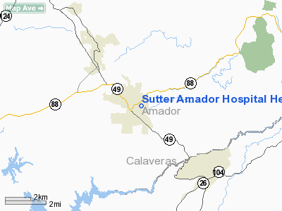
Sutter Amador Hospital Heliport |
|
|
Location
& QuickFacts
|
FAA
Information Effective: |
2006-09-28 |
|
Airport
Identifier: |
CL21 |
|
Longitude/Latitude: |
120-45-48.0000W/38-21-00.0000N
-120.763333/38.350000 (Estimated) |
|
Elevation: |
1246 ft / 379.78 m (Estimated) |
|
Land: |
0 acres |
|
From
nearest city: |
1 nautical miles NE of Jackson, CA |
|
Location: |
Amador County, CA |
|
Magnetic Variation: |
16E (1995) |
Owner
& Manager
|
Ownership: |
Privately
owned |
|
Owner: |
Sutter Amador Hospital |
|
Address: |
200 Mission Blvd
Jackson, CA 95642 |
|
Phone
number: |
209-223-7500 |
|
Manager: |
Doug Mc Elwee |
|
Address: |
Sutter Amador Hospital, 200 Mission Blvd
Jackson, CA 95642 |
|
Phone number: |
209-223-7500 |
Airport Operations and Facilities
|
Airport
Use: |
Private
MEDICAL USE. |
|
Wind
indicator: |
Yes |
|
Segmented Circle: |
No |
|
Control
Tower: |
No |
|
Attendance Schedule: |
UNATNDD |
|
Lighting
Schedule: |
PHONE REQ
FOR PERIMETER LGTS CALL (209) 223-7500. |
|
Sectional chart: |
San Francisco |
|
Region: |
AWP - Western-Pacific |
|
Boundary
ARTCC: |
ZOA - Oakland |
|
Responsible ARTCC: |
ZOA - Oakland |
|
Tie-in
FSS: |
RIU - Rancho Murieta |
|
FSS
Phone: |
916-354-0161 |
|
FSS
Toll Free: |
1-800-WX-BRIEF |
|
Runway Information
Helipad H1
|
Dimension: |
60
x 60 ft / 18.3 x 18.3 m |
|
Surface: |
CONC, |
|
|
Runway H1 |
Runway |
|
Traffic
Pattern: |
Left |
Left |
|
Radio Navigation
Aids
|
ID |
Type |
Name |
Ch |
Freq |
Var |
Dist |
|
TZZ |
VOR |
Travis |
|
116.40 |
17E |
49.4 nm |
|
HNW |
VOR/DME |
Hangtown |
102X |
115.50 |
17E |
22.5 nm |
|
MCC |
VOR/DME |
Mc Clellan |
029X |
109.20 |
17E |
35.7 nm |
|
MOD |
VOR/DME |
Modesto |
093X |
114.60 |
17E |
44.4 nm |
|
LIN |
VORTAC |
Linden |
095X |
114.80 |
17E |
20.1 nm |
|
ECA |
VORTAC |
Manteca |
107X |
116.00 |
17E |
36.6 nm |
|
SAC |
VORTAC |
Sacramento |
099X |
115.20 |
17E |
37.6 nm |
|
SAC |
VOT |
Sacramento Executive |
|
111.40 |
|
36.0 nm |
|
SMF |
VOT |
Sacramento Metropolitan |
|
111.40 |
|
44.0 nm |
Remarks
- OBSTRUCTION
LGTS ON SOME CORNERS OF BLDGS, AND PARKING LOT LGTS.
- PROVIDED
VFR OPNS, PRIVATE USE, AND SPONSOR ENSURES OBSTRUCTION FREE INGRESS/EGRESS
ROUTES, AND ARRIVALS/DEPARTURES FROM 006-012 DEGREES AND 186-192 DEGREES
DURING PERIODS OF MARGINAL VFR WEATHER.
Sutter Amador Hospital Heliport
Address:
Amador County, CA
Tel:
209-223-7500
Images
and information placed above are from
http://www.airport-data.com/airport/CL21/
We
thank them for the data!
| General
Info |
| Country |
United
States |
| State |
CALIFORNIA
|
| FAA ID |
CL21
|
| Latitude |
38-21-00.000N
|
| Longitude |
120-45-48.000W
|
| Elevation |
1246 feet
|
| Near City |
JACKSON
|
We don't guarantee the information is fresh and accurate. The data may
be wrong or outdated.
For more up-to-date information please refer to other sources.
|
|


