 |
|
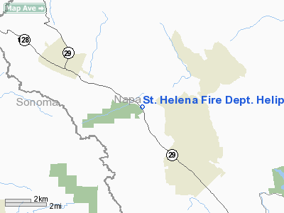
St Helena Fire Dept Heliport |
Location
& QuickFacts
|
FAA
Information Effective: |
2006-09-28 |
|
Airport
Identifier: |
CL39 |
|
Longitude/Latitude: |
122-30-38.6300W/38-32-54.6000N
-122.510731/38.548500 (Estimated) |
|
Elevation: |
308 ft / 93.88 m (Estimated) |
|
Land: |
0 acres |
|
From
nearest city: |
3 nautical miles N of St Helena, CA |
|
Location: |
Napa County, CA |
|
Magnetic Variation: |
16E (1995) |
Owner
& Manager
|
Ownership: |
Publicly owned |
|
Owner: |
St. Helena Fire Dept. |
|
Address: |
1500 Main Street
St. Helena, CA 94574 |
|
Phone number: |
707-967-2880 |
|
Address: |
|
Airport
Operations and Facilities
|
Airport
Use: |
Private |
|
Segmented
Circle: |
No |
|
Control
Tower: |
No |
|
Attendance
Schedule: |
ALL/ALL/ALL |
|
Lighting
Schedule: |
DUSK-DAWN |
|
Sectional
chart: |
San Francisco |
|
Region: |
AWP - Western-Pacific |
|
Boundary
ARTCC: |
ZOA - Oakland |
|
Responsible
ARTCC: |
ZOA - Oakland |
|
Tie-in
FSS: |
OAK - Oakland |
|
FSS
Phone: |
510-273-6111 |
|
FSS
Toll Free: |
1-800-WX-BRIEF |
|
Runway Information
Helipad H1
|
Dimension: |
100 x 100 ft / 30.5 x 30.5 m |
|
Surface: |
TURF, |
|
|
Runway H1 |
Runway |
|
Traffic
Pattern: |
Left |
Left |
|
Radio Navigation
Aids
|
ID |
Type |
Name |
Ch |
Freq |
Var |
Dist |
|
LOP |
NDB |
Lampson |
|
217.00 |
16E |
32.0 nm |
|
SUU |
TACAN |
Travis |
113X |
|
17E |
32.3 nm |
|
TZZ |
VOR |
Travis |
|
116.40 |
17E |
35.2 nm |
|
STS |
VOR/DME |
Santa Rosa |
077X |
113.00 |
16E |
14.3 nm |
|
CCR |
VOR/DME |
Concord |
117X |
117.00 |
17E |
37.4 nm |
|
SGD |
VORTAC |
Scaggs Island |
058X |
112.10 |
17E |
23.1 nm |
|
PYE |
VORTAC |
Point Reyes |
084X |
113.70 |
17E |
32.8 nm |
|
ILA |
VORTAC |
Williams |
091X |
114.40 |
18E |
38.7 nm |
|
SAU |
VORTAC |
Sausalito |
109X |
116.20 |
17E |
41.7 nm |
|
SAC |
VORTAC |
Sacramento |
099X |
115.20 |
17E |
45.6 nm |
|
ENI |
VORTAC |
Mendocino |
070X |
112.30 |
16E |
46.9 nm |
|
MXW |
VORTAC |
Maxwell |
037X |
110.00 |
18E |
48.2 nm |
|
SMF |
VOT |
Sacramento Metropolitan |
|
111.40 |
|
44.0 nm |
|
SAC |
VOT |
Sacramento Executive |
|
111.40 |
|
47.7 nm |
Remarks
- PROVIDED
VFR OPNS, PRIVATE USE AND INGRESS/EGRESS ROUTES DO NOT CONFLICT WITH
TPA OF ANY ESTABLISHED PUBLIC-USE LANDING AREAS.
St. Helena Fire Dept. Heliport
Address:
Napa County, CA
Tel:
707-967-2880
Images
and information placed above are from
http://www.airport-data.com/airport/CL39/
We
thank them for the data!
| General
Info |
| Country |
United
States |
| State |
CALIFORNIA
|
| FAA ID |
CL39
|
| Latitude |
38-32-54.600N
|
| Longitude |
122-30-38.630W
|
| Elevation |
308 feet
|
| Near City |
ST HELENA
|
We don't guarantee the information is fresh and accurate. The data may
be wrong or outdated.
For more up-to-date information please refer to other sources.
|
|


