 |
|
| Siskiyou County Airport |
| IATA: SIY – ICAO: KSIY |
| Summary |
| Airport type |
Public |
| Operator |
Siskiyou County |
| Location |
Montague, California |
| Elevation AMSL |
2,648 ft / 807 m |
| Coordinates |
41°46′53.190″N 122°28′05.194″W / 41.7814417°N 122.46810944°W / 41.7814417; -122.46810944Coordinates: 41°46′53.190″N 122°28′05.194″W / 41.7814417°N 122.46810944°W / 41.7814417; -122.46810944 |
| Runways |
| Direction |
Length |
Surface |
| ft |
m |
| 17/35 |
7,484 |
2,281 |
Asphalt |
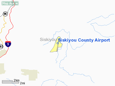
Siskiyou County Airport (IATA: SIY, ICAO: KSIY) is a public airport located three miles (4.8 km) northeast of Montague, serving Siskiyou County, California, USA. The airport has one runway and is mostly used for general aviation. Facilities
Siskiyou County Airport has one runway:
- Runway 17/35: 7,484 x 150 ft (2,281 x 46 m). Surface: Asphalt
The above content comes from Wikipedia and is published under free licenses – click here to read more.
Location
& QuickFacts
|
FAA
Information Effective: |
2006-09-28 |
|
Airport
Identifier: |
SIY |
|
Longitude/Latitude: |
122-28-05.1940W/41-46-53.1900N
-122.468109/41.781442 (Estimated) |
|
Elevation: |
2648 ft / 807.11 m (Surveyed) |
|
Land: |
1080 acres |
|
From
nearest city: |
3 nautical miles NE of Montague, CA |
|
Location: |
Siskiyou County, CA |
|
Magnetic Variation: |
18E (1985) |
Owner
& Manager
|
Ownership: |
Publicly owned |
|
Owner: |
Siskiyou County |
|
Address: |
305 Butte St
Yreka, CA 96097 |
|
Phone number: |
530-842-8295 |
|
Manager: |
Thomas L Anderson |
|
Address: |
Yreka, CA 96097 |
|
Phone number: |
530-842-8295
COUNTY AIRPORT OFFICE - YREKA. |
Airport
Operations and Facilities
|
Airport
Use: |
Open to public |
|
Wind
indicator: |
Yes |
|
Segmented
Circle: |
Yes |
|
Control
Tower: |
No |
|
Attendance
Schedule: |
ALL/ALL/0800-1700 |
|
Lighting
Schedule: |
DUSK-DAWN
ACTVT MIRL RY 17/35, PAPI RYS 17 AND 35, REIL RYS 17 AND
35 - CTAF. |
|
Beacon
Color: |
Clear-Green (lighted land airport) |
|
Landing
fee charge: |
Yes |
|
Sectional
chart: |
Klamath Falls |
|
Region: |
AWP - Western-Pacific |
|
Traffic
Pattern Alt: |
1000 ft |
|
Boundary
ARTCC: |
ZSE - Seattle |
|
Tie-in
FSS: |
RIU - Rancho Murieta |
|
FSS
Phone: |
916-354-0161 |
|
FSS
Toll Free: |
1-800-WX-BRIEF |
|
NOTAMs
Facility: |
SIY (NOTAM-d service avaliable) |
|
Federal Agreements: |
NGPY |
Airport
Communications
|
CTAF: |
123.000 |
|
Unicom: |
123.000 |
Airport
Services
|
Fuel
available: |
100LLA |
|
Airframe
Repair: |
MINOR |
|
Power
Plant Repair: |
MINOR |
|
Bottled
Oxygen: |
HIGH |
|
Bulk
Oxygen: |
NONE |
|
Runway Information
Runway 17/35
|
Dimension: |
7484 x 150 ft / 2281.1 x 45.7 m |
|
Surface: |
ASPH, Good Condition |
|
Weight
Limit: |
Single wheel: 60000 lbs.
Dual wheel: 180000 lbs.
Dual
tandem wheel: 270000 lbs. |
|
Edge
Lights: |
Medium |
|
|
Runway 17 |
Runway 35 |
|
Longitude: |
122-27-55.7110W |
122-28-14.6760W |
|
Latitude: |
41-47-29.4650N |
41-46-16.9140N |
|
Elevation: |
2628.00 ft |
2628.00 ft |
|
Alignment: |
127 |
11 |
|
Traffic
Pattern: |
Left |
Right |
|
Markings: |
Non-precision instrument, Fair Condition |
Non-precision instrument, Fair Condition |
|
VASI: |
2-light PAPI on left side |
2-light PAPI on left side |
|
Runway
End Identifier: |
Yes |
Yes |
|
Centerline
Lights: |
No |
No |
|
Touchdown
Lights: |
No |
No |
|
Obstruction: |
15 ft road, 900.0 ft from runway, 46:1 slope
to clear |
, 50:1 slope to clear |
|
Radio Navigation
Aids
|
ID |
Type |
Name |
Ch |
Freq |
Var |
Dist |
|
MOG |
NDB |
Montague |
|
404.00 |
19E |
3.3 nm |
|
LFA |
NDB |
Merrill |
|
347.00 |
17E |
38.9 nm |
|
MEF |
NDB |
Medford |
|
356.00 |
19E |
41.0 nm |
|
FJS |
VOR/DME |
Fort Jones |
033X |
109.60 |
19E |
25.1 nm |
|
LMT |
VORTAC |
Klamath Falls |
106X |
115.90 |
17E |
39.9 nm |
|
OED |
VORTAC |
Rogue Valley |
083X |
113.60 |
19E |
46.4 nm |
|
MFR |
VOT |
Medford-jackson County |
|
117.20 |
|
39.0 nm |
Remarks
- EXCP
RWY; PAVED AREAS IN FAIR TO POOR COND.
- 150
X 150' BLAST PAD EACH END.
- MIGRATORY
FLOCKS OF WATERFOWL IN VCNTY OF ARPT DURING SPRING & FALL.
- USFS
FIRE OPS MAY-SEPT
Based Aircraft
|
Aircraft
based on field: |
27 |
|
Single
Engine Airplanes: |
19 |
|
Multi
Engine Airplanes: |
2 |
|
Gliders: |
5 |
|
Ultralights: |
1 |
Operational Statistics
|
Aircraft
Operations: |
267/Week |
|
Air Taxi: |
1.1% |
|
General
Aviation Local: |
54.2% |
|
General
Aviation Itinerant: |
43.3% |
|
Military: |
1.4% |
Siskiyou County Airport
Address:
Siskiyou County, CA
Tel:
530-842-8295
Images
and information placed above are from
http://www.airport-data.com/airport/SIY/
We
thank them for the data!
| General
Info |
| Country |
United
States |
| State |
CALIFORNIA
|
| FAA ID |
SIY
|
| Latitude |
41-46-53.190N
|
| Longitude |
122-28-05.194W
|
| Elevation |
2648 feet
|
| Near City |
MONTAGUE
|
We don't guarantee the information is fresh and accurate. The data may
be wrong or outdated.
For more up-to-date information please refer to other sources.
|
|


