 |
|
|
|
|
|
Location
& QuickFacts
|
FAA
Information Effective: |
2006-09-28 |
|
Airport
Identifier: |
CN36 |
|
Longitude/Latitude: |
121-03-03.8170W/39-13-59.6180N
-121.051060/39.233227 (Estimated) |
|
Elevation: |
2900 ft / 883.92 m (Estimated) |
|
Land: |
0 acres |
|
From
nearest city: |
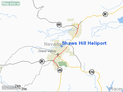
1 nautical miles NE of Grass Valley, CA |
|
Location: |
Nevada County, CA |
|
Magnetic Variation: |
16E (1985) |
Owner
& Manager
|
Ownership: |
Privately owned |
|
Owner: |
English Mountain Ranch |
|
Address: |
Box 950
Grass Valley, CA 95945 |
|
Phone
number: |
916-273-6176 |
|
Manager: |
Charles Litton, Sec/trea |
|
Address: |
Box 950 English Mtn Ranch
Grass Valley, CA 95945 |
|
Phone number: |
916-273-6176 |
Airport
Operations and Facilities
|
Airport Use: |
Private |
|
Wind indicator: |
Yes |
|
Segmented Circle: |
No |
|
Control Tower: |
No |
|
Attendance Schedule: |
UNATNDD |
|
Landing fee charge: |
No |
|
Sectional chart: |
San Francisco |
|
Region: |
AWP - Western-Pacific |
|
Boundary ARTCC: |
ZOA - Oakland |
|
Tie-in FSS: |
RIU - Rancho Murieta |
|
FSS on Airport: |
No |
|
FSS Phone: |
916-354-0161 |
|
FSS Toll Free: |
1-800-WX-BRIEF |
Airport
Services
|
Airframe
Repair: |
NONE |
|
Power
Plant Repair: |
NONE |
|
Runway Information
Helipad H1
|
Dimension: |
60 x 60 ft / 18.3 x 18.3 m |
|
Surface: |
ASPH, |
|
|
Runway H1 |
Runway |
|
Elevation: |
2900.00 ft |
0.00
ft |
|
Traffic
Pattern: |
Left |
Left |
|
Radio Navigation
Aids
|
ID |
Type |
Name |
Ch |
Freq |
Var |
Dist |
|
MY |
NDB |
Halow |
|
222.00 |
16E |
26.3 nm |
|
OVE |
NDB |
Oroville |
|
212.00 |
16E |
30.8 nm |
|
BAB |
TACAN |
Beale |
023X |
|
16E |
19.1 nm |
|
MYV |
VOR/DME |
Marysville |
045X |
110.80 |
16E |
25.6 nm |
|
HNW |
VOR/DME |
Hangtown |
102X |
115.50 |
17E |
33.7 nm |
|
SWR |
VOR/DME |
Squaw Valley |
079X |
113.20 |
16E |
36.5 nm |
|
MCC |
VOR/DME |
Mc Clellan |
029X |
109.20 |
17E |
37.8 nm |
|
CIC |
VOR/DME |
Chico |
035X |
109.80 |
16E |
49.8 nm |
|
ILA |
VORTAC |
Williams |
091X |
114.40 |
18E |
46.5 nm |
|
SMF |
VOT |
Sacramento Metropolitan |
|
111.40 |
|
41.2 nm |
|
SAC |
VOT |
Sacramento Executive |
|
111.40 |
|
48.0 nm |
Remarks
- ONLY
CLEAR APPROACH IS FROM THE WEST
- ESTABD
PRIOR TO 15 MAY 1959.
Based Aircraft
|
Aircraft
based on field: |
1 |
|
Helicopters: |
1 |
Shaws Hill Heliport
Address:
Nevada County, CA
Tel:
916-273-6176
Images
and information placed above are from
http://www.airport-data.com/airport/CN36/
We
thank them for the data!
| General
Info |
| Country |
United
States |
| State |
CALIFORNIA
|
| FAA ID |
CN36
|
| Latitude |
39-13-59.618N
|
| Longitude |
121-03-03.817W
|
| Elevation |
2900 feet
|
| Near City |
GRASS
VALLEY |
We don't guarantee the information is fresh and accurate. The data may
be wrong or outdated.
For more up-to-date information please refer to other sources.
|
|


