 |
|
|
|
|
|
Location
& QuickFacts
|
FAA
Information Effective: |
2006-09-28 |
|
Airport
Identifier: |
0Q4 |
|
Longitude/Latitude: |
119-39-30.4830W/36-34-53.8210N
-119.658468/36.581617 (Estimated) |
|
Elevation: |
305 ft / 92.96 m (Estimated) |
|
Land: |
23 acres |
|
From
nearest city: |
2 nautical miles NW of Selma, CA |
|
Location: |
Fresno County, CA |
|
Magnetic Variation: |
15E (1985) |
Owner
& Manager
|
Ownership: |
Privately owned |
|
Owner: |
Selma Aerodrome Inc. |
|
Address: |
7225 E Huntsman Ave.
Selma, CA 93662 |
|
Phone
number: |
559-896-1001 |
|
Manager: |
Alan Geringer |
|
Address: |
7225 E Huntsman Ave.
Selma, CA 93662 |
|
Phone number: |
559-896-1001 |
Airport
Operations and Facilities
|
Airport
Use: |
Open to public |
|
Wind
indicator: |
Yes |
|
Segmented
Circle: |
No |
|
Control
Tower: |
No |
|
Attendance
Schedule: |
ALL/ALL/0800-1700 |
|
Lighting
Schedule: |
DUSK-0100
PPR FOR ROTG BCN AFTER 0100 CALL (559) 896-1001 DURING ATTENDANT
HOURS. LIRL
RY 10/28 ON DUSK-DAWN. |
|
Beacon
Color: |
Clear-Green (lighted land airport) |
|
Landing
fee charge: |
No |
|
Sectional
chart: |
San Francisco |
|
Region: |
AWP - Western-Pacific |
|
Traffic
Pattern Alt: |
800 ft |
|
Boundary
ARTCC: |
ZOA - Oakland |
|
Tie-in
FSS: |
RIU - Rancho Murieta |
|
FSS
on Airport: |
No |
|
FSS
Phone: |
916-354-0161 |
|
FSS
Toll Free: |
1-800-WX-BRIEF |
|
NOTAMs
Facility: |
RIU (NOTAM-d service avaliable) |
Airport
Communications
|
CTAF: |
122.800 |
|
Unicom: |
122.800 |
Airport
Services
|
Fuel
available: |
100LL80 |
|
Airframe
Repair: |
MAJOR |
|
Power
Plant Repair: |
MAJOR |
|
Bottled
Oxygen: |
NONE |
|
Bulk
Oxygen: |
NONE |
|
Runway Information
Runway 10/28
|
Dimension: |
2490 x 50 ft / 759.0 x 15.2 m |
|
Surface: |
ASPH, Fair Condition |
|
Weight
Limit: |
Single wheel: 12000 lbs. |
|
Edge
Lights: |
Non-standard lighting system
NSTD LIRL; FIRST 176 FT OF RY 10 NOT LGTD. |
|
|
Runway 10 |
Runway 28 |
|
Elevation: |
305.00 ft |
296.00 ft |
|
Traffic
Pattern: |
Left |
Left |
|
Markings: |
Basic, Good Condition |
Basic, Good Condition |
|
Displaced
threshold: |
176.00 ft |
125.00 ft |
|
Runway
End Identifier: |
No |
No |
|
Centerline
Lights: |
No |
No |
|
Touchdown
Lights: |
No |
No |
|
Obstruction: |
30 ft pole, 555.0 ft from runway, 20 ft right
of centerline, 11:1 slope to clear
APCH RATIO 24:1 AT DSPLCD THR.
+12 FT PVT ROAD 0-100 FT FM RY END 50 FT L - 125 FT R; -10
FT CANAL PARALLEL TO ROAD. |
6 ft berm, 200.0 ft from runway, 100 ft left
of centerline
+10' BERM 100'L 0' FM DSPLCD THR 0:1 BASED ON DSPLCD THR.
+2 FT FENCE 60 FT FM RY END 125 FT L 125 FT R; +10 FT BERM
0-200 FT FM RY END TAPERS TO +6 FT AT 200 FT & 115-100
FT L. |
|
Radio Navigation
Aids
|
ID |
Type |
Name |
Ch |
Freq |
Var |
Dist |
|
CUK |
NDB |
Academy |
|
266.00 |
14E |
9.0 nm |
|
FCH |
NDB |
Chandler |
|
344.00 |
15E |
12.0 nm |
|
COR |
NDB |
Salyer Farms |
|
205.00 |
16E |
31.5 nm |
|
NLC |
TACAN |
Lemoore |
080X |
|
16E |
20.6 nm |
|
VIS |
VOR/DME |
Visalia |
031X |
109.40 |
16E |
15.4 nm |
|
CZQ |
VORTAC |
Clovis |
076X |
112.90 |
15E |
19.7 nm |
|
FRA |
VORTAC |
Friant |
103X |
115.60 |
17E |
31.6 nm |
Remarks
- ARPT
CLSD TO HELICOPTERS EXC PPR 559-896-1001.
Based Aircraft
|
Aircraft
based on field: |
50 |
|
Single
Engine Airplanes: |
49 |
|
Multi
Engine Airplanes: |
1 |
Operational Statistics
|
Aircraft
Operations: |
289/Week |
|
General
Aviation Local: |
40.0% |
|
General
Aviation Itinerant: |
60.0% |
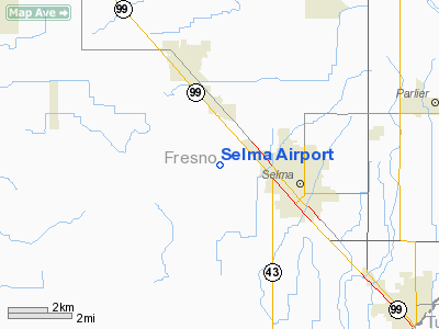
Selma Airport
Address:
Fresno County, CA
Tel:
559-896-1001
Images
and information placed above are from
http://www.airport-data.com/airport/0Q4/
We
thank them for the data!
| General
Info |
| Country |
United
States |
| State |
CALIFORNIA
|
| FAA ID |
0Q4
|
| Latitude |
36-34-53.821N
|
| Longitude |
119-39-30.483W
|
| Elevation |
305 feet
|
| Near City |
SELMA
|
We don't guarantee the information is fresh and accurate. The data may
be wrong or outdated.
For more up-to-date information please refer to other sources.
|
|


