 |
|
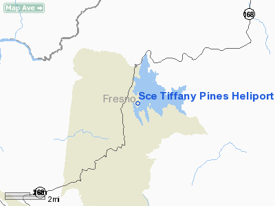
Southern California Edison Tiffany Pines Heliport |
Location
& QuickFacts
|
FAA
Information Effective: |
2006-09-28 |
|
Airport
Identifier: |
CL79 |
|
Longitude/Latitude: |
119-18-18.4510W/37-07-04.8090N
-119.305125/37.118003 (Estimated) |
|
Elevation: |
5548 ft / 1691.03 m (Estimated) |
|
Land: |
0 acres |
|
From
nearest city: |
1 nautical miles NE of Shaver Lake, CA |
|
Location: |
Fresno County, CA |
|
Magnetic Variation: |
15E (1980) |
Owner
& Manager
|
Ownership: |
Privately owned |
|
Owner: |
Southern California Edison Co |
|
Address: |
42696 Tollhouse Road
Shaver Lake, CA 93664 |
|
Phone
number: |
559-841-3131 |
|
Manager: |
Art Bradbury |
|
Address: |
2161 East Avion St
Ontario, CA 91761 |
|
Phone number: |
909-974-4691 |
Airport
Operations and Facilities
|
Airport
Use: |
Private |
|
Wind
indicator: |
Yes |
|
Segmented
Circle: |
No |
|
Control
Tower: |
No |
|
Attendance
Schedule: |
UNATNDD |
|
Sectional
chart: |
San Francisco |
|
Region: |
AWP - Western-Pacific |
|
Boundary
ARTCC: |
ZOA - Oakland |
|
Tie-in
FSS: |
RIU - Rancho Murieta |
|
FSS
Phone: |
916-354-0161 |
|
FSS
Toll Free: |
1-800-WX-BRIEF |
|
Runway Information
Helipad H1
|
Dimension: |
20
x 20 ft / 6.1 x 6.1 m |
|
Surface: |
CONC, |
|
|
Runway H1 |
Runway |
|
Traffic
Pattern: |
Left |
Left |
|
Radio Navigation
Aids
|
ID |
Type |
Name |
Ch |
Freq |
Var |
Dist |
|
CUK |
NDB |
Academy |
|
266.00 |
14E |
28.2 nm |
|
FCH |
NDB |
Chandler |
|
344.00 |
15E |
34.7 nm |
|
VIS |
VOR/DME |
Visalia |
031X |
109.40 |
16E |
45.9 nm |
|
BIH |
VOR/DME |
Bishop |
033X |
109.60 |
15E |
47.5 nm |
|
FRA |
VORTAC |
Friant |
103X |
115.60 |
17E |
13.9 nm |
|
CZQ |
VORTAC |
Clovis |
076X |
112.90 |
15E |
28.2 nm |
Remarks
- VFR,
PRIVATE USE; HELICOPTERS ARE CAPABLE OF PERFORMING OUT OF GROUND-EFFECT
HOVER.
Sce Tiffany Pines Heliport
Address:
Fresno County, CA
Tel:
559-841-3131,
909-974-4691
Images
and information placed above are from
http://www.airport-data.com/airport/CL79/
We
thank them for the data!
| General
Info |
| Country |
United
States |
| State |
CALIFORNIA
|
| FAA ID |
CL79
|
| Latitude |
37-07-04.809N
|
| Longitude |
119-18-18.451W
|
| Elevation |
5548 feet
|
| Near City |
SHAVER
LAKE |
We don't guarantee the information is fresh and accurate. The data may
be wrong or outdated.
For more up-to-date information please refer to other sources.
|
|


