 |
|
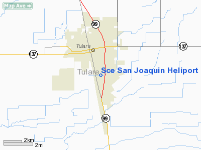
Southern California Edison San Joaquin Heliport |
Location
& QuickFacts
|
FAA
Information Effective: |
2006-09-28 |
|
Airport
Identifier: |
65CA |
|
Longitude/Latitude: |
119-20-01.4140W/36-10-55.8240N
-119.333726/36.182173 (Estimated) |
|
Elevation: |
279 ft / 85.04 m (Estimated) |
|
Land: |
0 acres |
|
From
nearest city: |
1 nautical miles S of Tulare, CA |
|
Location: |
Tulare County, CA |
|
Magnetic Variation: |
15E (1985) |
Owner
& Manager
|
Ownership: |
Privately owned |
|
Owner: |
Southern California Edison Co |
|
Address: |
2425 South Blackstone Ave
Tulare, CA 93274 |
|
Phone
number: |
209-685-3227 |
|
Manager: |
Art Bradbury |
|
Address: |
2161 East Avion St
Ontario, CA 91761 |
|
Phone number: |
909-974-4691 |
Airport
Operations and Facilities
|
Airport
Use: |
Private |
|
Wind
indicator: |
Yes |
|
Segmented
Circle: |
No |
|
Control
Tower: |
No |
|
Attendance
Schedule: |
UNATNDD |
|
Landing
fee charge: |
No |
|
Sectional
chart: |
San Francisco |
|
Region: |
AWP - Western-Pacific |
|
Boundary
ARTCC: |
ZOA - Oakland |
|
Tie-in
FSS: |
RIU - Rancho Murieta |
|
FSS
Phone: |
916-354-0161 |
|
FSS
Toll Free: |
1-800-WX-BRIEF |
|
Runway Information
Helipad H1
|
Dimension: |
20
x 20 ft / 6.1 x 6.1 m |
|
Surface: |
ASPH, |
|
|
Runway H1 |
Runway |
|
Traffic
Pattern: |
Left |
Left |
|
Radio Navigation
Aids
|
ID |
Type |
Name |
Ch |
Freq |
Var |
Dist |
|
COR |
NDB |
Salyer Farms |
|
205.00 |
16E |
12.1 nm |
|
CUK |
NDB |
Academy |
|
266.00 |
14E |
36.0 nm |
|
FCH |
NDB |
Chandler |
|
344.00 |
15E |
40.6 nm |
|
NLC |
TACAN |
Lemoore |
080X |
|
16E |
32.2 nm |
|
VIS |
VOR/DME |
Visalia |
031X |
109.40 |
16E |
13.3 nm |
|
TTE |
VOR/DME |
Tule |
029X |
109.20 |
16E |
22.2 nm |
|
EHF |
VORTAC |
Shafter |
101X |
115.40 |
14E |
43.5 nm |
|
AVE |
VORTAC |
Avenal |
118X |
117.10 |
16E |
44.9 nm |
|
CZQ |
VORTAC |
Clovis |
076X |
112.90 |
15E |
48.2 nm |
|
BFL |
VOT |
Bakersfield |
|
111.20 |
|
47.6 nm |
Remarks
Sce San Joaquin Heliport
Address:
Tulare County, CA
Tel:
209-685-3227,
909-974-4691
Images
and information placed above are from
http://www.airport-data.com/airport/65CA/
We
thank them for the data!
| General
Info |
| Country |
United
States |
| State |
CALIFORNIA
|
| FAA ID |
65CA
|
| Latitude |
36-10-55.824N
|
| Longitude |
119-20-01.414W
|
| Elevation |
279 feet
|
| Near City |
TULARE
|
We don't guarantee the information is fresh and accurate. The data may
be wrong or outdated.
For more up-to-date information please refer to other sources.
|
|


