 |
|
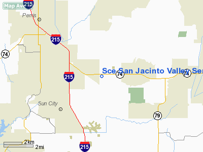
Southern California Edison San Jacinto Valley Service Center Heliport |
Location
& QuickFacts
|
FAA
Information Effective: |
2006-09-28 |
|
Airport
Identifier: |
0CL9 |
|
Longitude/Latitude: |
117-09-04.1160W/33-44-28.0730N
-117.151143/33.741131 (Estimated) |
|
Elevation: |
1482 ft / 451.71 m (Estimated) |
|
Land: |
0 acres |
|
From
nearest city: |
1 nautical miles NW of Romoland, CA |
|
Location: |
Riverside County, CA |
|
Magnetic Variation: |
14E (1985) |
Owner
& Manager
|
Ownership: |
Privately owned |
|
Owner: |
Southern California Edison Co |
|
Address: |
26100 Menifee Road
Romoland, CA 92380 |
|
Phone
number: |
909-943-8266 |
|
Manager: |
Art Bradbury |
|
Address: |
2161 East Avion St
Ontario, CA 91761 |
|
Phone number: |
909-974-4691 |
Airport
Operations and Facilities
|
Airport
Use: |
Private |
|
Wind
indicator: |
Yes |
|
Segmented
Circle: |
No |
|
Control
Tower: |
No |
|
Attendance
Schedule: |
UNATNDD |
|
Sectional
chart: |
Los Angeles |
|
Region: |
AWP - Western-Pacific |
|
Boundary
ARTCC: |
ZLA - Los Angeles |
|
Tie-in
FSS: |
RAL - Riverside |
|
FSS
Phone: |
951-351-3020 |
|
FSS
Toll Free: |
1-800-WX-BRIEF |
|
Runway Information
Helipad H1
|
Dimension: |
20
x 20 ft / 6.1 x 6.1 m |
|
Surface: |
CONC, |
|
|
Runway H1 |
Runway |
|
Traffic
Pattern: |
Left |
Left |
|
Radio Navigation
Aids
|
ID |
Type |
Name |
Ch |
Freq |
Var |
Dist |
|
SJY |
NDB |
San Jacinto |
|
227.00 |
14E |
8.2 nm |
|
SB |
NDB |
Petis |
|
397.00 |
14E |
21.8 nm |
|
EMT |
NDB |
El Monte |
|
359.00 |
15E |
48.6 nm |
|
RIV |
TACAN |
March |
077X |
|
14E |
11.7 nm |
|
NFG |
TACAN |
Camp Pendleton |
055X |
|
13E |
30.4 nm |
|
HDF |
VOR |
Homeland |
|
113.40 |
14E |
2.7 nm |
|
RAL |
VOR |
Riverside |
|
112.40 |
15E |
19.5 nm |
|
ELB |
VOR/DME |
El Toro |
119X |
117.20 |
14E |
29.3 nm |
|
PDZ |
VORTAC |
Paradise |
059X |
112.20 |
15E |
21.7 nm |
|
OCN |
VORTAC |
Oceanside |
100X |
115.30 |
15E |
32.9 nm |
|
PSP |
VORTAC |
Palm Springs |
102X |
115.50 |
13E |
36.9 nm |
|
POM |
VORTAC |
Pomona |
041X |
110.40 |
15E |
37.6 nm |
|
SLI |
VORTAC |
Seal Beach |
104X |
115.70 |
15E |
45.2 nm |
|
JLI |
VORTAC |
Julian |
087X |
114.00 |
15E |
45.9 nm |
|
SNA |
VOT |
Santa Ana |
|
110.00 |
|
36.2 nm |
Remarks
- PRVDD
VFT/PVT USE; AND IF OPERATIONS ARE CONDUCTED BETWEEN SS-SR HELIPORT
LIGHTING BE INSTALLED IN ACCORDANCE W/AC 150/5390-1B
Sce San Jacinto Valley Service Center
Heliport
Address:
Riverside County, CA
Tel:
909-943-8266,
909-974-4691
Images
and information placed above are from
http://www.airport-data.com/airport/0CL9/
We
thank them for the data!
| General
Info |
| Country |
United
States |
| State |
CALIFORNIA
|
| FAA ID |
0CL9
|
| Latitude |
33-44-28.073N
|
| Longitude |
117-09-04.116W
|
| Elevation |
1482 feet
|
| Near City |
ROMOLAND
|
We don't guarantee the information is fresh and accurate. The data may
be wrong or outdated.
For more up-to-date information please refer to other sources.
|
|


