 |
|
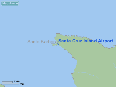
Santa Cruz Island Airport |
|
|
Location
& QuickFacts
|
FAA
Information Effective: |
2006-09-28 |
|
Airport
Identifier: |
SZN |
|
Longitude/Latitude: |
119-54-54.4680W/34-03-38.0100N
-119.915130/34.060558 (Estimated) |
|
Elevation: |
50 ft / 15.24 m (Estimated) |
|
Land: |
0 acres |
|
From
nearest city: |
24 nautical miles SW of Santa Barbara, CA |
|
Location: |
Santa Barbara County, CA |
|
Magnetic Variation: |
14E (1985) |
Owner
& Manager
|
Ownership: |
Privately owned |
|
Owner: |
The Nature Conservancy |
|
Address: |
213 Stearns Wharf
Santa Barbara, CA 93101 |
|
Phone
number: |
805-962-9111 |
|
Manager: |
Jim Sulentich |
|
Address: |
213 Stearns Wharf
Santa Barbara, CA 93101 |
|
Phone number: |
805-962-9111 |
Airport
Operations and Facilities
|
Airport Use: |
Private |
|
Wind indicator: |
Yes |
|
Segmented Circle: |
No |
|
Control Tower: |
No |
|
Attendance Schedule: |
UNATNDD |
|
Landing fee charge: |
No |
|
Sectional chart: |
Los Angeles |
|
Region: |
AWP - Western-Pacific |
|
Boundary ARTCC: |
ZLA - Los Angeles |
|
Tie-in FSS: |
HHR - Hawthorne |
|
FSS on Airport: |
No |
|
FSS Phone: |
310-970-0102 |
|
FSS Toll Free: |
1-800-WX-BRIEF |
Airport
Services
|
Airframe
Repair: |
NONE |
|
Power
Plant Repair: |
NONE |
|
Runway Information
Runway 09/27
|
Dimension: |
2150 x 50 ft / 655.3 x 15.2 m |
|
Surface: |
DIRT, |
|
|
Runway 09 |
Runway 27 |
|
Traffic
Pattern: |
Right |
Left |
|
Radio Navigation
Aids
|
ID |
Type |
Name |
Ch |
Freq |
Var |
Dist |
|
NTD |
TACAN |
Point Mugu |
043X |
|
15E |
39.7 nm |
|
CMA |
VOR/DME |
Camarillo |
105X |
115.80 |
15E |
41.8 nm |
|
VTU |
VOR/DME |
Ventura |
019X |
108.20 |
15E |
43.2 nm |
|
RZS |
VORTAC |
San Marcus |
096X |
114.90 |
14E |
27.9 nm |
|
GVO |
VORTAC |
Gaviota |
085X |
113.80 |
16E |
29.6 nm |
Remarks
- PVT
LNDG STRIP... TRESPASSERS ARE PROSECUTED.
- OWNER
DOES NOT DESIRE ARPT TO BE CHARTED.
- (E3A)
ADDNL PHONE NR TO HHR FSS 1-WX-BRIEF.
- EXISTED
PRIOR TO 5/15/59.
Santa Cruz Island Airport
Address:
Santa Barbara County, CA
Tel:
805-962-9111
Images
and information placed above are from
http://www.airport-data.com/airport/SZN/
We
thank them for the data!
| General
Info |
| Country |
United
States |
| State |
CALIFORNIA
|
| FAA ID |
SZN
|
| Latitude |
34-03-38.010N
|
| Longitude |
119-54-54.468W
|
| Elevation |
50 feet
|
| Near City |
SANTA
BARBARA |
We don't guarantee the information is fresh and accurate. The data may
be wrong or outdated.
For more up-to-date information please refer to other sources.
|
|


