 |
|
|
|
|
|
Location
& QuickFacts
|
FAA
Information Effective: |
2006-09-28 |
|
Airport
Identifier: |
81CL |
|
Longitude/Latitude: |
122-11-43.8790W/37-55-16.7270N
-122.195522/37.921313 (Estimated) |
|
Elevation: |
956 ft / 291.39 m (Estimated) |
|
Land: |
3 acres |
|
From
nearest city: |
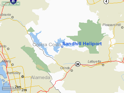
3 nautical miles N of Orinda, CA |
|
Location: |
Contra Costa County, CA |
|
Magnetic Variation: |
16E (1985) |
Owner
& Manager
|
Ownership: |
Privately owned |
|
Owner: |
Esther Holmes |
|
Address: |
60 Melody La
Orinda, CA 94563 |
|
Phone number: |
415-254-6742 |
|
Manager: |
Robert G. Holmes |
|
Address: |
60 Melody La
Orinda, CA 94563 |
|
Phone number: |
415-254-6742 |
Airport
Operations and Facilities
|
Airport Use: |
Private |
|
Wind indicator: |
Yes |
|
Segmented Circle: |
No |
|
Control Tower: |
No |
|
Attendance Schedule: |
UNATNDD |
|
Landing fee charge: |
No |
|
Sectional chart: |
San Francisco |
|
Region: |
AWP - Western-Pacific |
|
Boundary ARTCC: |
ZOA - Oakland |
|
Tie-in FSS: |
OAK - Oakland |
|
FSS on Airport: |
No |
|
FSS Phone: |
510-273-6111 |
|
FSS Toll Free: |
1-800-WX-BRIEF |
Airport
Communications
Airport
Services
|
Airframe
Repair: |
NONE |
|
Power
Plant Repair: |
NONE |
|
Runway Information
Helipad H1
|
Dimension: |
400 x 60 ft / 121.9 x 18.3 m |
|
Surface: |
GRAVEL, |
|
|
Runway H1 |
Runway |
|
Traffic
Pattern: |
Left |
Left |
|
Radio Navigation
Aids
|
ID |
Type |
Name |
Ch |
Freq |
Var |
Dist |
|
LV |
NDB |
Reiga |
|
374.00 |
16E |
27.9 nm |
|
TCY |
NDB |
Tracy |
|
203.00 |
15E |
38.2 nm |
|
SUU |
TACAN |
Travis |
113X |
|
17E |
22.8 nm |
|
NUQ |
TACAN |
Moffett |
123X |
|
17E |
30.1 nm |
|
TZZ |
VOR |
Travis |
|
116.40 |
17E |
31.3 nm |
|
CCR |
VOR/DME |
Concord |
117X |
117.00 |
17E |
10.3 nm |
|
SFO |
VOR/DME |
San Francisco |
105X |
115.80 |
17E |
20.0 nm |
|
SJC |
VOR/DME |
San Jose |
088X |
114.10 |
16E |
35.0 nm |
|
STS |
VOR/DME |
Santa Rosa |
077X |
113.00 |
16E |
45.7 nm |
|
OAK |
VORTAC |
Oakland |
115X |
116.80 |
17E |
11.8 nm |
|
SAU |
VORTAC |
Sausalito |
109X |
116.20 |
17E |
16.0 nm |
|
SGD |
VORTAC |
Scaggs Island |
058X |
112.10 |
17E |
17.6 nm |
|
OSI |
VORTAC |
Woodside |
086X |
113.90 |
17E |
32.0 nm |
|
PYE |
VORTAC |
Point Reyes |
084X |
113.70 |
17E |
33.2 nm |
|
SAC |
VORTAC |
Sacramento |
099X |
115.20 |
17E |
43.7 nm |
|
ECA |
VORTAC |
Manteca |
107X |
116.00 |
17E |
48.9 nm |
|
SFO |
VOT |
San Francisco Intl |
|
111.00 |
|
20.1 nm |
|
SAC |
VOT |
Sacramento Executive |
|
111.40 |
|
48.5 nm |
Remarks
Based Aircraft
|
Aircraft
based on field: |
1 |
|
Helicopters: |
1
AUTOGYRO. |
Sandhill Heliport
Address:
Contra Costa County, CA
Tel:
415-254-6742
Images
and information placed above are from
http://www.airport-data.com/airport/81CL/
We
thank them for the data!
| General
Info |
| Country |
United
States |
| State |
CALIFORNIA
|
| FAA ID |
81CL
|
| Latitude |
37-55-16.727N
|
| Longitude |
122-11-43.879W
|
| Elevation |
956 feet
|
| Near City |
ORINDA
|
We don't guarantee the information is fresh and accurate. The data may
be wrong or outdated.
For more up-to-date information please refer to other sources.
|
|


