 |
|
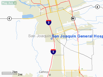
San Joaquin General Hospital Heliport |
|
|
Location
& QuickFacts
|
FAA
Information Effective: |
2006-09-28 |
|
Airport
Identifier: |
CL52 |
|
Longitude/Latitude: |
121-17-05.8010W/37-53-15.7310N
-121.284945/37.887703 (Estimated) |
|
Elevation: |
15 ft / 4.57 m (Estimated) |
|
Land: |
1 acres |
|
From
nearest city: |
6 nautical miles S of Stockton, CA |
|
Location: |
San Joaquin County, CA |
|
Magnetic Variation: |
16E (1985) |
Owner
& Manager
|
Ownership: |
Publicly owned |
|
Owner: |
San Joaquin General Hospital |
|
Address: |
500 West Hospital Road
French Camp, CA 95231 |
|
Phone
number: |
209-468-6000 |
|
Manager: |
Steven Ebert |
|
Address: |
500 W. Hospital Road
French Camp, CA 95231 |
|
Phone number: |
209-468-6000 |
Airport
Operations and Facilities
|
Airport
Use: |
Private
MEDICAL. |
|
Wind
indicator: |
Yes |
|
Segmented
Circle: |
No |
|
Control
Tower: |
No |
|
Attendance
Schedule: |
ALL/ALL/ALL |
|
Lighting
Schedule: |
PHONE REQ
FOR PERIMETER LGTS CALL 209-468-6300. |
|
Sectional
chart: |
San Francisco |
|
Region: |
AWP - Western-Pacific |
|
Boundary
ARTCC: |
ZOA - Oakland |
|
Tie-in
FSS: |
RIU - Rancho Murieta |
|
FSS
on Airport: |
No |
|
FSS
Phone: |
916-354-0161 |
|
FSS
Toll Free: |
1-800-WX-BRIEF |
|
Runway Information
Helipad H1
|
Dimension: |
95 x 95 ft / 29.0 x 29.0 m |
|
Surface: |
CONC, Good Condition |
|
|
Runway H1 |
Runway |
|
Traffic
Pattern: |
Left |
Left |
|
Radio Navigation
Aids
|
ID |
Type |
Name |
Ch |
Freq |
Var |
Dist |
|
TCY |
NDB |
Tracy |
|
203.00 |
15E |
14.0 nm |
|
LV |
NDB |
Reiga |
|
374.00 |
16E |
22.3 nm |
|
SUU |
TACAN |
Travis |
113X |
|
17E |
37.9 nm |
|
NUQ |
TACAN |
Moffett |
123X |
|
17E |
45.8 nm |
|
TZZ |
VOR |
Travis |
|
116.40 |
17E |
37.0 nm |
|
MOD |
VOR/DME |
Modesto |
093X |
114.60 |
17E |
22.1 nm |
|
CCR |
VOR/DME |
Concord |
117X |
117.00 |
17E |
37.2 nm |
|
SJC |
VOR/DME |
San Jose |
088X |
114.10 |
16E |
44.0 nm |
|
MCC |
VOR/DME |
Mc Clellan |
029X |
109.20 |
17E |
47.2 nm |
|
ECA |
VORTAC |
Manteca |
107X |
116.00 |
17E |
6.3 nm |
|
LIN |
VORTAC |
Linden |
095X |
114.80 |
17E |
17.4 nm |
|
SAC |
VORTAC |
Sacramento |
099X |
115.20 |
17E |
35.7 nm |
|
OAK |
VORTAC |
Oakland |
115X |
116.80 |
17E |
45.6 nm |
|
SAC |
VOT |
Sacramento Executive |
|
111.40 |
|
39.0 nm |
Remarks
- VFR,
PRIVATE USE; COMMUNICATIONS MAINTAINED WITH STOCKTON ATCT WHEN USING
HELIPORT.
San Joaquin General Hospital Heliport
Address:
San Joaquin County, CA
Tel:
209-468-6000
Images
and information placed above are from
http://www.airport-data.com/airport/CL52/
We
thank them for the data!
| General
Info |
| Country |
United
States |
| State |
CALIFORNIA
|
| FAA ID |
CL52
|
| Latitude |
37-53-15.731N
|
| Longitude |
121-17-05.801W
|
| Elevation |
15 feet
|
| Near City |
STOCKTON
|
We don't guarantee the information is fresh and accurate. The data may
be wrong or outdated.
For more up-to-date information please refer to other sources.
|
|


