 |
|
|
|
|
|
Location
& QuickFacts
|
FAA
Information Effective: |
2006-09-28 |
|
Airport
Identifier: |
CA88 |
|
Longitude/Latitude: |
120-54-27.6580W/36-01-33.8740N
-120.907683/36.026076 (Estimated) |
|
Elevation: |
441 ft / 134.42 m (Estimated) |
|
Land: |
20 acres |
|
From
nearest city: |
1 nautical miles NW of San Ardo, CA |
|
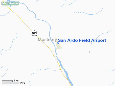
Location: |
Monterey County, CA |
|
Magnetic Variation: |
15E (1985) |
Owner
& Manager
|
Ownership: |
Privately owned |
|
Owner: |
San Bernardo Rancho |
|
Address: |
Box 82
San Ardo, CA 93450 |
|
Phone
number: |
408-627-2357 |
|
Manager: |
Margaret Du Flock |
|
Address: |
Box 82
San Ardo, CA 93450 |
|
Phone
number: |
408-627-2357
MANAGER'S RESIDENCE - NOT ON ARPT. |
Airport
Operations and Facilities
|
Airport Use: |
Private |
|
Wind indicator: |
Yes |
|
Segmented Circle: |
No |
|
Control Tower: |
No |
|
Attendance Schedule: |
UNATNDD |
|
Landing fee charge: |
No |
|
Sectional chart: |
San Francisco |
|
Region: |
AWP - Western-Pacific |
|
Traffic Pattern Alt: |
800 ft |
|
Boundary ARTCC: |
ZOA - Oakland |
|
Tie-in FSS: |
HHR - Hawthorne |
|
FSS on Airport: |
No |
|
FSS Phone: |
310-970-0102 |
|
FSS Toll Free: |
1-800-WX-BRIEF |
Airport
Services
|
Airframe
Repair: |
NONE |
|
Power
Plant Repair: |
NONE |
|
Bottled
Oxygen: |
NONE |
|
Bulk
Oxygen: |
NONE |
|
Runway Information
Runway 14/32
|
Dimension: |
2000 x 45 ft / 609.6 x 13.7 m |
|
Surface: |
ASPH, Fair Condition
WEEDS GROWING THROUGH RY SFC. |
|
Weight
Limit: |
Single wheel: 12000 lbs. |
|
|
Runway 14 |
Runway 32 |
|
Traffic
Pattern: |
Left |
Left |
|
Runway
End Identifier: |
No |
No |
|
Centerline
Lights: |
No |
No |
|
Touchdown
Lights: |
No |
No |
|
Obstruction: |
25 ft pline, 720.0 ft from runway, 20:1 slope
to clear
DIRT FARM RD AT APCH EOR; +6 INCH IRRIGATION PIPE 20 FT FM
EOR 125 FT LEFT TO 125 FT RIGHT. |
75 ft trees, 435.0 ft from runway, 145 ft left
of centerline, 3:1 slope to clear
PAVED RD AT APCH END OF RWY. |
|
Radio Navigation
Aids
|
ID |
Type |
Name |
Ch |
Freq |
Var |
Dist |
|
HGT |
NDB |
Hunter Liggett |
|
209.00 |
15E |
14.2 nm |
|
UAD |
NDB |
Chualar |
|
263.00 |
16E |
39.2 nm |
|
NLC |
TACAN |
Lemoore |
080X |
|
16E |
49.5 nm |
|
ROM |
VOR |
Priest |
|
110.00 |
16E |
13.6 nm |
|
PRB |
VORTAC |
Paso Robles |
090X |
114.30 |
16E |
25.3 nm |
|
BSR |
VORTAC |
Big Sur |
087X |
114.00 |
16E |
36.9 nm |
|
PXN |
VORTAC |
Panoche |
073X |
112.60 |
16E |
41.9 nm |
|
MQO |
VORTAC |
Morro Bay |
071X |
112.40 |
16E |
47.1 nm |
Remarks
- PART
77 VIOLATION: TREES SW OF RY 14/32 HOUSE 50 FT LEFT OF CNTRLN RY 32
& FARM EQUIP PARKED 50 FT RIGHT OF RY 14 CNTRLN; PENETRATE 7:1 SLOPE;
6 INCH IRRIGATION PIPE 30 FT FM RY CNTRLN & 350 FT FM END OF RY
32 IS WITHIN PRIMARY SFC.
- ESTABD
PRIOR TO 5/15/59.
Operational Statistics
|
Aircraft
Operations: |
25/Month |
|
General
Aviation Itinerant: |
100.0% |
San Ardo Field Airport
Address:
Monterey County, CA
Tel:
408-627-2357
Images
and information placed above are from
http://www.airport-data.com/airport/CA88/
We
thank them for the data!
| General
Info |
| Country |
United
States |
| State |
CALIFORNIA
|
| FAA ID |
CA88
|
| Latitude |
36-01-33.874N
|
| Longitude |
120-54-27.658W
|
| Elevation |
441 feet
|
| Near City |
SAN ARDO
|
We don't guarantee the information is fresh and accurate. The data may
be wrong or outdated.
For more up-to-date information please refer to other sources.
|
|


