 |
|
|
|
Location
& QuickFacts
|
FAA
Information Effective: |
2006-09-28 |
|
Airport
Identifier: |
24CL |
|
Longitude/Latitude: |
119-32-33.4440W/36-05-19.8250N
-119.542623/36.088840 (Estimated) |
|
Elevation: |
205 ft / 62.48 m (Surveyed) |
|
Land: |
31 acres |
|
From
nearest city: |
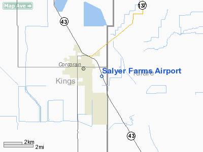
2 nautical miles SE of Corcoran, CA |
|
Location: |
Kings County, CA |
|
Magnetic Variation: |
15E (1985) |
Owner
& Manager
|
Ownership: |
Privately owned |
|
Owner: |
Jg Boswell Company |
|
Address: |
Po Box 457
Corcoran, CA 93212 |
|
Phone
number: |
559-992-2141 |
|
Manager: |
John Lichty |
|
Address: |
Jg Boswell Co Po Box 457
Corcoran, CA 93212 |
|
Phone number: |
559-992-2141 |
Airport
Operations and Facilities
|
Airport Use: |
Private |
|
Wind indicator: |
Yes |
|
Segmented Circle: |
No |
|
Control Tower: |
No |
|
Attendance Schedule: |
UNATNDD |
|
Landing fee charge: |
No |
|
Sectional chart: |
San Francisco |
|
Region: |
AWP - Western-Pacific |
|
Boundary ARTCC: |
ZOA - Oakland |
|
Tie-in FSS: |
RIU - Rancho Murieta |
|
FSS on Airport: |
No |
|
FSS Phone: |
916-354-0161 |
|
FSS Toll Free: |
1-800-WX-BRIEF |
Airport
Services
|
Airframe
Repair: |
NONE |
|
Power
Plant Repair: |
NONE |
|
Runway Information
Runway 14/32
|
Dimension: |
7000 x 80 ft / 2133.6 x 24.4 m |
|
Surface: |
ASPH, |
|
|
Runway 14 |
Runway 32 |
|
Traffic
Pattern: |
Left |
Right |
|
Radio Navigation
Aids
|
ID |
Type |
Name |
Ch |
Freq |
Var |
Dist |
|
COR |
NDB |
Salyer Farms |
|
205.00 |
16E |
1.4 nm |
|
CUK |
NDB |
Academy |
|
266.00 |
14E |
38.8 nm |
|
FCH |
NDB |
Chandler |
|
344.00 |
15E |
40.7 nm |
|
NLC |
TACAN |
Lemoore |
080X |
|
16E |
25.6 nm |
|
VIS |
VOR/DME |
Visalia |
031X |
109.40 |
16E |
17.0 nm |
|
TTE |
VOR/DME |
Tule |
029X |
109.20 |
16E |
27.5 nm |
|
AVE |
VORTAC |
Avenal |
118X |
117.10 |
16E |
34.0 nm |
|
EHF |
VORTAC |
Shafter |
101X |
115.40 |
14E |
42.3 nm |
|
CZQ |
VORTAC |
Clovis |
076X |
112.90 |
15E |
49.6 nm |
|
BFL |
VOT |
Bakersfield |
|
111.20 |
|
46.7 nm |
Remarks
- PRVDD
PROPONENT PAYS FOR COST INSTALLATION & FUTURE MAINT OF 6 SIGNS TO
BE PLACED ON STATE HWY & ROADS ADJ TO ARPT NTFY MOTORIST. OF THE
POSSIBILITY OF LOW FLYING ACFT IN VCNTY OF ARPT; RELCT THR RWY 14 TO
PRVD 200' SAFETY AREA.
Based Aircraft
|
Aircraft
based on field: |
4 |
|
Multi
Engine Airplanes: |
2 |
|
Jet Engine
Airplanes: |
1 |
|
Helicopters: |
1 |
Salyer Farms Airport
Address:
Kings County, CA
Tel:
559-992-2141
Images
and information placed above are from
http://www.airport-data.com/airport/24CL/
We
thank them for the data!
| General
Info |
| Country |
United
States |
| State |
CALIFORNIA
|
| FAA ID |
24CL
|
| Latitude |
36-05-19.825N
|
| Longitude |
119-32-33.444W
|
| Elevation |
205 feet
|
| Near City |
CORCORAN
|
We don't guarantee the information is fresh and accurate. The data may
be wrong or outdated.
For more up-to-date information please refer to other sources.
|
|


