|
|
Sacramento Mather Airport |
| Sacramento Mather Airport |
 |
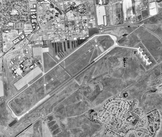
| USGS aerial photo as of 17 Aug 1998 |
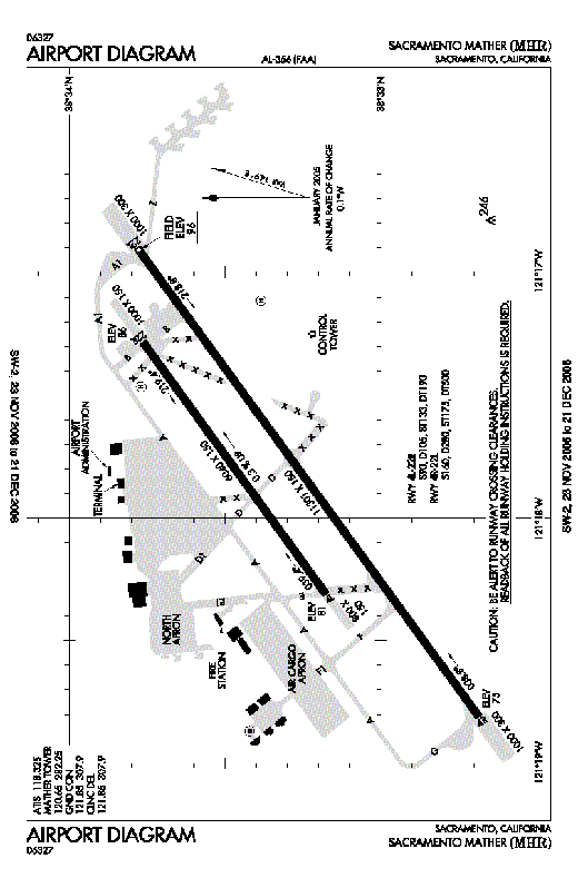 |
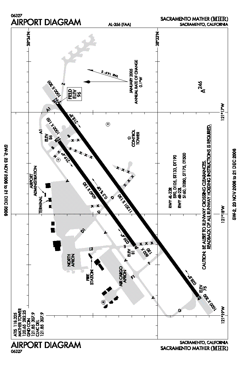
| FAA airport diagram |
| IATA: MHR – ICAO: KMHR – FAA LID: MHR |
| Summary |
| Airport type |
Public |
| Owner |
Sacramento County |
| Serves |
Sacramento, California |
| Elevation AMSL |
96 ft / 29 m |
| Coordinates |
38°33′14″N 121°17′51″W / 38.55389°N 121.2975°W / 38.55389; -121.2975 |
| Runways |
| Direction |
Length |
Surface |
| ft |
m |
| 4R/22L |
11,301 |
3,445 |
Asphalt/Concrete |
| 4L/22R |
6,040 |
1,841 |
Asphalt |
| Helipads |
| Number |
Length |
Surface |
| ft |
m |
| H1 |
30 |
9 |
Asphalt |
| H2 |
100 |
30 |
Asphalt |
| Statistics (2005) |
| Aircraft operations |
101,000 |
| Based aircraft |
152 |
| Source: FAA and airport web page |
Sacramento Mather Airport (IATA: MHR, ICAO: KMHR, FAA LID: MHR), also known as simply Mather Airport, is a county-owned public-use airport located 10 nautical miles (19 km) east of the central business district of Sacramento, in the city of Rancho Cordova, California, United States. It is located on the site of the former Mather Air Force Base which was closed in 1993. Facilities and aircraft
Sacramento Mather Airport covers an area of 2,875 acres (1,163 ha) at an elevation of 99 feet (30 m) above mean sea level. It has two runways: 4L/22R is 6,040 by 150 feet (1,841 x 46 m) with an asphalt pavement; 4R/22L is 11,301 by 150 feet (3,445 x 46 m) with a concrete and asphalt surface. The airport also has two helipads: H1 is 30 x 30 ft. (9 x 9 m); H2 is 100 x 100 ft. (30 x 30 m).
For the 12-month period ending December 31, 2005, the airport had 101,000 aircraft operations, an average of 276 per day: 55% general aviation, 19% air taxi, 16% scheduled commercial and 10% military. At that time there were 152 aircraft based at this airport: 23% single-engine, 24% multi-engine, 2% jet, 24% helicopter and 27% military.
Incidents
On February 17, 2000 an Emery Worldwide DC-8 cargo plane crashed shortly after take-off from this airport.
The above content comes from Wikipedia and is published under free licenses – click here to read more.
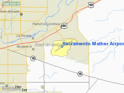
Location
& QuickFacts
|
FAA
Information Effective: |
2006-09-28 |
|
Airport
Identifier: |
MHR |
|
Longitude/Latitude: |
121-17-51.3270W/38-33-14.0290N
-121.297591/38.553897 (Estimated) |
|
Elevation: |
96 ft / 29.26 m (Surveyed) |
|
Land: |
2875 acres |
|
From
nearest city: |
10 nautical miles E of Sacramento, CA |
|
Location: |
Sacramento County, CA |
|
Magnetic Variation: |
16E (1985) |
Owner
& Manager
|
Ownership: |
Publicly owned |
|
Owner: |
County Of Sacramento |
|
Address: |
3745 Whitehead St.
Mather, CA 95655 |
|
Phone number: |
916-875-7077 |
|
Manager: |
Larry E. Kozub |
|
Address: |
3745 Whitehead Street
Mather, CA 95655 |
|
Phone number: |
916-875-7077 |
Airport
Operations and Facilities
|
Airport
Use: |
Open to public |
|
Wind
indicator: |
Yes |
|
Segmented
Circle: |
No |
|
Control
Tower: |
Yes |
|
Attendance
Schedule: |
ALL/ALL/ALL |
|
Lighting
Schedule: |
SS-SR |
|
Beacon
Color: |
Clear-Green (lighted land airport) |
|
Landing
fee charge: |
No |
|
Sectional
chart: |
San Francisco |
|
Region: |
AWP - Western-Pacific |
|
Boundary
ARTCC: |
ZOA - Oakland |
|
Tie-in
FSS: |
RIU - Rancho Murieta |
|
FSS
on Airport: |
No |
|
FSS
Phone: |
916-354-0161 |
|
FSS
Toll Free: |
1-800-WX-BRIEF |
|
NOTAMs
Facility: |
MHR (NOTAM-d service avaliable) |
|
Federal Agreements: |
N |
Airport
Communications
Airport
Services
|
Fuel
available: |
100LLA |
|
Airframe
Repair: |
MAJOR |
|
Power
Plant Repair: |
MAJOR |
|
Bulk
Oxygen: |
LOW |
|
Runway Information
Runway 04L/22R
|
Dimension: |
6040 x 150 ft / 1841.0 x 45.7 m |
|
Surface: |
ASPH, Good Condition
PAVEMENT HAS NUMEROUS CRACKS AND HOLDS WATER IN PLACES. |
|
Weight
Limit: |
Single wheel: 90000 lbs.
Dual wheel: 105000 lbs.
Dual tandem wheel: 190000 lbs.
SWL 65/PSI 640. |
|
Edge
Lights: |
Medium |
|
|
Runway 04L |
Runway 22R |
|
Longitude: |
121-18-18.8210W |
121-17-16.8170W |
|
Latitude: |
38-33-10.6630N |
38-33-45.6630N |
|
Elevation: |
78.00 ft |
95.00 ft |
|
Traffic
Pattern: |
Left |
Right |
|
Markings: |
Non-precision instrument, Good Condition |
Non-precision instrument, Good Condition |
|
Runway
End Identifier: |
No |
No |
|
Centerline
Lights: |
No |
No |
|
Touchdown
Lights: |
No |
No |
|
Runway 04R/22L
|
Dimension: |
11301 x 150 ft / 3444.5 x 45.7 m |
|
Surface: |
ASPH-CONC, Good Condition
PAVEMENT HAS NUMEROUS CRACKS AND HOLDS WATER IN PLACES. |
|
Weight
Limit: |
Single wheel: 160000 lbs.
Dual wheel: 280000 lbs.
Dual tandem wheel: 500000 lbs.
SWL 65/PSI 640. |
|
Edge
Lights: |
High |
|
|
Runway 04R |
Runway 22L |
|
Longitude: |
121-18-48.6490W |
121-16-53.9910W |
|
Latitude: |
38-32-40.9650N |
38-33-47.0860N |
|
Elevation: |
75.00 ft |
96.00 ft |
|
Alignment: |
54 |
127 |
|
ILS
Type: |
|
LOC/GS |
|
Traffic
Pattern: |
Right |
Left |
|
Markings: |
Precision instrument, Good Condition |
Precision instrument, Good Condition |
|
Crossing
Height: |
50.00 ft |
55.00 ft |
|
VASI: |
4-box on left side |
4-box on left side |
|
Visual
Glide Angle: |
3.00� |
3.00� |
|
RVR
Equipment: |
touchdown |
touchdown |
|
Approach
lights: |
|
MALSR |
|
Centerline
Lights: |
No |
No |
|
Touchdown
Lights: |
No |
No |
|
Helipad H1
|
Dimension: |
30
x 30 ft / 9.1 x 9.1 m |
|
Surface: |
ASPH, Poor Condition
PAVEMENT HAS NUMEROUS CRACKS AND HOLDS WATER IN PLACES. |
|
|
Runway H1 |
Runway |
|
Traffic
Pattern: |
Left |
Left |
|
Helipad H2
|
Dimension: |
100 x 100 ft / 30.5 x 30.5 m |
|
Surface: |
ASPH, Fair Condition
PAVEMENT HAS NUMEROUS CRACKS AND HOLDS WATER IN PLACES. |
|
|
Runway H2 |
Runway |
|
Traffic
Pattern: |
Left |
Left |
|
Radio Navigation
Aids
|
ID |
Type |
Name |
Ch |
Freq |
Var |
Dist |
|
MY |
NDB |
Halow |
|
222.00 |
16E |
39.8 nm |
|
BAB |
TACAN |
Beale |
023X |
|
16E |
35.6 nm |
|
SUU |
TACAN |
Travis |
113X |
|
17E |
35.7 nm |
|
TZZ |
VOR |
Travis |
|
116.40 |
17E |
27.2 nm |
|
MCC |
VOR/DME |
Mc Clellan |
029X |
109.20 |
17E |
8.5 nm |
|
HNW |
VOR/DME |
Hangtown |
102X |
115.50 |
17E |
27.7 nm |
|
MYV |
VOR/DME |
Marysville |
045X |
110.80 |
16E |
35.2 nm |
|
CCR |
VOR/DME |
Concord |
117X |
117.00 |
17E |
46.7 nm |
|
SAC |
VORTAC |
Sacramento |
099X |
115.20 |
17E |
13.7 nm |
|
LIN |
VORTAC |
Linden |
095X |
114.80 |
17E |
32.0 nm |
|
ECA |
VORTAC |
Manteca |
107X |
116.00 |
17E |
43.7 nm |
|
ILA |
VORTAC |
Williams |
091X |
114.40 |
18E |
46.2 nm |
|
SAC |
VOT |
Sacramento Executive |
|
111.40 |
|
9.7 nm |
|
SMF |
VOT |
Sacramento Metropolitan |
|
111.40 |
|
16.0 nm |
Remarks
- RY
22L CALM WIND RY.
- BE
ALERT FOR LARGE TRANSPORT ACFT TKOFS & LNDGS AND HIGH PERFORMANCE
MILITARY T-38 JETS.
- AVOID
NOISE SENSITIVE RESIDENTIAL AREAS NORTH/EAST OF RY 22L ILS FINAL APCH
COURSE. TURBOJET NIGHTTIME NOISE ABATEMENT ARRIVAL AND DEPARTURE PROCEDURES
IN EFFECT 2200-0700 DAILY.
- PILOT
INFORMATION ON NOISE ABATEMENT (916) 874-0359.
- TWY
D LTD TO ACFT WITH MAXIMUM GWT 50,000 LBS OR LESS. TWY D1 LIMITED TO
ACFT WITH MAXIMUM GWT OF 17,000 LBS OR LESS.
- BIRDS
INVOF OF ARPT.
- NO
OBJECTION
Based Aircraft
|
Aircraft
based on field: |
152 |
|
Single
Engine Airplanes: |
35 |
|
Multi
Engine Airplanes: |
36 |
|
Jet Engine
Airplanes: |
3 |
|
Helicopters: |
37 |
|
Military: |
41 |
Operational Statistics
|
Aircraft
Operations: |
321/Day |
|
Air Carrier: |
13.7% |
|
Air Taxi: |
16.2% |
|
General
Aviation Local: |
33.3% |
|
General
Aviation Itinerant: |
14.5% |
|
Military: |
8.5% |
Sacramento Mather Airport
Address:
Sacramento County, CA
Tel:
916-875-7077
Images
and information placed above are from
http://www.airport-data.com/airport/MHR/
We
thank them for the data!
| General
Info |
| Country |
United
States |
| State |
CALIFORNIA
|
| FAA ID |
MHR
|
| Latitude |
38-33-14.029N
|
| Longitude |
121-17-51.327W
|
| Elevation |
96 feet
|
| Near City |
SACRAMENTO
|
We don't guarantee the information is fresh and accurate. The data may
be wrong or outdated.
For more up-to-date information please refer to other sources.
|
|