 |
|
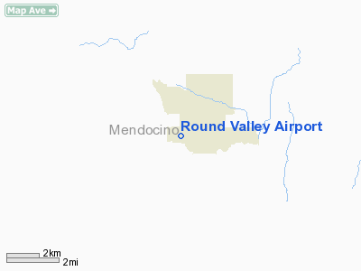
| Round Valley Airport |
| IATA: none – ICAO: none – FAA LID: O09 |
| Summary |
| Airport type |
Public |
| Operator |
Mendocino County |
| Location |
Covelo, California |
| Elevation AMSL |
1,434 ft / 437.1 m |
| Coordinates |
39°47′25″N 123°15′59″W / 39.79028°N 123.26639°W / 39.79028; -123.26639Coordinates: 39°47′25″N 123°15′59″W / 39.79028°N 123.26639°W / 39.79028; -123.26639 |
| Runways |
| Direction |
Length |
Surface |
| ft |
m |
| 10/28 |
3,670 |
1,119 |
Asphalt |
Round Valley Airport (FAA LID: O09) is a public airport located one mile (1.6 km) southwest of Covelo, serving Mendocino County, California, USA. The airport is mostly used for general aviation.
Facilities
Round Valley Airport covers 110 acres (45 ha) and has one asphalt paved runway (10/28) measuring 3,670 x 55 ft. (1,119 x 17 m).
The above content comes from Wikipedia and is published under free licenses – click here to read more.
Location
& QuickFacts
|
FAA
Information Effective: |
2006-09-28 |
|
Airport
Identifier: |
O09 |
|
Longitude/Latitude: |
123-15-59.0490W/39-47-24.5560N
-123.266402/39.790154 (Estimated) |
|
Elevation: |
1434 ft / 437.08 m (Estimated) |
|
Land: |
110 acres |
|
From
nearest city: |
1 nautical miles SW of Covelo, CA |
|
Location: |
Mendocino County, CA |
|
Magnetic Variation: |
17E (1985) |
Owner
& Manager
|
Ownership: |
Publicly owned |
|
Owner: |
Mendocino County |
|
Address: |
340 Lake Mendocino Drive
Ukiah, CA 95482-9432 |
|
Phone
number: |
707-463-4363 |
|
Manager: |
Charles A. Boyer
DOT BUSINESS SERVICES MGR. |
|
Address: |
340 Lake Mendocino Drive
Ukiah, CA 95482-9432 |
|
Phone number: |
707-463-4363
OFFICE IN UKIAH, CA. |
Airport
Operations and Facilities
|
Airport
Use: |
Open to public |
|
Wind
indicator: |
Yes |
|
Segmented
Circle: |
Yes |
|
Control
Tower: |
No |
|
Attendance
Schedule: |
ALL/MON-FRI/ON CALL
FOR ARPT ATTENDANT PHONE (707) 983-6542. |
|
Lighting
Schedule: |
DUSK-DAWN
ARPT BCN OTS INDEFLY. |
|
Beacon
Color: |
Clear-Green (lighted land airport) |
|
Landing
fee charge: |
No |
|
Sectional
chart: |
San Francisco |
|
Region: |
AWP - Western-Pacific |
|
Traffic
Pattern Alt: |
800 ft |
|
Boundary
ARTCC: |
ZOA - Oakland |
|
Tie-in
FSS: |
OAK - Oakland |
|
FSS
on Airport: |
No |
|
FSS
Phone: |
510-273-6111 |
|
FSS
Toll Free: |
1-800-WX-BRIEF |
|
NOTAMs
Facility: |
OAK (NOTAM-d service avaliable) |
|
Federal Agreements: |
N |
Airport
Communications
|
CTAF: |
122.800 |
|
Unicom: |
122.800 |
Airport
Services
|
Airframe
Repair: |
NONE |
|
Power
Plant Repair: |
NONE |
|
Bottled
Oxygen: |
NONE |
|
Bulk
Oxygen: |
NONE |
|
Runway Information
Runway 10/28
|
Dimension: |
3670 x 55 ft / 1118.6 x 16.8 m |
|
Surface: |
ASPH, Good Condition |
|
Weight
Limit: |
Single wheel: 30000 lbs. |
|
Edge
Lights: |
Medium |
|
|
Runway 10 |
Runway 28 |
|
Traffic
Pattern: |
Left |
Right |
|
Markings: |
Basic, Fair Condition |
Basic, Fair Condition |
|
Displaced
threshold: |
210.00 ft |
270.00 ft |
|
Runway
End Identifier: |
No |
No |
|
Centerline
Lights: |
No |
No |
|
Touchdown
Lights: |
No |
No |
|
Obstruction: |
250 ft hill, 2500.0 ft from runway, 100 ft
right of centerline, 9:1 slope to clear
APCH RATIO 10:1 TO DSPLCD THLD.
ROAD 100 FT FM THR & 4 FT FENCE 135 FT FM THR; 3 FT TIRES
80 FT 0B FM THR. |
100 ft trees, 3500.0 ft from runway, 33:1 slope
to clear
APCH RATIO TO DSPLCD THR 37:1; APCH RATIO TO DSPLCD THR OVER
+15 FT ROAD 310 FT FM DSPLCD THR 20:1.
ROAD 50 FT FM THR; 4 FT FENCE 40 FT FM THR; 5 FT FENCE 110
FT FM THR. |
|
Radio Navigation
Aids
|
ID |
Type |
Name |
Ch |
Freq |
Var |
Dist |
|
ENI |
VORTAC |
Mendocino |
070X |
112.30 |
16E |
44.3 nm |
Based Aircraft
|
Aircraft
based on field: |
18 |
|
Single
Engine Airplanes: |
9 |
|
Jet Engine
Airplanes: |
9 |
Operational Statistics
|
Aircraft
Operations: |
39/Week |
|
Air Taxi: |
25.0% |
|
General
Aviation Local: |
50.0% |
|
General
Aviation Itinerant: |
25.0% |
Round Valley Airport
Address:
Mendocino County, CA
Tel:
707-463-4363
Images
and information placed above are from
http://www.airport-data.com/airport/O09/
We
thank them for the data!
| General
Info |
| Country |
United
States |
| State |
CALIFORNIA
|
| FAA ID |
O09
|
| Latitude |
39-47-24.556N
|
| Longitude |
123-15-59.049W
|
| Elevation |
1434 feet
|
| Near City |
COVELO
|
We don't guarantee the information is fresh and accurate. The data may
be wrong or outdated.
For more up-to-date information please refer to other sources.
|
|


