 |
|
Location
& QuickFacts
|
FAA
Information Effective: |
2006-09-28 |
|
Airport
Identifier: |
CA09 |
|
Longitude/Latitude: |
122-50-40.1220W/41-53-10.4820N
-122.844478/41.886245 (Estimated) |
|
Elevation: |
3500 ft / 1066.80 m (Estimated) |
|
Land: |
0 acres |
|
From
nearest city: |
2 nautical miles NW of Klamath River, CA |
|
Location: |
Siskiyou County, CA |
|
Magnetic Variation: |
18E (1985) |
Owner
& Manager
|
Ownership: |
Privately owned |
|
Owner: |
Carter C. Taylor |
|
Address: |
220 Highland Avenue
Piedmont, CA 94611 |
|
Address: |
|
Airport
Operations and Facilities
|
Airport
Use: |
Private |
|
Wind
indicator: |
Yes |
|
Segmented
Circle: |
No |
|
Control
Tower: |
No |
|
Attendance
Schedule: |
UNATNDD |
|
Landing
fee charge: |
No |
|
Sectional
chart: |
Klamath Falls |
|
Region: |
AWP - Western-Pacific |
|
Boundary
ARTCC: |
ZSE - Seattle |
|
Tie-in
FSS: |
RIU - Rancho Murieta |
|
FSS
on Airport: |
No |
|
FSS
Phone: |
916-354-0161 |
|
FSS
Toll Free: |
1-800-WX-BRIEF |
|
Runway Information
Runway 03/21
|
Dimension: |
1500 x 50 ft / 457.2 x 15.2 m |
|
Surface: |
DIRT, |
|
|
Runway 03 |
Runway 21 |
|
Traffic
Pattern: |
Left |
Left |
|
Radio Navigation
Aids
|
ID |
Type |
Name |
Ch |
Freq |
Var |
Dist |
|
MOG |
NDB |
Montague |
|
404.00 |
19E |
18.9 nm |
|
MEF |
NDB |
Medford |
|
356.00 |
19E |
30.4 nm |
|
FJS |
VOR/DME |
Fort Jones |
033X |
109.60 |
19E |
26.3 nm |
|
OED |
VORTAC |
Rogue Valley |
083X |
113.60 |
19E |
35.8 nm |
|
MFR |
VOT |
Medford-jackson County |
|
117.20 |
|
28.4 nm |
Remarks
- <
NORTHEAST TKOF AND SOUTHWEST>
- VFR
ONLY.
Based Aircraft
|
Aircraft
based on field: |
1 |
|
Single
Engine Airplanes: |
1 |
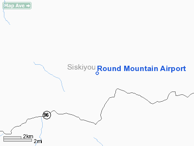
Round Mountain Airport
Address:
Siskiyou County, CA
Tel:
Images
and information placed above are from
http://www.airport-data.com/airport/CA09/
We
thank them for the data!
| General
Info |
| Country |
United
States |
| State |
CALIFORNIA
|
| FAA ID |
CA09
|
| Latitude |
41-53-10.482N
|
| Longitude |
122-50-40.122W
|
| Elevation |
3500 feet
|
| Near City |
KLAMATH
RIVER |
We don't guarantee the information is fresh and accurate. The data may
be wrong or outdated.
For more up-to-date information please refer to other sources.
|
|


