 |
|
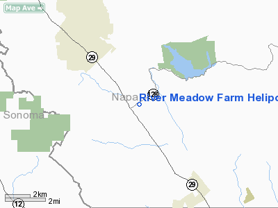
River Meadow Farm Heliport |
Location
& QuickFacts
|
FAA
Information Effective: |
2006-09-28 |
|
Airport
Identifier: |
7CA9 |
|
Longitude/Latitude: |
122-24-52.9230W/38-27-42.6750N
-122.414701/38.461854 (Estimated) |
|
Elevation: |
146 ft / 44.50 m (Estimated) |
|
Land: |
0 acres |
|
From
nearest city: |
1 nautical miles SE of Rutherford, CA |
|
Location: |
Napa County, CA |
|
Magnetic Variation: |
16E (1985) |
Owner
& Manager
|
Ownership: |
Privately
owned |
|
Owner: |
Alfred S. Wilsey |
|
Address: |
Po Box 3532
San Francisco, CA 94119 |
|
Phone
number: |
415-391-4150 |
|
Manager: |
C. D. Mooney |
|
Address: |
Po Box 3532
San Francisco, CA 94119 |
|
Phone number: |
415-391-4150 |
Airport Operations and Facilities
|
Airport
Use: |
Private |
|
Wind
indicator: |
Yes |
|
Segmented Circle: |
No |
|
Control
Tower: |
No |
|
Attendance Schedule: |
UNATNDD |
|
Landing
fee charge: |
No |
|
Sectional chart: |
San Francisco |
|
Region: |
AWP - Western-Pacific |
|
Boundary
ARTCC: |
ZOA - Oakland |
|
Tie-in
FSS: |
OAK - Oakland |
|
FSS
on Airport: |
No |
|
FSS
Phone: |
510-273-6111 |
|
FSS
Toll Free: |
1-800-WX-BRIEF |
|
Runway Information
Helipad H1
|
Dimension: |
65
x 65 ft / 19.8 x 19.8 m |
|
Surface: |
CONC, |
|
|
Runway H1 |
Runway |
|
Traffic
Pattern: |
Left |
Left |
|
Radio Navigation
Aids
|
ID |
Type |
Name |
Ch |
Freq |
Var |
Dist |
|
LOP |
NDB |
Lampson |
|
217.00 |
16E |
38.9 nm |
|
SUU |
TACAN |
Travis |
113X |
|
17E |
25.7 nm |
|
TZZ |
VOR |
Travis |
|
116.40 |
17E |
29.3 nm |
|
STS |
VOR/DME |
Santa Rosa |
077X |
113.00 |
16E |
18.8 nm |
|
CCR |
VOR/DME |
Concord |
117X |
117.00 |
17E |
30.5 nm |
|
MCC |
VOR/DME |
Mc Clellan |
029X |
109.20 |
17E |
49.1 nm |
|
SGD |
VORTAC |
Scaggs Island |
058X |
112.10 |
17E |
17.1 nm |
|
PYE |
VORTAC |
Point Reyes |
084X |
113.70 |
17E |
31.4 nm |
|
SAU |
VORTAC |
Sausalito |
109X |
116.20 |
17E |
36.8 nm |
|
SAC |
VORTAC |
Sacramento |
099X |
115.20 |
17E |
40.6 nm |
|
ILA |
VORTAC |
Williams |
091X |
114.40 |
18E |
40.9 nm |
|
OAK |
VORTAC |
Oakland |
115X |
116.80 |
17E |
45.1 nm |
|
SMF |
VOT |
Sacramento Metropolitan |
|
111.40 |
|
41.1 nm |
|
SAC |
VOT |
Sacramento Executive |
|
111.40 |
|
43.2 nm |
Remarks
Based Aircraft
|
Aircraft
based on field: |
1 |
|
Helicopters: |
1 |
River Meadow Farm Heliport
Address:
Napa County, CA
Tel:
415-391-4150
Images
and information placed above are from
http://www.airport-data.com/airport/7CA9/
We
thank them for the data!
| General
Info |
| Country |
United
States |
| State |
CALIFORNIA
|
| FAA ID |
7CA9
|
| Latitude |
38-27-42.675N
|
| Longitude |
122-24-52.923W
|
| Elevation |
146 feet
|
| Near City |
RUTHERFORD
|
We don't guarantee the information is fresh and accurate. The data may
be wrong or outdated.
For more up-to-date information please refer to other sources.
|
|


