 |
|
|
|
|
|
Location
& QuickFacts
|
FAA
Information Effective: |
2006-09-28 |
|
Airport
Identifier: |
07CL |
|
Longitude/Latitude: |
121-46-16.9130W/39-29-51.5890N
-121.771365/39.497664 (Estimated) |
|
Elevation: |
100 ft / 30.48 m (Estimated) |
|
Land: |
12 acres |
|
From
nearest city: |
1 nautical miles W of Richvale, CA |
|
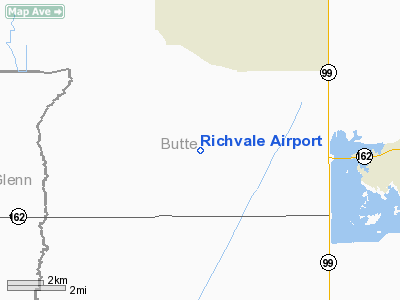
Location: |
Butte County, CA |
|
Magnetic Variation: |
17E (1985) |
Owner
& Manager
|
Ownership: |
Privately owned |
|
Owner: |
Craig Compton |
|
Address: |
1778 Richvale Rd
Richvale, CA 95974 |
|
Manager: |
Craig Compton |
|
Address: |
Box 245
Richvale, CA 95974 |
|
Phone number: |
916-882-4286 |
Airport
Operations and Facilities
|
Airport Use: |
Private |
|
Wind indicator: |
Yes |
|
Segmented Circle: |
No |
|
Control Tower: |
No |
|
Attendance Schedule: |
UNATNDD |
|
Lighting Schedule: |
DUSK-DAWN |
|
Landing fee charge: |
No |
|
Sectional chart: |
San Francisco |
|
Region: |
AWP - Western-Pacific |
|
Traffic Pattern Alt: |
800 ft |
|
Boundary ARTCC: |
ZOA - Oakland |
|
Tie-in FSS: |
RIU - Rancho Murieta |
|
FSS on Airport: |
No |
|
FSS Phone: |
916-354-0161 |
|
FSS Toll Free: |
1-800-WX-BRIEF |
Airport
Services
|
Airframe
Repair: |
NONE |
|
Power
Plant Repair: |
NONE |
|
Bottled
Oxygen: |
NONE |
|
Bulk
Oxygen: |
NONE |
|
Runway Information
Runway 16/34
|
Dimension: |
2220 x 50 ft / 676.7 x 15.2 m |
|
Surface: |
ASPH, |
|
Edge
Lights: |
Low |
|
|
Runway 16 |
Runway 34 |
|
Elevation: |
100.00 ft |
100.00 ft |
|
Traffic
Pattern: |
Left |
Left |
|
Markings: |
Nonstandard, Good Condition
NUMBERS ONLY. |
Nonstandard, Good Condition |
|
Runway
End Identifier: |
No |
No |
|
Centerline
Lights: |
No |
No |
|
Touchdown
Lights: |
No |
No |
|
Radio Navigation
Aids
|
ID |
Type |
Name |
Ch |
Freq |
Var |
Dist |
|
OVE |
NDB |
Oroville |
|
212.00 |
16E |
6.9 nm |
|
MY |
NDB |
Halow |
|
222.00 |
16E |
21.1 nm |
|
PBT |
NDB |
Proberta |
|
338.00 |
16E |
42.8 nm |
|
BAB |
TACAN |
Beale |
023X |
|
16E |
26.7 nm |
|
CIC |
VOR/DME |
Chico |
035X |
109.80 |
16E |
17.9 nm |
|
MYV |
VOR/DME |
Marysville |
045X |
110.80 |
16E |
25.7 nm |
|
MXW |
VORTAC |
Maxwell |
037X |
110.00 |
18E |
23.5 nm |
|
ILA |
VORTAC |
Williams |
091X |
114.40 |
18E |
28.3 nm |
|
RBL |
VORTAC |
Red Bluff |
104X |
115.70 |
18E |
42.0 nm |
|
SMF |
VOT |
Sacramento Metropolitan |
|
111.40 |
|
49.2 nm |
Remarks
- APCH
END RWY 34 POWERLINES UNDERGROUND BTN POLES.
- RICHVALE
ELEVATION 112 PAINTED AT RWY MID POINT.
- ESTABD
PRIOR TO 15 MAY 1959.
Based Aircraft
|
Aircraft
based on field: |
22 |
|
Single
Engine Airplanes: |
17 |
|
Helicopters: |
5 |
Operational Statistics
|
Aircraft
Operations: |
193/Week |
|
General
Aviation Local: |
60.0% |
|
General
Aviation Itinerant: |
40.0% |
Richvale Airport
Address:
Butte County, CA
Tel:
916-882-4286
Images
and information placed above are from
http://www.airport-data.com/airport/07CL/
We
thank them for the data!
| General
Info |
| Country |
United
States |
| State |
CALIFORNIA
|
| FAA ID |
07CL
|
| Latitude |
39-29-51.589N
|
| Longitude |
121-46-16.913W
|
| Elevation |
100 feet
|
| Near City |
RICHVALE
|
We don't guarantee the information is fresh and accurate. The data may
be wrong or outdated.
For more up-to-date information please refer to other sources.
|
|


