 |
|
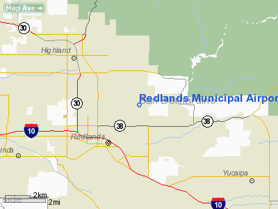
Redlands Municipal Airport |
|
|
Location
& QuickFacts
|
FAA
Information Effective: |
2006-09-28 |
|
Airport
Identifier: |
L12 |
|
Longitude/Latitude: |
117-08-46.9640W/34-05-06.9420N
-117.146379/34.085262 (Estimated) |
|
Elevation: |
1571 ft / 478.84 m (Surveyed) |
|
Land: |
194 acres |
|
From
nearest city: |
2 nautical miles NE of Redlands, CA |
|
Location: |
San Bernardino County, CA |
|
Magnetic Variation: |
14E (1995) |
Owner
& Manager
|
Ownership: |
Publicly owned |
|
Owner: |
City Of Redlands |
|
Address: |
35 Cajon Street, Suite 15a
Redlands, CA 92374 |
|
Phone
number: |
909-798-7668 |
|
Manager: |
Todd Housley |
|
Address: |
35 Cajon Street, Suite 15a
Redlands, CA 92373 |
|
Phone number: |
909-798-7668
MAIN NO: 909-798-7655 |
Airport
Operations and Facilities
|
Airport
Use: |
Open to public |
|
Wind
indicator: |
Yes |
|
Segmented
Circle: |
Yes |
|
Control
Tower: |
No |
|
Attendance
Schedule: |
ALL/ALL/0800-1700 |
|
Lighting
Schedule: |
DUSK-DAWN
ACTVT MIRL RY 08/26, REIL RYS 08 & RY 26, PAPI RY 08
- CTAF. |
|
Beacon
Color: |
Clear-Green (lighted land airport) |
|
Landing
fee charge: |
No |
|
Sectional
chart: |
Los Angeles |
|
Region: |
AWP - Western-Pacific |
|
Traffic
Pattern Alt: |
929 ft |
|
Boundary
ARTCC: |
ZLA - Los Angeles |
|
Tie-in
FSS: |
RAL - Riverside |
|
FSS
on Airport: |
No |
|
FSS
Phone: |
951-351-3020 |
|
FSS
Toll Free: |
1-800-WX-BRIEF |
|
NOTAMs
Facility: |
RAL (NOTAM-d service avaliable) |
|
Federal Agreements: |
NGY |
Airport
Communications
|
CTAF: |
123.050 |
|
Unicom: |
123.050 |
Airport
Services
|
Fuel
available: |
100LL
SELF SERVE 100LL FUEL AVAIL. 24-7. |
|
Airframe
Repair: |
MAJOR |
|
Power
Plant Repair: |
MAJOR |
|
Bottled
Oxygen: |
NONE |
|
Bulk
Oxygen: |
HIGH/LOW |
|
Runway Information
Runway 08/26
|
Dimension: |
4505 x 75 ft / 1373.1 x 22.9 m |
|
Surface: |
ASPH, Good Condition |
|
Weight
Limit: |
Single wheel: 12500 lbs. |
|
Edge
Lights: |
Medium |
|
|
Runway 08 |
Runway 26 |
|
Longitude: |
117-09-13.7350W |
117-08-20.1930W |
|
Latitude: |
34-05-06.8100N |
34-05-07.0730N |
|
Elevation: |
1469.00 ft |
1571.00 ft |
|
Alignment: |
90 |
127 |
|
Traffic
Pattern: |
Left |
Right |
|
Markings: |
Basic, Good Condition |
Basic, Fair Condition |
|
Crossing
Height: |
40.00 ft |
0.00
ft |
|
VASI: |
2-light PAPI on left side |
|
|
Visual
Glide Angle: |
3.00� |
0.00� |
|
Runway
End Identifier: |
Yes |
Yes |
|
Centerline
Lights: |
No |
No |
|
Touchdown
Lights: |
No |
No |
|
Obstruction: |
4 ft fence, 300.0 ft from runway, 125 ft left
of centerline, 25:1 slope to clear |
60 ft trees, 1500.0 ft from runway, 120 ft
left of centerline, 22:1 slope to clear |
|
Radio Navigation
Aids
|
ID |
Type |
Name |
Ch |
Freq |
Var |
Dist |
|
SB |
NDB |
Petis |
|
397.00 |
14E |
11.1 nm |
|
SJY |
NDB |
San Jacinto |
|
227.00 |
14E |
18.9 nm |
|
EMT |
NDB |
El Monte |
|
359.00 |
15E |
44.0 nm |
|
RIV |
TACAN |
March |
077X |
|
14E |
12.5 nm |
|
RAL |
VOR |
Riverside |
|
112.40 |
15E |
17.1 nm |
|
HDF |
VOR |
Homeland |
|
113.40 |
14E |
18.7 nm |
|
VCV |
VOR/DME |
Victorville |
031X |
109.40 |
14E |
32.9 nm |
|
ELB |
VOR/DME |
El Toro |
119X |
117.20 |
14E |
38.2 nm |
|
PDZ |
VORTAC |
Paradise |
059X |
112.20 |
15E |
21.6 nm |
|
POM |
VORTAC |
Pomona |
041X |
110.40 |
15E |
31.9 nm |
|
PSP |
VORTAC |
Palm Springs |
102X |
115.50 |
13E |
38.0 nm |
|
SLI |
VORTAC |
Seal Beach |
104X |
115.70 |
15E |
48.8 nm |
|
SNA |
VOT |
Santa Ana |
|
110.00 |
|
43.7 nm |
Based Aircraft
|
Aircraft
based on field: |
221 |
|
Single
Engine Airplanes: |
194 |
|
Multi
Engine Airplanes: |
20 |
|
Jet Engine
Airplanes: |
1 |
|
Helicopters: |
3 |
|
Gliders: |
2 |
|
Ultralights: |
1 |
Operational Statistics
|
Aircraft
Operations: |
121/Day |
|
General
Aviation Local: |
74.5% |
|
General
Aviation Itinerant: |
25.5% |
Redlands Municipal Airport
Address:
San Bernardino County, CA
Tel:
909-798-7668
Images
and information placed above are from
http://www.airport-data.com/airport/L12/
We
thank them for the data!
| General
Info |
| Country |
United
States |
| State |
CALIFORNIA
|
| FAA ID |
L12
|
| Latitude |
34-05-06.942N
|
| Longitude |
117-08-46.964W
|
| Elevation |
1571 feet
|
| Near City |
REDLANDS
|
We don't guarantee the information is fresh and accurate. The data may
be wrong or outdated.
For more up-to-date information please refer to other sources.
|
|


