|
|
Redding Municipal Airport |
Coordinates: 40°30′32″N 122°17′36″W / 40.50889°N 122.29333°W / 40.50889; -122.29333
| Redding Municipal Airport |
 |
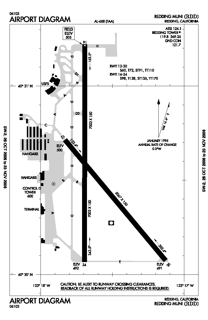
| FAA airport diagram |
| IATA: RDD – ICAO: KRDD – FAA LID: RDD |
| Summary |
| Airport type |
Public |
| Owner |
City of Redding |
| Serves |
Redding, California |
| Location |
Redding, California, USA |
| Elevation AMSL |
505 ft / 154 m |
| Coordinates |
40°30′32″N 122°17′36″W / 40.50889°N 122.29333°W / 40.50889; -122.29333 |
| Runways |
| Direction |
Length |
Surface |
| ft |
m |
| 16/34 |
7,003 |
2,135 |
Asphalt |
| 12/30 |
5,067 |
1,544 |
Asphalt |
| Statistics (2006) |
| Aircraft operations |
77,211 |
| Based aircraft |
181 |
| Source: Federal Aviation Administration |
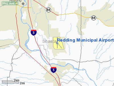
Redding Municipal Airport (IATA: RDD, ICAO: KRDD, FAA LID: RDD) is a city-owned public-use airport located six miles (10 km) southeast of the central business district of Redding, a city in Shasta County, California, United States. It is one of two airports located in the City of Redding, the other being Benton Airpark. The airport is mostly used for general aviation, but is also served by two commercial airlines. History
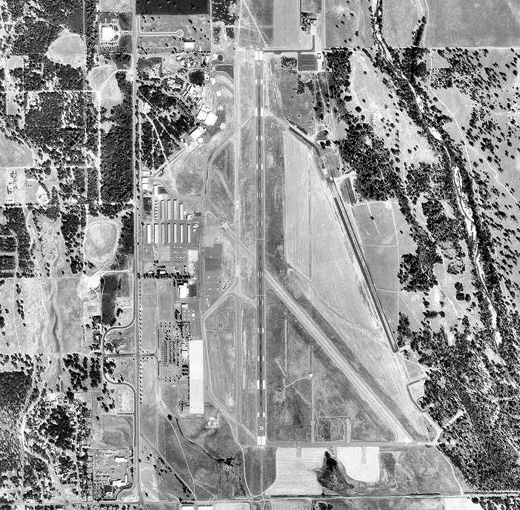 | |
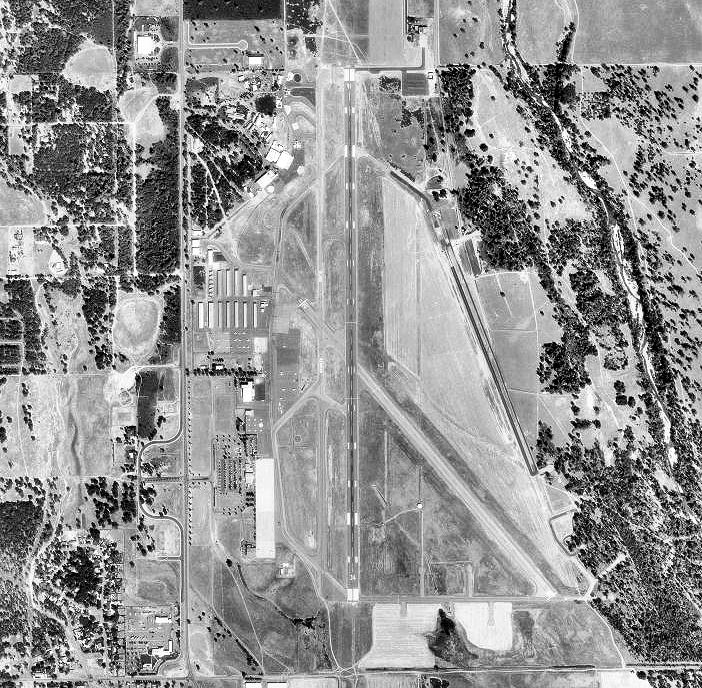
Redding Municipal Airport, 9 October 1998 |
In 1942, the site of Redding Army Airfield was acquired by the United States Army Corps of Engineers for the United States Army Air Forces. Initially Redding AAF was a sub-base for Chico AAF and garrisoned by the 433d Army Air Force Base Unit. It was under the overall command of Fourth Air Force at Hamiltion AAF.
The overall mission of Redding Army Airfield was advanced flight training of new airmen prior to their deployment overseas into the combat zoned of the Pacific, China, Mediterranean or European Theaters. The USAAF 339th Fighter Squadron, 369th Fighter Group operated P-39 Airacobras from the airfield to perform that mission.
On 1 November 1944, operational control of Redding AAF was transferred from the Fourth Air Force to the Sacramento Area Command of the Army Air Forces’ Air Technical Service Command headquartered at McClellan Army Airfield near Sacramento. The host unit was redesignated as the 4191st Army Air Force Base Unit. The mission was changed from training air crews to that of a refueling and maintenance facility for transient aircraft, which it remained until the end of the war.
On 19 December 1945 the military declared Redding AAF to be excess to requirements, and on 18 November 1946 the facility was turned over to the City of Redding to operate a civil airfield on the site. Final transfer of the facility was in 1949, ending military ownership of the airfield.
Today, the City of Redding continues to operate the site as Redding Municipal Airport and has embarked on a major commercial development of the Site.
On July 17, 2008, President George Bush and staff landed at The Redding Airport in Air Force One. The purpose of the trip was to allow the president to survey and evaluate the damage done by northstate wildfires.
Facilities and aircraft
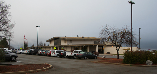 | |
The Redding Airport terminal |
Redding Municipal Airport covers an area of 1,584 acres (641 ha) which contains two asphalt paved runways: 16/34 measuring 7,003 x 150 ft (2,135 x 46 m) and 12/30 measuring 5,067 x 150 ft (1,544 x 46 m).
For the 12-month period ending December 31, 2006, the airport had 77,211 aircraft operations, an average of 211 per day: 80% general aviation, 16% air taxi, 3% scheduled commercial and 1% military (781). There are 181 aircraft based at this airport: 75% single-engine, 15% multi-engine, 7% helicopter and 3% jet.
Expansion plans
The City of Redding is looking into expanding Redding Municipal Airport. The airport now imposes a $4.50 fee for expansion of the terminal, rehabilitation of two taxiways, and a better safety buffer. The airport needs to raise at least $10.8 million for these projects. The amount of passengers has increased due to the Horizon Air flight to Los Angeles. Airport staff have made efforts to arrange United Express service to Denver and Delta Connection service to Salt Lake City.
Airlines and destinations
| Airlines |
Destinations |
| Horizon Air |
Eureka/Arcata , Los Angeles |
| United Express operated by SkyWest Airlines |
San Francisco |
The above content comes from Wikipedia and is published under free licenses – click here to read more.
Location
& QuickFacts
|
FAA
Information Effective: |
2006-09-28 |
|
Airport
Identifier: |
RDD |
|
Longitude/Latitude: |
122-17-36.2000W/40-30-32.4000N
-122.293389/40.509000 (Estimated) |
|
Elevation: |
505 ft / 153.92 m (Surveyed) |
|
Land: |
1584 acres |
|
From
nearest city: |
6 nautical miles SE of Redding, CA |
|
Location: |
Shasta County, CA |
|
Magnetic Variation: |
18E (1980) |
Owner
& Manager
|
Ownership: |
Publicly owned |
|
Owner: |
City Of Redding |
|
Address: |
Airports Division, Po Box 496071
Redding, CA 96049-6071 |
|
Phone
number: |
530-224-4321 |
|
Manager: |
Rod Dinger |
|
Address: |
Redding Muni Airport, 6751 Woodrum Circle
Suite 200
Redding, CA 96002 |
|
Phone number: |
530-224-4321 |
Airport
Operations and Facilities
|
Airport
Use: |
Open to public |
|
Wind
indicator: |
Yes
WIND TEE & WIND CONE COLOCATED IN SEGMENTED CIRCLE. |
|
Segmented
Circle: |
Yes |
|
Control
Tower: |
Yes |
|
Attendance
Schedule: |
ALL/ALL/DAWN-DUSK |
|
Lighting
Schedule: |
DUSK-DAWN
ACTVT HIRL RY 16/34, MIRL RY 12/30, VASI RY 16, MALSR RY
34 & AND TWY LGTS - CTAF. |
|
Beacon
Color: |
Clear-Green (lighted land airport) |
|
Landing
fee charge: |
No |
|
Sectional
chart: |
Klamath Falls |
|
Region: |
AWP - Western-Pacific |
|
Boundary
ARTCC: |
ZOA - Oakland |
|
Tie-in
FSS: |
RIU - Rancho Murieta |
|
FSS
on Airport: |
No |
|
FSS
Phone: |
916-354-0161 |
|
FSS
Toll Free: |
1-800-WX-BRIEF |
|
NOTAMs
Facility: |
RDD (NOTAM-d service avaliable) |
|
Certification
type/date: |
I AS 5/1973
PPR FOR UNSKED ACR OPNS WITH MORE THAN 30 PSGR SEATS 2130-0630
CALL AMGR (530) 224-4321. |
|
Federal Agreements: |
NGPRVY |
Airport
Communications
|
CTAF: |
119.800 |
|
Unicom: |
122.950 |
Airport
Services
|
Fuel
available: |
100LLA |
|
Airframe
Repair: |
MAJOR |
|
Power
Plant Repair: |
MAJOR |
|
Bottled
Oxygen: |
HIGH/LOW |
|
Bulk
Oxygen: |
HIGH/LOW |
|
Runway Information
Runway 12/30
|
Dimension: |
5067 x 150 ft / 1544.4 x 45.7 m |
|
Surface: |
ASPH, Fair Condition |
|
Weight
Limit: |
Single wheel: 60000 lbs.
Dual wheel: 72000 lbs.
Dual
tandem wheel: 110000 lbs. |
|
Edge
Lights: |
Medium |
|
|
Runway 12 |
Runway 30 |
|
Longitude: |
122-17-49.8393W |
122-17-07.7599W |
|
Latitude: |
40-30-42.8961N |
40-30-04.4910N |
|
Elevation: |
500.00 ft |
492.00 ft |
|
Alignment: |
127 |
127 |
|
Traffic
Pattern: |
Left |
Left |
|
Markings: |
Basic, Good Condition |
Basic, Good Condition |
|
VASI: |
|
2-light PAPI on left side |
|
Visual
Glide Angle: |
0.00� |
3.00� |
|
Runway
End Identifier: |
No |
No |
|
Centerline
Lights: |
No |
No |
|
Touchdown
Lights: |
No |
No |
|
Obstruction: |
65 ft trees, 1600.0 ft from runway, 300 ft
right of centerline, 21:1 slope to clear |
88 ft tree, 2075.0 ft from runway, 275 ft right
of centerline, 21:1 slope to clear |
|
Runway 16/34
|
Dimension: |
7003 x 150 ft / 2134.5 x 45.7 m |
|
Surface: |
ASPH, Good Condition |
|
Surface
Treatment: |
Saw-cut or plastic Grooved |
|
Weight
Limit: |
Single wheel: 98000 lbs.
Dual wheel: 128000 lbs.
Dual
tandem wheel: 195000 lbs. |
|
Edge
Lights: |
High |
|
|
Runway 16 |
Runway 34 |
|
Longitude: |
122-17-41.4746W |
122-17-41.5903W |
|
Latitude: |
40-31-13.2064N |
40-30-04.0044N |
|
Elevation: |
505.00 ft |
491.00 ft |
|
Alignment: |
127 |
0 |
|
ILS
Type: |
|
ILS |
|
Traffic
Pattern: |
Left |
Left |
|
Markings: |
Precision instrument, Good Condition |
Precision instrument, Good Condition |
|
Crossing
Height: |
36.00 ft |
55.00 ft |
|
VASI: |
4-box on left side |
4-light PAPI on left side |
|
Visual
Glide Angle: |
3.00� |
3.00� |
|
Approach
lights: |
|
MALSR |
|
Runway
End Identifier: |
Yes |
No |
|
Centerline
Lights: |
No |
No |
|
Touchdown
Lights: |
No |
No |
|
Obstruction: |
44 ft tree, 1700.0 ft from runway, 650 ft right
of centerline, 34:1 slope to clear |
, 50:1 slope to clear |
|
Helipad H1
|
Dimension: |
60 x 60 ft / 18.3 x 18.3 m |
|
Surface: |
ASPH, Fair Condition |
|
Weight
Limit: |
Dual wheel: 30000 lbs. |
|
|
Runway H1 |
Runway |
|
Traffic
Pattern: |
Left |
Left |
|
Radio Navigation
Aids
|
ID |
Type |
Name |
Ch |
Freq |
Var |
Dist |
|
PBT |
NDB |
Proberta |
|
338.00 |
16E |
23.9 nm |
|
RDD |
VOR/DME |
Redding |
021X |
108.40 |
18E |
0.3 nm |
|
CIC |
VOR/DME |
Chico |
035X |
109.80 |
16E |
47.8 nm |
|
RBL |
VORTAC |
Red Bluff |
104X |
115.70 |
18E |
24.8 nm |
Remarks
- U.S.
FOREST SERVICE ON FLD.
- FIELD
CONDITIONS RWY; APNS & TWYS GOOD TO FAIR.
- FOR
NOISE ABATEMENT AVOID OVERFLIGHTS OF RESIDENTIAL HOUSING WHEN POSSIBLE.
- DEER
ON AND INVOF RY AND TWY.
Based Aircraft
|
Aircraft
based on field: |
170 |
|
Single
Engine Airplanes: |
135 |
|
Multi
Engine Airplanes: |
28 |
|
Jet Engine
Airplanes: |
1 |
|
Helicopters: |
6 |
Major Carriers
Serving This Airport
Most Popular Destinations
| San Francisco Intl (SFO) |
100.0% |
Most Popular Aircraft
|
N226SW |
4.1% |
| N227SW |
3.9% |
|
N250YV |
3.7% |
| N294SW |
3.3% |
|
N299SW |
3.3% |
| N284YV |
3.3% |
|
N218SW |
3.1% |
| N289YV |
3.1% |
|
N292SW |
2.8% |
| N270YV |
2.8% |
Operational Statistics
|
Aircraft
Operations: |
223/Day |
|
Air Carrier: |
0.3% |
|
Air Taxi: |
25.5% |
|
General
Aviation Local: |
29.7% |
|
General
Aviation Itinerant: |
42.7% |
|
Military: |
1.4% |
Redding Municipal Airport
Address:
Shasta County, CA
Tel:
530-224-4321
Images
and information placed above are from
http://www.airport-data.com/airport/RDD/
We
thank them for the data!
| General
Info |
| Country |
United
States |
| State |
CALIFORNIA
|
| FAA ID |
RDD
|
| Latitude |
40-30-32.341N
|
| Longitude |
122-17-36.247W
|
| Elevation |
502 feet
|
| Near City |
REDDING
|
We don't guarantee the information is fresh and accurate. The data may
be wrong or outdated.
For more up-to-date information please refer to other sources.
|
|