 |
|
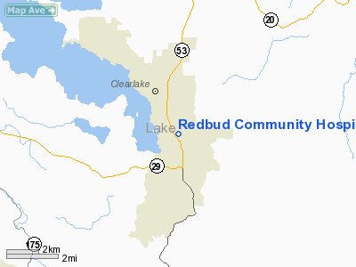
Redbud Community Hospital Heliport |
Location
& QuickFacts
|
FAA
Information Effective: |
2006-09-28 |
|
Airport
Identifier: |
CL53 |
|
Longitude/Latitude: |
122-36-54.2800W/38-55-44.4500N
-122.615078/38.929014 (Estimated) |
|
Elevation: |
1407 ft / 428.85 m (Estimated) |
|
Land: |
0 acres |
|
From
nearest city: |
1 nautical miles N of Clearlake, CA |
|
Location: |
Lake County, CA |
|
Magnetic Variation: |
16E (1995) |
Owner
& Manager
|
Ownership: |
Privately owned |
|
Owner: |
Redbud Community Hospital |
|
Address: |
18th Ave. & Hwy 53, Box 6720
Clearlake, CA 95422 |
|
Phone number: |
707-994-6486 |
|
Address: |
|
Airport
Operations and Facilities
|
Airport
Use: |
Private
MEDICAL USE. |
|
Segmented
Circle: |
No |
|
Control
Tower: |
No |
|
Attendance
Schedule: |
UNATNDD |
|
Lighting
Schedule: |
PHONE REQ
FOR PORTABLE PERIMETER LGTS CALL LOCAL FIRE DEPT. AT (707)
994-2170 OR ALTERNATE PHONE NUMBER (707) 998-3294. |
|
Sectional
chart: |
San Francisco |
|
Region: |
AWP - Western-Pacific |
|
Boundary
ARTCC: |
ZOA - Oakland |
|
Tie-in
FSS: |
OAK - Oakland |
|
FSS
Phone: |
510-273-6111 |
|
FSS
Toll Free: |
1-800-WX-BRIEF |
|
Runway Information
Helipad H1
|
Dimension: |
100 x 100 ft / 30.5 x 30.5 m |
|
Surface: |
ASPH, |
|
|
Runway H1 |
Runway |
|
Traffic
Pattern: |
Left |
Left |
|
Radio Navigation
Aids
|
ID |
Type |
Name |
Ch |
Freq |
Var |
Dist |
|
LOP |
NDB |
Lampson |
|
217.00 |
16E |
13.2 nm |
|
MY |
NDB |
Halow |
|
222.00 |
16E |
49.1 nm |
|
STS |
VOR/DME |
Santa Rosa |
077X |
113.00 |
16E |
26.9 nm |
|
MYV |
VOR/DME |
Marysville |
045X |
110.80 |
16E |
49.7 nm |
|
ILA |
VORTAC |
Williams |
091X |
114.40 |
18E |
28.8 nm |
|
MXW |
VORTAC |
Maxwell |
037X |
110.00 |
18E |
29.7 nm |
|
ENI |
VORTAC |
Mendocino |
070X |
112.30 |
16E |
31.7 nm |
|
SGD |
VORTAC |
Scaggs Island |
058X |
112.10 |
17E |
46.5 nm |
Remarks
- PROVIDED
VFR OPNS, PRIVATE USE, AND INGRESS/EGRESS ROUTES DO NOT CONFLICT WITH
TPA OF ESTABLISHED PUBLIC USE LANDING AREAS.
Redbud Community Hospital Heliport
Address:
Lake County, CA
Tel:
707-994-6486
Images
and information placed above are from
http://www.airport-data.com/airport/CL53/
We
thank them for the data!
| General
Info |
| Country |
United
States |
| State |
CALIFORNIA
|
| FAA ID |
CL53
|
| Latitude |
38-55-44.450N
|
| Longitude |
122-36-54.280W
|
| Elevation |
1407 feet
|
| Near City |
CLEARLAKE
|
We don't guarantee the information is fresh and accurate. The data may
be wrong or outdated.
For more up-to-date information please refer to other sources.
|
|


