 |
|
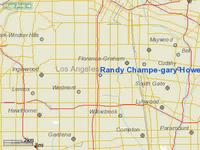
Randy Champe-gary Howe Memorial Heliport |
Location
& QuickFacts
|
FAA
Information Effective: |
2006-09-28 |
|
Airport
Identifier: |
4CA9 |
|
Longitude/Latitude: |
118-16-38.0000W/33-57-30.0000N
-118.277222/33.958333 (Estimated) |
|
Elevation: |
184 ft / 56.08 m (Estimated) |
|
Land: |
0 acres |
|
From
nearest city: |
6 nautical miles SS of Los Angeles, CA |
|
Location: |
Los Angeles County, CA |
|
Magnetic Variation: |
14E (1995) |
Owner
& Manager
|
Ownership: |
Privately owned |
|
Owner: |
City Of La Police Dept. |
|
Address: |
7600 South Boradway
Los Angeles, CA 90003 |
|
Phone number: |
213-485-4162 |
|
Address: |
|
Airport
Operations and Facilities
|
Airport
Use: |
Private |
|
Wind
indicator: |
Yes |
|
Segmented
Circle: |
No |
|
Control
Tower: |
No |
|
Attendance
Schedule: |
UNATNDD |
|
Sectional
chart: |
Los Angeles |
|
Region: |
AWP - Western-Pacific |
|
Boundary
ARTCC: |
ZLA - Los Angeles |
|
Tie-in
FSS: |
HHR - Hawthorne |
|
FSS
Phone: |
310-970-0102 |
|
FSS
Toll Free: |
1-800-WX-BRIEF |
|
Runway Information
Helipad H1
|
Dimension: |
50 x 50 ft / 15.2 x 15.2 m |
|
Surface: |
ASPH, |
|
|
Runway H1 |
Runway |
|
Traffic
Pattern: |
Left |
Left |
|
Radio Navigation
Aids
|
ID |
Type |
Name |
Ch |
Freq |
Var |
Dist |
|
CPM |
NDB |
Compton |
|
378.00 |
15E |
4.4 nm |
|
EMT |
NDB |
El Monte |
|
359.00 |
15E |
14.5 nm |
|
PAI |
NDB |
Pacoima |
|
370.00 |
15E |
19.3 nm |
|
SB |
NDB |
Petis |
|
397.00 |
14E |
45.8 nm |
|
GWF |
NDB |
Gen William J Fox |
|
282.00 |
15E |
47.0 nm |
|
NTD |
TACAN |
Point Mugu |
043X |
|
15E |
43.2 nm |
|
RAL |
VOR |
Riverside |
|
112.40 |
15E |
41.3 nm |
|
SMO |
VOR/DME |
Santa Monica |
045X |
110.80 |
15E |
9.5 nm |
|
VNY |
VOR/DME |
Van Nuys |
078X |
113.10 |
15E |
19.2 nm |
|
ELB |
VOR/DME |
El Toro |
119X |
117.20 |
14E |
32.1 nm |
|
VTU |
VOR/DME |
Ventura |
019X |
108.20 |
15E |
39.6 nm |
|
CMA |
VOR/DME |
Camarillo |
105X |
115.80 |
15E |
43.5 nm |
|
LAX |
VORTAC |
Los Angeles |
083X |
113.60 |
15E |
7.9 nm |
|
SLI |
VORTAC |
Seal Beach |
104X |
115.70 |
15E |
15.3 nm |
|
POM |
VORTAC |
Pomona |
041X |
110.40 |
15E |
25.5 nm |
|
SXC |
VORTAC |
Santa Catalina |
051X |
111.40 |
15E |
35.8 nm |
|
PDZ |
VORTAC |
Paradise |
059X |
112.20 |
15E |
37.3 nm |
|
FIM |
VORTAC |
Fillmore |
072X |
112.50 |
15E |
38.4 nm |
|
PMD |
VORTAC |
Palmdale |
092X |
114.50 |
15E |
41.8 nm |
|
LHS |
VORTAC |
Lake Hughes |
021X |
108.40 |
15E |
46.0 nm |
|
LAX |
VOT |
San Pedro Hill |
|
113.90 |
|
13.1 nm |
|
SNA |
VOT |
Santa Ana |
|
110.00 |
|
26.5 nm |
Remarks
- PROVIDED
VFR, PRIVATE USE, INSTALL HELIPORT LIGHTING IF OPERATIONS CONDUCTED
BTN SS AND SR.
Randy Champe-gary Howe Memorial Heliport
Address:
Los Angeles County, CA
Tel:
213-485-4162
Images
and information placed above are from
http://www.airport-data.com/airport/4CA9/
We
thank them for the data!
We don't guarantee the information is fresh and accurate. The data may
be wrong or outdated.
For more up-to-date information please refer to other sources.
|
|


