 |
|
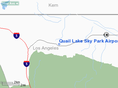
Quail Lake Sky Park Airport |
Location
& QuickFacts
|
FAA
Information Effective: |
2006-09-28 |
|
Airport
Identifier: |
CL46 |
|
Longitude/Latitude: |
118-43-54.3240W/34-46-03.9290N
-118.731757/34.767758 (Estimated) |
|
Elevation: |
3370 ft / 1027.18 m (Estimated) |
|
Land: |
65 acres |
|
From
nearest city: |
6 nautical miles SE of Gorman/lancaster,
CA |
|
Location: |
Los Angeles County, CA |
|
Magnetic Variation: |
14E (1985) |
Owner
& Manager
|
Ownership: |
Privately owned |
|
Owner: |
R.c.k. Properties, Inc. |
|
Address: |
1731 21st St
Santa Monica, CA 90404 |
|
Phone
number: |
213-828-2190 |
|
Manager: |
Sigmund Lichter |
|
Address: |
1731 21st St
Santa Monica, CA 90404 |
|
Phone number: |
213-828-2190 |
Airport
Operations and Facilities
|
Airport
Use: |
Private |
|
Wind
indicator: |
Yes |
|
Segmented
Circle: |
No |
|
Control
Tower: |
No |
|
Attendance
Schedule: |
ALL/ALL/ALL |
|
Landing
fee charge: |
No |
|
Sectional
chart: |
Los Angeles |
|
Region: |
AWP - Western-Pacific |
|
Boundary
ARTCC: |
ZLA - Los Angeles |
|
Tie-in
FSS: |
RAL - Riverside |
|
FSS
on Airport: |
No |
|
FSS
Phone: |
951-351-3020 |
|
FSS
Toll Free: |
1-800-WX-BRIEF |
|
Runway Information
Runway 08/26
|
Dimension: |
3100 x 40 ft / 944.9 x 12.2 m |
|
Surface: |
ASPH, |
|
|
Runway 08 |
Runway 26 |
|
Traffic
Pattern: |
Left |
Left |
|
Radio Navigation
Aids
|
ID |
Type |
Name |
Ch |
Freq |
Var |
Dist |
|
GWF |
NDB |
Gen William J Fox |
|
282.00 |
15E |
25.5 nm |
|
PAI |
NDB |
Pacoima |
|
370.00 |
15E |
34.4 nm |
|
NTD |
TACAN |
Point Mugu |
043X |
|
15E |
43.3 nm |
|
VNY |
VOR/DME |
Van Nuys |
078X |
113.10 |
15E |
34.8 nm |
|
CMA |
VOR/DME |
Camarillo |
105X |
115.80 |
15E |
37.9 nm |
|
VTU |
VOR/DME |
Ventura |
019X |
108.20 |
15E |
42.3 nm |
|
SMO |
VOR/DME |
Santa Monica |
045X |
110.80 |
15E |
47.5 nm |
|
GMN |
VORTAC |
Gorman |
108X |
116.10 |
16E |
6.8 nm |
|
LHS |
VORTAC |
Lake Hughes |
021X |
108.40 |
15E |
9.2 nm |
|
FIM |
VORTAC |
Fillmore |
072X |
112.50 |
15E |
25.8 nm |
|
PMD |
VORTAC |
Palmdale |
092X |
114.50 |
15E |
34.0 nm |
|
EHF |
VORTAC |
Shafter |
101X |
115.40 |
14E |
46.7 nm |
|
BFL |
VOT |
Bakersfield |
|
111.20 |
|
42.4 nm |
Based Aircraft
|
Aircraft
based on field: |
6 |
|
Single
Engine Airplanes: |
5 |
|
Multi
Engine Airplanes: |
1 |
Quail Lake Sky Park Airport
Address:
Los Angeles County, CA
Tel:
213-828-2190
Images
and information placed above are from
http://www.airport-data.com/airport/CL46/
We
thank them for the data!
| General
Info |
| Country |
United
States |
| State |
CALIFORNIA
|
| FAA ID |
CL46
|
| Latitude |
34-46-03.929N
|
| Longitude |
118-43-54.324W
|
| Elevation |
3370 feet
|
| Near City |
GORMAN/LANCASTER
|
We don't guarantee the information is fresh and accurate. The data may
be wrong or outdated.
For more up-to-date information please refer to other sources.
|
|


