 |
|
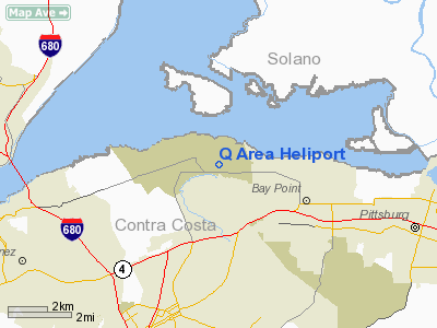
Location
& QuickFacts
|
FAA
Information Effective: |
2006-09-28 |
|
Airport
Identifier: |
60CA |
|
Longitude/Latitude: |
122-00-25.8630W/38-02-41.7110N
-122.007184/38.044920 (Estimated) |
|
Elevation: |
49 ft / 14.94 m (Estimated) |
|
Land: |
0 acres |
|
From
nearest city: |
5 nautical miles NE of Concord, CA |
|
Location: |
Contra Costa County, CA |
|
Magnetic Variation: |
16E (1985) |
Owner
& Manager
|
Ownership: |
Navy owned |
|
Owner: |
Naval Weapons Station |
|
Address: |
Port Chicago Hwy
Concord, CA 94520 |
|
Phone
number: |
510-246-5650 |
|
Manager: |
G.r. Wegener |
|
Address: |
Naval Weapons Station
Concord, CA 94520 |
|
Phone number: |
510-246-5817 |
Airport
Operations and Facilities
|
Airport
Use: |
Private |
|
Wind
indicator: |
Yes |
|
Segmented
Circle: |
No |
|
Control
Tower: |
No |
|
Attendance
Schedule: |
UNATNDD |
|
Landing
fee charge: |
No |
|
Sectional
chart: |
San Francisco |
|
Region: |
AWP - Western-Pacific |
|
Boundary
ARTCC: |
ZOA - Oakland |
|
Tie-in
FSS: |
OAK - Oakland |
|
FSS
Phone: |
510-273-6111 |
|
FSS
Toll Free: |
1-800-WX-BRIEF |
|
Runway Information
Helipad H1
|
Dimension: |
100 x 100 ft / 30.5 x 30.5 m |
|
Surface: |
CONC, |
|
|
Runway H1 |
Runway |
|
Traffic
Pattern: |
Left |
Left |
|
Radio Navigation
Aids
|
ID |
Type |
Name |
Ch |
Freq |
Var |
Dist |
|
LV |
NDB |
Reiga |
|
374.00 |
16E |
26.2 nm |
|
TCY |
NDB |
Tracy |
|
203.00 |
15E |
34.1 nm |
|
SUU |
TACAN |
Travis |
113X |
|
17E |
12.4 nm |
|
NUQ |
TACAN |
Moffett |
123X |
|
17E |
36.9 nm |
|
TZZ |
VOR |
Travis |
|
116.40 |
17E |
20.2 nm |
|
CCR |
VOR/DME |
Concord |
117X |
117.00 |
17E |
1.8 nm |
|
SFO |
VOR/DME |
San Francisco |
105X |
115.80 |
17E |
30.9 nm |
|
SJC |
VOR/DME |
San Jose |
088X |
114.10 |
16E |
40.4 nm |
|
MCC |
VOR/DME |
Mc Clellan |
029X |
109.20 |
17E |
47.0 nm |
|
STS |
VOR/DME |
Santa Rosa |
077X |
113.00 |
16E |
47.0 nm |
|
SGD |
VORTAC |
Scaggs Island |
058X |
112.10 |
17E |
19.1 nm |
|
OAK |
VORTAC |
Oakland |
115X |
116.80 |
17E |
21.7 nm |
|
SAU |
VORTAC |
Sausalito |
109X |
116.20 |
17E |
27.0 nm |
|
SAC |
VORTAC |
Sacramento |
099X |
115.20 |
17E |
32.2 nm |
|
PYE |
VORTAC |
Point Reyes |
084X |
113.70 |
17E |
40.8 nm |
|
OSI |
VORTAC |
Woodside |
086X |
113.90 |
17E |
41.3 nm |
|
ECA |
VORTAC |
Manteca |
107X |
116.00 |
17E |
41.6 nm |
|
LIN |
VORTAC |
Linden |
095X |
114.80 |
17E |
47.5 nm |
|
SFO |
VOT |
San Francisco Intl |
|
111.00 |
|
31.0 nm |
|
SAC |
VOT |
Sacramento Executive |
|
111.40 |
|
37.0 nm |
|
SMF |
VOT |
Sacramento Metropolitan |
|
111.40 |
|
43.5 nm |
Remarks
- POC
AT WPNSTA CONCORD IS R. PIEPER (510) 246-5650 FAX (510) 246-2003.
- VFR;
PRIVATE USE; PRVDD PILOTS USING HELIPORT ESTABLISH & REMAIN INTWO-WAY
RADIO COMS WITH CONCORD ATCT WHILE OPERATING WITHIN THE BUCHANAN FIELD
ARPT TRAFFIC AREA.
Q Area Heliport
Address:
Contra Costa County, CA
Tel:
510-246-5650,
510-246-5817
Images
and information placed above are from
http://www.airport-data.com/airport/60CA/
We
thank them for the data!
| General
Info |
| Country |
United
States |
| State |
CALIFORNIA
|
| FAA ID |
60CA
|
| Latitude |
38-02-41.711N
|
| Longitude |
122-00-25.863W
|
| Elevation |
49 feet
|
| Near City |
CONCORD
|
We don't guarantee the information is fresh and accurate. The data may
be wrong or outdated.
For more up-to-date information please refer to other sources.
|
|


