 |
|
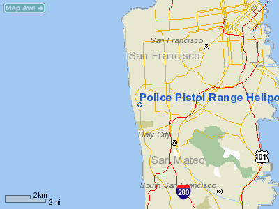
Police Pistol Range Heliport |
Location
& QuickFacts
|
FAA
Information Effective: |
2006-09-28 |
|
Airport
Identifier: |
16CA |
|
Longitude/Latitude: |
122-29-55.9010W/37-43-09.7550N
-122.498861/37.719376 (Estimated) |
|
Elevation: |
24 ft / 7.32 m (Estimated) |
|
Land: |
0 acres |
|
From
nearest city: |
0 nautical miles N of San Francisco, CA |
|
Location: |
San Francisco County, CA |
|
Magnetic Variation: |
16E (1985) |
Owner
& Manager
|
Ownership: |
Publicly owned |
|
Owner: |
City Of San Francisco |
|
Address: |
850 Bryant Street
San Francisco, CA 94103 |
|
Phone
number: |
415-553-1551 |
|
Manager: |
Gary Epperly |
|
Address: |
850 Bryant Street
San Francisco, CA 94103 |
|
Phone number: |
415-553-1200 |
Airport
Operations and Facilities
|
Airport
Use: |
Private |
|
Wind
indicator: |
Yes |
|
Segmented
Circle: |
No |
|
Control
Tower: |
No |
|
Attendance
Schedule: |
UNATNDD |
|
Landing
fee charge: |
No |
|
Sectional
chart: |
San Francisco |
|
Region: |
AWP - Western-Pacific |
|
Boundary
ARTCC: |
ZOA - Oakland |
|
Tie-in
FSS: |
OAK - Oakland |
|
FSS
on Airport: |
No |
|
FSS
Phone: |
510-273-6111 |
|
FSS
Toll Free: |
1-800-WX-BRIEF |
|
Runway Information
Helipad H1
|
Dimension: |
150 x 100 ft / 45.7 x 30.5 m |
|
Surface: |
ASPH, |
|
|
Runway H1 |
Runway |
|
Traffic
Pattern: |
Left |
Left |
|
Radio Navigation
Aids
|
ID |
Type |
Name |
Ch |
Freq |
Var |
Dist |
|
LV |
NDB |
Reiga |
|
374.00 |
16E |
38.8 nm |
|
NUQ |
TACAN |
Moffett |
123X |
|
17E |
27.2 nm |
|
SUU |
TACAN |
Travis |
113X |
|
17E |
41.1 nm |
|
TZZ |
VOR |
Travis |
|
116.40 |
17E |
49.7 nm |
|
SFO |
VOR/DME |
San Francisco |
105X |
115.80 |
17E |
8.5 nm |
|
CCR |
VOR/DME |
Concord |
117X |
117.00 |
17E |
29.1 nm |
|
SJC |
VOR/DME |
San Jose |
088X |
114.10 |
16E |
33.6 nm |
|
STS |
VOR/DME |
Santa Rosa |
077X |
113.00 |
16E |
49.7 nm |
|
SAU |
VORTAC |
Sausalito |
109X |
116.20 |
17E |
8.3 nm |
|
OAK |
VORTAC |
Oakland |
115X |
116.80 |
17E |
13.1 nm |
|
OSI |
VORTAC |
Woodside |
086X |
113.90 |
17E |
22.2 nm |
|
PYE |
VORTAC |
Point Reyes |
084X |
113.70 |
17E |
27.8 nm |
|
SGD |
VORTAC |
Scaggs Island |
058X |
112.10 |
17E |
28.3 nm |
|
SFO |
VOT |
San Francisco Intl |
|
111.00 |
|
8.4 nm |
Remarks
- HELI
RESTRD TO POLICE DEPARTMENT ONLY - DO NOT CHART.
- PROVIDED
APCH/DEP IS OVER LAKE MERCED; LIMITED TO VFR, PERSONAL USE; INSTALL
WIND INDICATOR; MARK LNDG AREA.
Police Pistol Range Heliport
Address:
San Francisco County, CA
Tel:
415-553-1551,
415-553-1200
Images
and information placed above are from
http://www.airport-data.com/airport/16CA/
We
thank them for the data!
| General
Info |
| Country |
United
States |
| State |
CALIFORNIA
|
| FAA ID |
16CA
|
| Latitude |
37-43-09.755N
|
| Longitude |
122-29-55.901W
|
| Elevation |
24 feet
|
| Near City |
SAN FRANCISCO
|
We don't guarantee the information is fresh and accurate. The data may
be wrong or outdated.
For more up-to-date information please refer to other sources.
|
|


