 |
|
|
|
Location
& QuickFacts
|
FAA
Information Effective: |
2006-09-28 |
|
Airport
Identifier: |
8CA7 |
|
Longitude/Latitude: |
119-33-40.4480W/34-19-58.9880N
-119.561236/34.333052 (Estimated) |
|
Elevation: |
111 ft / 33.83 m (Estimated) |
|
Land: |
0 acres |
|
From
nearest city: |
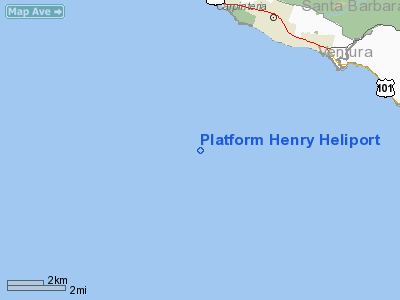
4 nautical miles W of Carpinteria, CA |
|
Location: |
Santa Barbara County, CA |
|
Magnetic Variation: |
14E (1985) |
Owner
& Manager
|
Ownership: |
Privately owned |
|
Owner: |
Unocal |
|
Address: |
P.o. Box 6176
Ventura, CA 93006 |
|
Phone
number: |
805-656-7600 |
|
Manager: |
D. A. Chudanov |
|
Address: |
P.o. Box 6176
Ventura, CA 93006 |
|
Phone number: |
805-656-7600 |
Airport
Operations and Facilities
|
Airport
Use: |
Private |
|
Wind
indicator: |
Yes |
|
Segmented
Circle: |
No |
|
Control
Tower: |
No |
|
Attendance
Schedule: |
UNATNDD |
|
Lighting
Schedule: |
PHONE REQ
FOR PERIMETER LGTS CALL 805-653-1286. |
|
Landing
fee charge: |
No |
|
Sectional
chart: |
Los Angeles |
|
Region: |
AWP - Western-Pacific |
|
Boundary
ARTCC: |
ZLA - Los Angeles |
|
Tie-in
FSS: |
HHR - Hawthorne |
|
FSS
on Airport: |
No |
|
FSS
Phone: |
310-970-0102 |
|
FSS
Toll Free: |
1-800-WX-BRIEF |
|
Runway Information
Helipad H1
|
Dimension: |
58 x 55 ft / 17.7 x 16.8 m |
|
Surface: |
MATS,
REINFORCED STRUCTURAL STEEL PLATE SFC 12000 LBS RATED. |
|
|
Runway H1 |
Runway |
|
Traffic
Pattern: |
Left |
Left |
|
Radio Navigation
Aids
|
ID |
Type |
Name |
Ch |
Freq |
Var |
Dist |
|
NTD |
TACAN |
Point Mugu |
043X |
|
15E |
25.2 nm |
|
CMA |
VOR/DME |
Camarillo |
105X |
115.80 |
15E |
24.3 nm |
|
VTU |
VOR/DME |
Ventura |
019X |
108.20 |
15E |
28.6 nm |
|
RZS |
VORTAC |
San Marcus |
096X |
114.90 |
14E |
14.9 nm |
|
GVO |
VORTAC |
Gaviota |
085X |
113.80 |
16E |
28.8 nm |
|
FIM |
VORTAC |
Fillmore |
072X |
112.50 |
15E |
33.8 nm |
|
GMN |
VORTAC |
Gorman |
108X |
116.10 |
16E |
44.7 nm |
|
FLW |
VORTAC |
Fellows |
122X |
117.50 |
16E |
48.1 nm |
Remarks
- (E3A)
ADDNL PHONE NR TO HHR FSS 1-WX-BRIEF.
- E111:
PVT USE; VFR CONDITIONS ONLY.
Platform Henry Heliport
Address:
Santa Barbara County, CA
Tel:
805-656-7600
Images
and information placed above are from
http://www.airport-data.com/airport/8CA7/
We
thank them for the data!
| General
Info |
| Country |
United
States |
| State |
CALIFORNIA
|
| FAA ID |
8CA7
|
| Latitude |
34-19-58.988N
|
| Longitude |
119-33-40.448W
|
| Elevation |
111 feet
|
| Near City |
CARPINTERIA
|
We don't guarantee the information is fresh and accurate. The data may
be wrong or outdated.
For more up-to-date information please refer to other sources.
|
|


