 |
|
|
|
|
|
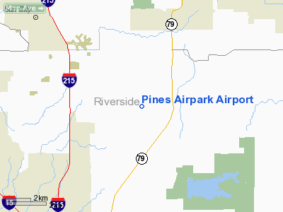
Location
& QuickFacts
|
FAA
Information Effective: |
2006-09-28 |
|
Airport
Identifier: |
8CA5 |
|
Longitude/Latitude: |
117-06-36.1090W/33-38-44.0840N
-117.110030/33.645579 (Estimated) |
|
Elevation: |
1420 ft / 432.82 m (Estimated) |
|
Land: |
40 acres |
|
From
nearest city: |
4 nautical miles SW of Winchester, CA |
|
Location: |
Riverside County, CA |
|
Magnetic Variation: |
14E (1985) |
Owner
& Manager
|
Ownership: |
Privately owned |
|
Owner: |
Pines Airpark Ass'n
AND ARMAND LABARRE; B.J. & MARLENE WILSON; AND STANLEY
& AUDREY PEDERSON. |
|
Address: |
32875 Pines Airpark Rd
Winchester, CA 92396 |
|
Manager: |
William Schicora |
|
Address: |
32875 Pines Airpark Rd
Winchester, CA 92396 |
|
Phone number: |
714-926-1837 |
Airport
Operations and Facilities
|
Airport
Use: |
Private |
|
Wind
indicator: |
Yes |
|
Segmented
Circle: |
Yes |
|
Control
Tower: |
No |
|
Attendance
Schedule: |
IREG |
|
Landing
fee charge: |
No |
|
Sectional
chart: |
Los Angeles |
|
Region: |
AWP - Western-Pacific |
|
Boundary
ARTCC: |
ZLA - Los Angeles |
|
Tie-in
FSS: |
RAL - Riverside |
|
FSS
on Airport: |
No |
|
FSS
Phone: |
951-351-3020 |
|
FSS
Toll Free: |
1-800-WX-BRIEF |
|
Runway Information
Runway 18/36
|
Dimension: |
2500 x 150 ft / 762.0 x 45.7 m |
|
Surface: |
TURF-DIRT, |
|
|
Runway 18 |
Runway 36 |
|
Traffic
Pattern: |
Right |
Left |
|
Displaced
threshold: |
1000.00 ft |
300.00 ft |
|
Obstruction: |
1000 ft tower, 1000.0 ft from runway |
1000 ft hill, 2000.0 ft from runway |
|
Radio Navigation
Aids
|
ID |
Type |
Name |
Ch |
Freq |
Var |
Dist |
|
SJY |
NDB |
San Jacinto |
|
227.00 |
14E |
10.5 nm |
|
SB |
NDB |
Petis |
|
397.00 |
14E |
27.8 nm |
|
RIV |
TACAN |
March |
077X |
|
14E |
17.7 nm |
|
NFG |
TACAN |
Camp Pendleton |
055X |
|
13E |
26.3 nm |
|
NKX |
TACAN |
Miramar |
033X |
|
15E |
46.7 nm |
|
NKX |
UHF/NDB |
Miramar |
|
352.00 |
15E |
46.4 nm |
|
HDF |
VOR |
Homeland |
|
113.40 |
14E |
8.7 nm |
|
RAL |
VOR |
Riverside |
|
112.40 |
15E |
25.0 nm |
|
ELB |
VOR/DME |
El Toro |
119X |
117.20 |
14E |
31.1 nm |
|
PDZ |
VORTAC |
Paradise |
059X |
112.20 |
15E |
26.6 nm |
|
OCN |
VORTAC |
Oceanside |
100X |
115.30 |
15E |
28.8 nm |
|
PSP |
VORTAC |
Palm Springs |
102X |
115.50 |
13E |
36.6 nm |
|
JLI |
VORTAC |
Julian |
087X |
114.00 |
15E |
40.2 nm |
|
POM |
VORTAC |
Pomona |
041X |
110.40 |
15E |
42.6 nm |
|
TRM |
VORTAC |
Thermal |
109X |
116.20 |
13E |
47.5 nm |
|
SLI |
VORTAC |
Seal Beach |
104X |
115.70 |
15E |
48.0 nm |
|
SNA |
VOT |
Santa Ana |
|
110.00 |
|
38.1 nm |
|
SAN |
VOT |
Mount Soledad |
|
109.00 |
|
49.0 nm |
|
SEE |
VOT |
Gillespie Field |
|
110.00 |
|
49.8 nm |
Remarks
- OWNER
DESIRES CHARTING.
- RWY
EASEMENT IS PROPERTY OF PINES AIRPARK ASSN.
Based Aircraft
|
Aircraft
based on field: |
4 |
|
Single
Engine Airplanes: |
4 |
Pines Airpark Airport
Address:
Riverside County, CA
Tel:
714-926-1837
Images
and information placed above are from
http://www.airport-data.com/airport/8CA5/
We
thank them for the data!
| General
Info |
| Country |
United
States |
| State |
CALIFORNIA
|
| FAA ID |
8CA5
|
| Latitude |
33-38-44.084N
|
| Longitude |
117-06-36.109W
|
| Elevation |
1420 feet
|
| Near City |
WINCHESTER
|
We don't guarantee the information is fresh and accurate. The data may
be wrong or outdated.
For more up-to-date information please refer to other sources.
|
|


