 |
|
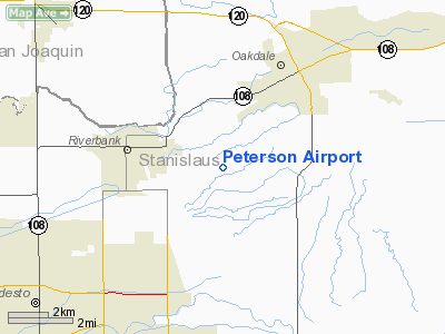
Location
& QuickFacts
|
FAA
Information Effective: |
2006-09-28 |
|
Airport
Identifier: |
CA17 |
|
Longitude/Latitude: |
120-53-23.7570W/37-43-24.7430N
-120.889933/37.723540 (Estimated) |
|
Elevation: |
158 ft / 48.16 m (Estimated) |
|
Land: |
0 acres |
|
From
nearest city: |
3 nautical miles SE of Riverbank, CA |
|
Location: |
Stanislaus County, CA |
|
Magnetic Variation: |
16E (1985) |
Owner
& Manager
|
Ownership: |
Privately owned |
|
Owner: |
Dean T. Peterson |
|
Address: |
5800 Langworth Rd
Oakdale, CA 95361 |
|
Manager: |
Dean T. Peterson |
|
Address: |
5800 Langworth Rd
Oakdale, CA 95361 |
|
Phone number: |
209-869-6078 |
Airport
Operations and Facilities
|
Airport Use: |
Private |
|
Wind indicator: |
Yes |
|
Segmented Circle: |
No |
|
Control Tower: |
No |
|
Attendance Schedule: |
ALL/ALL/ALL |
|
Landing fee charge: |
Yes |
|
Sectional chart: |
San Francisco |
|
Region: |
AWP - Western-Pacific |
|
Boundary ARTCC: |
ZOA - Oakland |
|
Tie-in FSS: |
RIU - Rancho Murieta |
|
FSS on Airport: |
No |
|
FSS Phone: |
916-354-0161 |
|
FSS Toll Free: |
1-800-WX-BRIEF |
Airport
Services
|
Airframe
Repair: |
NONE |
|
Power
Plant Repair: |
NONE |
|
Runway
Information
Runway E/W
|
Dimension: |
2485 x 40 ft / 757.4 x 12.2 m |
|
Surface: |
ASPH, |
|
|
Runway E |
Runway W |
|
Traffic
Pattern: |
Left |
Left |
|
Radio Navigation
Aids
|
ID |
Type |
Name |
Ch |
Freq |
Var |
Dist |
|
TCY |
NDB |
Tracy |
|
203.00 |
15E |
26.4 nm |
|
LV |
NDB |
Reiga |
|
374.00 |
16E |
37.8 nm |
|
MOD |
VOR/DME |
Modesto |
093X |
114.60 |
17E |
6.6 nm |
|
HYP |
VOR/DME |
El Nido |
089X |
114.20 |
15E |
38.3 nm |
|
ECA |
VORTAC |
Manteca |
107X |
116.00 |
17E |
14.9 nm |
|
LIN |
VORTAC |
Linden |
095X |
114.80 |
17E |
21.8 nm |
Remarks
- BLDG
SW END; PLINES SW END OF STRIP.
- OWNER
DESIRES ARPT BE CHARTED.
- ARPT
IS 7 MI NE OF MODESTO CITY-CO ARPT.
Based Aircraft
|
Aircraft
based on field: |
3 |
|
Single
Engine Airplanes: |
1 |
|
Ultralights: |
2 |
Peterson Airport
Address:
Stanislaus County, CA
Tel:
209-869-6078
Images
and information placed above are from
http://www.airport-data.com/airport/CA17/
We
thank them for the data!
| General
Info |
| Country |
United
States |
| State |
CALIFORNIA
|
| FAA ID |
CA17
|
| Latitude |
37-43-24.743N
|
| Longitude |
120-53-23.757W
|
| Elevation |
158 feet
|
| Near City |
RIVERBANK
|
We don't guarantee the information is fresh and accurate. The data may
be wrong or outdated.
For more up-to-date information please refer to other sources.
|
|


