 |
|
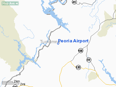
Location
& QuickFacts
|
FAA
Information Effective: |
2006-09-28 |
|
Airport
Identifier: |
6CL9 |
|
Longitude/Latitude: |
120-30-55.0000W/37-55-18.0000N
-120.515278/37.921667 (Estimated) |
|
Elevation: |
830 ft / 252.98 m (Estimated) |
|
Land: |
0 acres |
|
From
nearest city: |
5 nautical miles W of Jamestown, CA |
|
Location: |
Tuolumne County, CA |
|
Magnetic Variation: |
15E (1995) |
Owner
& Manager
|
Ownership: |
Privately owned |
|
Owner: |
Dafka Llc |
|
Address: |
17775 Hwy 108
Jamestown, CA 95327 |
|
Phone number: |
209-984-8750 |
|
Manager: |
Bob Hix |
|
Address: |
17775 Hwy 108
Jamestown, CA 95327 |
|
Phone number: |
209-984-8750 |
Airport
Operations and Facilities
|
Airport
Use: |
Private |
|
Segmented
Circle: |
No |
|
Control
Tower: |
No |
|
Attendance
Schedule: |
UNATNDD |
|
Sectional
chart: |
San Francisco |
|
Region: |
AWP - Western-Pacific |
|
Boundary
ARTCC: |
ZOA - Oakland |
|
Tie-in
FSS: |
RIU - Rancho Murieta |
|
FSS
Phone: |
916-354-0161 |
|
FSS
Toll Free: |
1-800-WX-BRIEF |
|
Runway Information
Runway 09/27
|
Dimension: |
2500 x 50 ft / 762.0 x 15.2 m |
|
Surface: |
TURF, |
|
|
Runway 09 |
Runway 27 |
|
Traffic
Pattern: |
Left |
Left |
|
Radio Navigation
Aids
|
ID |
Type |
Name |
Ch |
Freq |
Var |
Dist |
|
TCY |
NDB |
Tracy |
|
203.00 |
15E |
46.2 nm |
|
MOD |
VOR/DME |
Modesto |
093X |
114.60 |
17E |
27.5 nm |
|
HYP |
VOR/DME |
El Nido |
089X |
114.20 |
15E |
42.6 nm |
|
HNW |
VOR/DME |
Hangtown |
102X |
115.50 |
17E |
49.5 nm |
|
LIN |
VORTAC |
Linden |
095X |
114.80 |
17E |
24.9 nm |
|
ECA |
VORTAC |
Manteca |
107X |
116.00 |
17E |
31.6 nm |
Remarks
- OWNER
DESIRES ARPT BE CHARTED.
- PROVIDED
PRIVATE USE, VFR OPNS, SPONSOR ENSURES OBSTRUCTION FREE INGRESS AND
EGRESS ROUTES.
Based Aircraft
|
Aircraft
based on field: |
1 |
|
Single
Engine Airplanes: |
1 |
Peoria Airport
Address:
Tuolumne County, CA
Tel:
209-984-8750
Images
and information placed above are from
http://www.airport-data.com/airport/6CL9/
We
thank them for the data!
| General
Info |
| Country |
United
States |
| State |
CALIFORNIA
|
| FAA ID |
6CL9
|
| Latitude |
37-55-18.000N
|
| Longitude |
120-30-55.000W
|
| Elevation |
830 feet
|
| Near City |
JAMESTOWN
|
We don't guarantee the information is fresh and accurate. The data may
be wrong or outdated.
For more up-to-date information please refer to other sources.
|
|


