|
 |
|
||||
|
Palmdale Airport (IATA: PMD, ICAO: KPMD) is an airport in the city of Palmdale in Los Angeles County, California, United States, owned and operated by the federal government of the United States. It contains two separate facilities: United States Air Force Plant 42 an entity of the United States Air Force which controls and oversees the airport property. - Main Article Plant 42 The LA/Palmdale Regional Airport, owned and operated by Los Angeles World Airports, an agency of the city of Los Angeles, controls a small commercial terminal and a hangar complex (Site 9) on land leased from the US government. OverviewWhen combining the existing 5,800 acres (23 km²) of the current airport with the 17,500 acres (71 km²) of undeveloped land for the future airport, at 23,300 acres (94 km²) Palmdale Airport is generally considered one of the largest civilian airports in the world. Most of the existing airport serves predominantly as a manufacturing plant for aircraft used by the United States' and their allies' military forces. The LA/Palmdale Regional Airport itself is a small commercial air terminal leased from the Air Force by Los Angeles World Airports (LAWA), a department of the city of Los Angeles. The airport terminal is located at the southwest corner of the airport and began civilian operations in 1971. The FAA's Los Angeles Air Route Traffic Control Center is located next to the facility at Palmdale Airport. HistoryBuilt in 1940, Palmdale Airport was operated by the United States government, primarily as an emergency landing strip. In 1946 its operation was turned over to Los Angeles County for private use. In 1950, the airport was again taken over by the federal government for use in building and testing military aircraft, thus establishing operation of United States Air Force Plant 42. From 1970 to 1983, the Los Angeles Department of Airports, now called Los Angeles World Airports (LAWA), acquired approximately 17,750 acres (72 km) of land east and south of the airport in unincorporated Los Angeles County to be developed into the future "Palmdale Intercontinental Airport," with the goal of providing a regional alternative to LAX. To date, LAWA has not developed its Palmdale airport land beyond that of a small commuter airport terminal serving only the Antelope Valley. In late 2008, the city of Palmdale expressed interest in assuming operations at Palmdale Airport, including management of the terminal, taxiways, and parking, from LAWA. In response, LAWA indicated that it was receptive to transferring the lease to Palmdale. Los Angeles still desires to retain the land it owns adjacent to Palmdale for eventual use as an airport. However, the city is currently exploring potential non-aviation uses for the land, including activities related to energy production.
After several airlines were unable to sustain flight operations at Palmdale, the terminal was remodeled and reopened in May 2007 to attract commercial carriers to the airport. But convincing airlines of the marketability of the airport without subsidies has been difficult. Although Palmdale Airport offers airline passengers a quicker ground transportation travel time from Sherman Oaks than the standard LAX airport car trip down the 405 freeway, it has not consistently provided the range of destinations that would convince passengers to consider it as an alternative to relieve the overcrowding at LAX and Bob Hope Airport in Burbank. While the communities surrounding LAX and Burbank do not want the added traffic volume and noise of additional flights, most Antelope Valley residents support expanding service at Palmdale Regional, due to the positive economic benefits that regular commercial service would provide. In January 2007, subsidies valued at $4.6 million, with $2 million slated to underwrite losses incurred from providing airline service, were raised to restore commercial service to the airport. The incentive package included a $900,000 grant from the federal government given to the city of Palmdale to develop regional airport service. In February 2007, the city of Palmdale and LAWA selected United Airlines to provide service between Palmdale and San Francisco International Airport. (The only other proposal was from Delta Air Lines to Salt Lake City). The SkyWest Airlines-operated United Express offered twice-daily, regional jet service beginning on 7 June 2007. Between 7 June and 31 December 2007, the airport had served a total of 12,022 passengers. Based on this total and the current level of service, the annual average passenger volume of Palmdale Regional Airport should be about 21,198 passengers annually (approximately 58 passengers per day). On 3 September 2008, the San Francisco service was increased from two 50-seat regional jets to four 30-seat turboprop flights per day. However, on its 18 September schedule update, United canceled all flights beginning 7 December 2008, the day after the expiration of the federal grant and exactly 18 months after the beginning of the PMD services. LAWA is currently developing a master plan for Palmdale that will guide airport land use and development decisions through 2030. Scheduled servicePalmdale Regional Airport currently does not have any scheduled service due to the economic recession, but has had scheduled air service in the past. The following is a table of former flights that have been offered from PMD:
IncidentsOn 1 February 1991, USAir Flight 1493, a Boeing 737 landing on Runway 24L at LAX, collided upon touchdown with a SkyWest Airlines Fairchild Metroliner, Flight 5569 departing to Palmdale Regional Airport, that had been holding in position on the same runway. The collision killed all 12 occupants of the SkyWest plane and 22 persons aboard the USAir 737. Location and layout
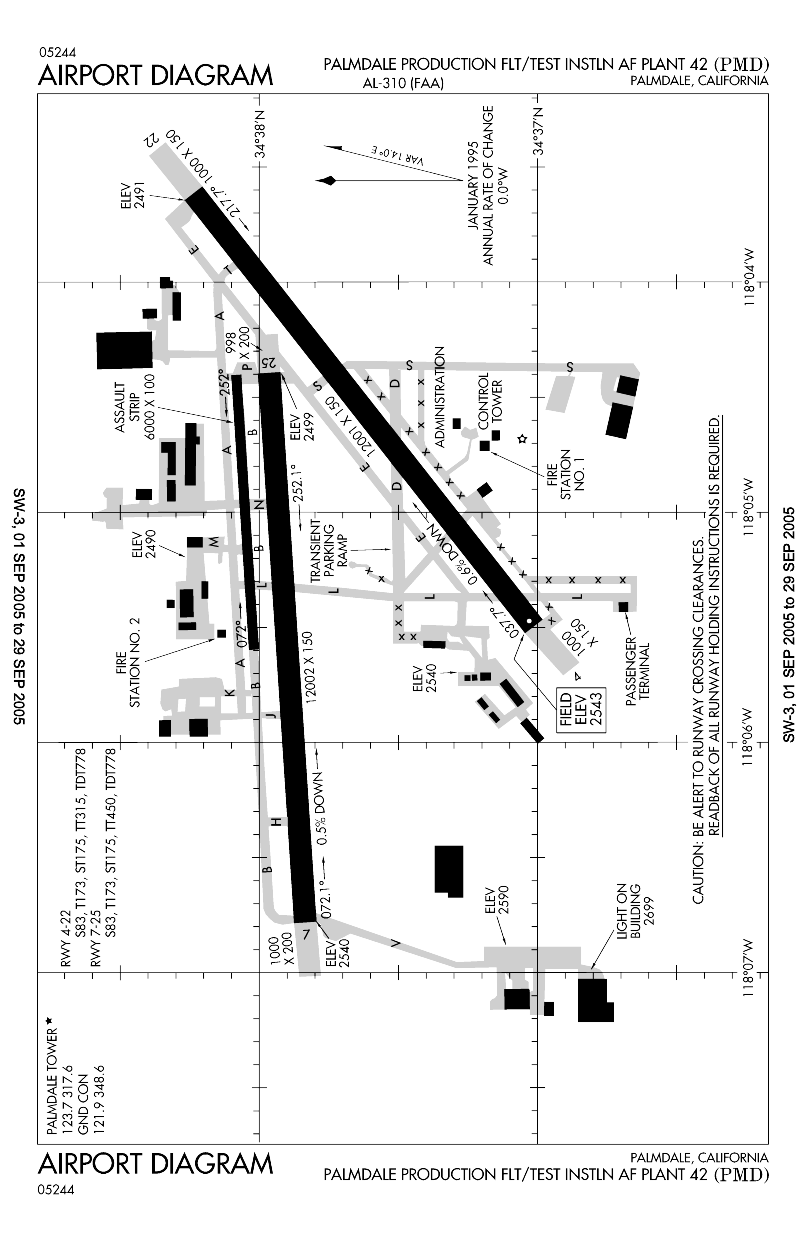
The two main runways at this airport are each over 2 miles (3 km) in length each. The FAA's Los Angeles Air Route Traffic Control Center is located at this airport. The above content comes from Wikipedia and is published under free licenses – click here to read more.
Runway InformationRunway 04/22
Runway 07/25
Runway 072/252
Radio Navigation Aids
Remarks
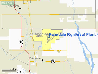
Palmdale Rgnl/usaf Plant 42 Airport Address: Los Angeles County, CA Tel: 661-272-6700, 661-272-6715 Images
and information placed above are from We thank them for the data!
We don't guarantee the information is fresh and accurate. The data may
be wrong or outdated. |
||||||||||||||||||||||||||||||||||||||||||||||||||||||||||||||||||||||||||||||||||||||||||||||||||||||||||||||||||||||||||||||||||||||||||||||||||||||||||||||||||||||||||||||||||||||||||||||||||||||||||||||||||||||||||||||||||||||||||||||||||||||||||||||||||||||||||||||||||||||||||||||||||||||||||||||||||||||||||||||||||||||||||||||||||||||||||||||||||||||||||||||||||||||||||||||||||||||||||||||||||||||||

 |
|
Copyright 2004-2026 © by Airports-Worldwide.com, Vyshenskoho st. 36, Lviv 79010, Ukraine Legal Disclaimer |