 |
|
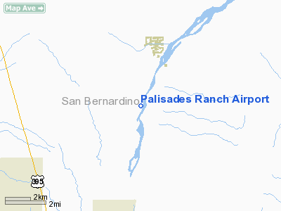
Location
& QuickFacts
|
FAA
Information Effective: |
2006-09-28 |
|
Airport
Identifier: |
19CL |
|
Longitude/Latitude: |
117-21-03.1730W/34-42-43.9550N
-117.350881/34.712210 (Estimated) |
|
Elevation: |
2510 ft / 765.05 m (Estimated) |
|
Land: |
240 acres |
|
From
nearest city: |
3 nautical miles SW of Helendale, CA |
|
Location: |
San Bernardino County, CA |
|
Magnetic Variation: |
14E (1985) |
Owner
& Manager
|
Ownership: |
Privately owned |
|
Owner: |
Older Trust |
|
Address: |
13850 Bryman Rd
Oro Grande, CA 92368 |
|
Phone
number: |
760-245-8889 |
|
Manager: |
Steven T. Older |
|
Address: |
13850 Bryman Rd
Oro Grande, CA 92368 |
|
Phone number: |
760-245-8889 |
Airport
Operations and Facilities
|
Airport
Use: |
Private |
|
Wind
indicator: |
Yes |
|
Segmented
Circle: |
Yes |
|
Control
Tower: |
No |
|
Attendance
Schedule: |
UNATNDD |
|
Landing
fee charge: |
No |
|
Sectional
chart: |
Los Angeles |
|
Region: |
AWP - Western-Pacific |
|
Boundary
ARTCC: |
ZLA - Los Angeles |
|
Tie-in
FSS: |
RAL - Riverside |
|
FSS
on Airport: |
No |
|
FSS
Phone: |
951-351-3020 |
|
FSS
Toll Free: |
1-800-WX-BRIEF |
|
Runway Information
Runway 01/19
|
Dimension: |
3800 x 100 ft / 1158.2 x 30.5 m |
|
Surface: |
DIRT, |
|
|
Runway 01 |
Runway 19 |
|
Traffic
Pattern: |
Right |
Left |
|
Radio Navigation
Aids
|
ID |
Type |
Name |
Ch |
Freq |
Var |
Dist |
|
SB |
NDB |
Petis |
|
397.00 |
14E |
39.4 nm |
|
GWF |
NDB |
Gen William J Fox |
|
282.00 |
15E |
42.8 nm |
|
RIV |
TACAN |
March |
077X |
|
14E |
48.6 nm |
|
RAL |
VOR |
Riverside |
|
112.40 |
15E |
46.0 nm |
|
VCV |
VOR/DME |
Victorville |
031X |
109.40 |
14E |
7.4 nm |
|
EDW |
VORTAC |
Edwards |
111X |
116.40 |
15E |
24.9 nm |
|
PMD |
VORTAC |
Palmdale |
092X |
114.50 |
15E |
35.6 nm |
|
DAG |
VORTAC |
Daggett |
079X |
113.20 |
15E |
41.0 nm |
|
POM |
VORTAC |
Pomona |
041X |
110.40 |
15E |
43.8 nm |
|
HEC |
VORTAC |
Hector |
074X |
112.70 |
15E |
44.1 nm |
|
PDZ |
VORTAC |
Paradise |
059X |
112.20 |
15E |
48.5 nm |
Remarks
- (E111-2)
ALL USERS OF THE ARPT BE BRIEFED ON INGRESS/EGRESS RTES ESTABD &
MIL ACTIVITIES IN THE AREA.
- THAT
INGRESS/EGRESS RTES & ARPT PROCEDURES BE COORD WITH GEORGE AFB OPNS.
RADIO COM BE ESTABD & MAINTD WITH GEORGE AFB ATCT WHILE OPERG WI
THE GEORGE AFB CTLZ EXTN. (AGRICULTURAL
ACFT ON DUSTING OPNS ARE EXCLUDED.)
Palisades Ranch Airport
Address:
San Bernardino County, CA
Tel:
760-245-8889
Images
and information placed above are from
http://www.airport-data.com/airport/19CL/
We
thank them for the data!
| General
Info |
| Country |
United
States |
| State |
CALIFORNIA
|
| FAA ID |
19CL
|
| Latitude |
34-42-43.955N
|
| Longitude |
117-21-03.173W
|
| Elevation |
2510 feet
|
| Near City |
HELENDALE
|
We don't guarantee the information is fresh and accurate. The data may
be wrong or outdated.
For more up-to-date information please refer to other sources.
|
|


