 |
|
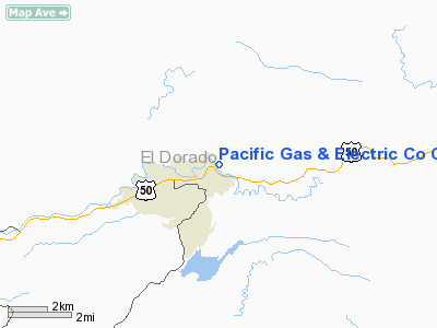
Pacific Gas & Electric Co Camp 5 Heliport |
|
|
Location
& QuickFacts
|
FAA
Information Effective: |
2006-09-28 |
|
Airport
Identifier: |
67CN |
|
Longitude/Latitude: |
120-32-55.7320W/38-46-06.6520N
-120.548814/38.768514 (Estimated) |
|
Elevation: |
3800 ft / 1158.24 m (Estimated) |
|
Land: |
0 acres |
|
From
nearest city: |
13 nautical miles E of Placerville, CA |
|
Location: |
El Dorado County, CA |
|
Magnetic Variation: |
16E (1985) |
Owner
& Manager
|
Ownership: |
Privately owned |
|
Owner: |
El Dorado Irrigation District |
|
Address: |
2890 Mosquito Road
Placerville, CA 95677 |
|
Phone
number: |
530-662-4513 |
|
Manager: |
Kathy Hill
PACIFIC GAS & ELECTRIC CO. |
|
Address: |
7225 Us Hwy 50
Pollock Pines, CA 95726 |
|
Phone number: |
530-644-1960 |
Airport
Operations and Facilities
|
Airport Use: |
Private |
|
Wind indicator: |
Yes |
|
Segmented Circle: |
Yes |
|
Control Tower: |
No |
|
Attendance Schedule: |
ALL/MON-FRI/0700-1530 |
|
Landing fee charge: |
No |
|
Sectional chart: |
San Francisco |
|
Region: |
AWP - Western-Pacific |
|
Boundary ARTCC: |
ZOA - Oakland |
|
Tie-in FSS: |
RIU - Rancho Murieta |
|
FSS on Airport: |
No |
|
FSS Phone: |
916-354-0161 |
|
FSS Toll Free: |
1-800-WX-BRIEF |
Airport
Services
|
Airframe
Repair: |
NONE |
|
Power
Plant Repair: |
NONE |
|
Runway Information
Helipad H1
|
Dimension: |
114 x 50 ft / 34.7 x 15.2 m |
|
Surface: |
ASPH-CONC, |
|
|
Runway H1 |
Runway |
|
Traffic
Pattern: |
Left |
Left |
|
Radio Navigation
Aids
|
ID |
Type |
Name |
Ch |
Freq |
Var |
Dist |
|
BAB |
TACAN |
Beale |
023X |
|
16E |
47.1 nm |
|
HNW |
VOR/DME |
Hangtown |
102X |
115.50 |
17E |
9.8 nm |
|
SWR |
VOR/DME |
Squaw Valley |
079X |
113.20 |
16E |
28.0 nm |
|
MCC |
VOR/DME |
Mc Clellan |
029X |
109.20 |
17E |
40.6 nm |
|
LIN |
VORTAC |
Linden |
095X |
114.80 |
17E |
46.9 nm |
|
SAC |
VOT |
Sacramento Executive |
|
111.40 |
|
47.1 nm |
|
SMF |
VOT |
Sacramento Metropolitan |
|
111.40 |
|
49.1 nm |
Remarks
- NO
FORMAL ANALYSIS RQRD; 5 NM FM NEAREST PUBLIC USE ARPT & 20 NM FM
NEAREST INSTRUMENT ARPT.
Pacific Gas & Electric Co Camp 5 Heliport
Address:
El Dorado County, CA
Tel:
530-662-4513,
530-644-1960
Images
and information placed above are from
http://www.airport-data.com/airport/67CN/
We
thank them for the data!
| General
Info |
| Country |
United
States |
| State |
CALIFORNIA
|
| FAA ID |
67CN
|
| Latitude |
38-46-06.652N
|
| Longitude |
120-32-55.732W
|
| Elevation |
3800 feet
|
| Near City |
PLACERVILLE
|
We don't guarantee the information is fresh and accurate. The data may
be wrong or outdated.
For more up-to-date information please refer to other sources.
|
|


