 |
|
Pacific Gas and Electric Fresno Service Center Heliport |
|
|
Location
& QuickFacts
|
FAA
Information Effective: |
2006-09-28 |
|
Airport
Identifier: |
CN34 |
|
Longitude/Latitude: |
119-45-35.5130W/36-43-09.8180N
-119.759865/36.719394 (Estimated) |
|
Elevation: |
289 ft / 88.09 m (Estimated) |
|
Land: |
0 acres |
|
From
nearest city: |
1 nautical miles SE of Fresno, CA |
|
Location: |
Fresno County, CA |
|
Magnetic Variation: |
15E (1985) |
Owner
& Manager
|
Ownership: |
Privately owned |
|
Owner: |
Pacific Gas & Electric |
|
Address: |
3530 E. California Ave
Fresno, CA 93702 |
|
Phone
number: |
209-263-7298 |
|
Manager: |
P.e. Deyoung |
|
Address: |
3530 E. California Ave
Fresno, CA 93702 |
|
Phone number: |
209-263-7298 |
Airport
Operations and Facilities
|
Airport Use: |
Private |
|
Segmented Circle: |
Yes |
|
Control Tower: |
No |
|
Attendance Schedule: |
ALL/MON-FRI/0800-1700 |
|
Landing fee charge: |
No |
|
Sectional chart: |
San Francisco |
|
Region: |
AWP - Western-Pacific |
|
Boundary ARTCC: |
ZOA - Oakland |
|
Tie-in FSS: |
RIU - Rancho Murieta |
|
FSS on Airport: |
No |
|
FSS Phone: |
916-354-0161 |
|
FSS Toll Free: |
1-800-WX-BRIEF |
Airport
Services
|
Airframe
Repair: |
NONE |
|
Power
Plant Repair: |
NONE |
|
Runway Information
Helipad H1
|
Dimension: |
95 x 95 ft / 29.0 x 29.0 m |
|
Surface: |
ASPH, |
|
|
Runway H1 |
Runway |
|
Traffic
Pattern: |
Left |
Left |
|
Radio Navigation
Aids
|
ID |
Type |
Name |
Ch |
Freq |
Var |
Dist |
|
FCH |
NDB |
Chandler |
|
344.00 |
15E |
3.6 nm |
|
CUK |
NDB |
Academy |
|
266.00 |
14E |
6.0 nm |
|
COR |
NDB |
Salyer Farms |
|
205.00 |
16E |
40.7 nm |
|
NLC |
TACAN |
Lemoore |
080X |
|
16E |
24.7 nm |
|
VIS |
VOR/DME |
Visalia |
031X |
109.40 |
16E |
25.1 nm |
|
HYP |
VOR/DME |
El Nido |
089X |
114.20 |
15E |
43.0 nm |
|
CZQ |
VORTAC |
Clovis |
076X |
112.90 |
15E |
10.3 nm |
|
FRA |
VORTAC |
Friant |
103X |
115.60 |
17E |
24.5 nm |
|
PXN |
VORTAC |
Panoche |
073X |
112.60 |
16E |
49.1 nm |
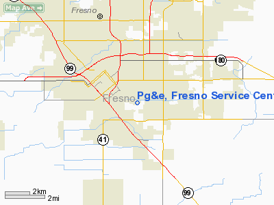
Pg&e, Fresno Service Center Heliport
Address:
Fresno County, CA
Tel:
209-263-7298
Images
and information placed above are from
http://www.airport-data.com/airport/CN34/
We
thank them for the data!
| General
Info |
| Country |
United
States |
| State |
CALIFORNIA
|
| FAA ID |
CN34
|
| Latitude |
36-43-09.818N
|
| Longitude |
119-45-35.513W
|
| Elevation |
289 feet
|
| Near City |
FRESNO
|
We don't guarantee the information is fresh and accurate. The data may
be wrong or outdated.
For more up-to-date information please refer to other sources.
|
|


