 |
|
|
|
|
|
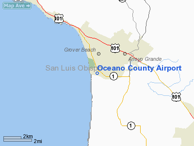
Location
& QuickFacts
|
FAA
Information Effective: |
2006-09-28 |
|
Airport
Identifier: |
L52 |
|
Longitude/Latitude: |
120-37-19.6150W/35-06-04.9130N
-120.622115/35.101365 (Estimated) |
|
Elevation: |
14 ft / 4.27 m (Surveyed) |
|
Land: |
58 acres |
|
From
nearest city: |
1 nautical miles W of Oceano, CA |
|
Location: |
San Luis Obispo County, CA |
|
Magnetic Variation: |
15E (1985) |
Owner
& Manager
|
Ownership: |
Publicly owned |
|
Owner: |
San Luis Obispo County |
|
Address: |
County Govt Cntr 460
San Luis Obispo, CA 93408 |
|
Phone
number: |
805-781-5200 |
|
Manager: |
Klaasje Nairne
COUNTY AIRPORT MANAGER LOCATED IN SAN LUIS OBISPO. |
|
Address: |
903-5 Airport Drive
San Luis Obispo, CA 93401 |
|
Phone number: |
805-781-5205
PHONE AT ARPT 805-473-2001 |
Airport
Operations and Facilities
|
Airport
Use: |
Open to public |
|
Wind
indicator: |
Yes |
|
Segmented
Circle: |
Yes |
|
Control
Tower: |
No |
|
Attendance
Schedule: |
ALL/WED-MON/0800-1700
ARPT UNATNDD TUESDAYS & CHRISTMAS DAY. |
|
Lighting
Schedule: |
DUSK-DAWN
ACTVT MIRL RY 11/29 - CTAF. |
|
Beacon
Color: |
Clear-Green (lighted land airport) |
|
Landing
fee charge: |
No |
|
Sectional
chart: |
Los Angeles |
|
Region: |
AWP - Western-Pacific |
|
Traffic
Pattern Alt: |
986 ft |
|
Boundary
ARTCC: |
ZLA - Los Angeles |
|
Tie-in
FSS: |
HHR - Hawthorne |
|
FSS
on Airport: |
No |
|
FSS
Phone: |
310-970-0102 |
|
FSS
Toll Free: |
1-800-WX-BRIEF |
|
NOTAMs
Facility: |
HHR (NOTAM-d service avaliable) |
|
Federal Agreements: |
NGY |
Airport
Communications
|
CTAF: |
122.700 |
|
Unicom: |
122.700 |
Airport
Services
|
Bottled
Oxygen: |
NONE |
|
Bulk
Oxygen: |
NONE |
|
Runway Information
Runway 11/29
|
Dimension: |
2325 x 50 ft / 708.7 x 15.2 m |
|
Surface: |
ASPH, Fair Condition |
|
Weight
Limit: |
Single wheel: 12500 lbs. |
|
Edge
Lights: |
Medium |
|
|
Runway 11 |
Runway 29 |
|
Traffic
Pattern: |
Right |
Left |
|
Markings: |
Basic, Fair Condition |
Basic, Fair Condition |
|
Runway
End Identifier: |
|
No |
|
Centerline
Lights: |
|
No |
|
Touchdown
Lights: |
|
No |
|
Obstruction: |
17 ft brush, 240.0 ft from runway, 130 ft right
of centerline, 2:1 slope to clear |
18 ft brush, 200.0 ft from runway, 125 ft left
of centerline |
|
Radio Navigation
Aids
|
ID |
Type |
Name |
Ch |
Freq |
Var |
Dist |
|
VBG |
TACAN |
Vandenberg |
059Y |
|
15E |
22.3 nm |
|
GLJ |
VOR |
Guadalupe |
|
111.00 |
16E |
10.2 nm |
|
MQO |
VORTAC |
Morro Bay |
071X |
112.40 |
16E |
11.3 nm |
|
PRB |
VORTAC |
Paso Robles |
090X |
114.30 |
16E |
34.3 nm |
|
FLW |
VORTAC |
Fellows |
122X |
117.50 |
16E |
37.2 nm |
|
GVO |
VORTAC |
Gaviota |
085X |
113.80 |
16E |
43.1 nm |
|
AVE |
VORTAC |
Avenal |
118X |
117.10 |
16E |
45.5 nm |
Remarks
- <
AND SOFT AREAS>
- RECURRING
FLOCKS OF WATERFOWL ON AND IN VICINITY OF AIRPORT.
- ULTRALIGHT
ACTIVITY ON & INVOF ARPT.
- BE
ALERT FOR KITES FLOWN ALONG BEACH 1/2 MILE WEST OF RY.
- TAXILANES
VERY NARROW NEAR BLDGS & PARKED ACFT.
- EXTREMELY
NOISE SENSITIVE ARPT & COMMUNITY; FOR TAKEOFF RY 29 PILOTS ARE REQUESTED
TO MAINTAIN RY HEADING UNTIL CROSSING THE SHORELINE.
Based Aircraft
|
Aircraft
based on field: |
27 |
|
Single
Engine Airplanes: |
24 |
|
Ultralights: |
3 |
Operational Statistics
|
Aircraft
Operations: |
193/Week |
|
General
Aviation Local: |
40.0% |
|
General
Aviation Itinerant: |
60.0% |
Oceano County Airport
Address:
San Luis Obispo County, CA
Tel:
805-781-5200,
805-781-5205
Images
and information placed above are from
http://www.airport-data.com/airport/L52/
We
thank them for the data!
| General
Info |
| Country |
United
States |
| State |
CALIFORNIA
|
| FAA ID |
L52
|
| Latitude |
35-06-04.913N
|
| Longitude |
120-37-19.615W
|
| Elevation |
14 feet
|
| Near City |
OCEANO
|
We don't guarantee the information is fresh and accurate. The data may
be wrong or outdated.
For more up-to-date information please refer to other sources.
|
|


