 |
|
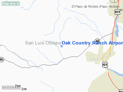
Oak Country Ranch Airport |
|
|
Location
& QuickFacts
|
FAA
Information Effective: |
2006-09-28 |
|
Airport
Identifier: |
33CL |
|
Longitude/Latitude: |
120-47-50.6340W/35-34-05.8970N
-120.797398/35.568305 (Estimated) |
|
Elevation: |
1200 ft / 365.76 m (Estimated) |
|
Land: |
0 acres |
|
From
nearest city: |
6 nautical miles SW of Paso Robles, CA |
|
Location: |
San Luis Obispo County, CA |
|
Magnetic Variation: |
15E (1985) |
Owner
& Manager
|
Ownership: |
Privately owned |
|
Owner: |
Robert O. Berg |
|
Address: |
5161 Vineyard Drive
Paso Robles, CA 93446 |
|
Phone
number: |
805-238-2401 |
|
Manager: |
Robert O. Berg |
|
Address: |
5161 Vineyard Drive
Paso Robles, CA 93446 |
|
Phone number: |
805-238-2401 |
Airport
Operations and Facilities
|
Airport Use: |
Private |
|
Wind indicator: |
Yes |
|
Segmented Circle: |
No |
|
Control Tower: |
No |
|
Attendance Schedule: |
UNATNDD |
|
Landing fee charge: |
No |
|
Sectional chart: |
Los Angeles |
|
Region: |
AWP - Western-Pacific |
|
Boundary ARTCC: |
ZOA - Oakland |
|
Tie-in FSS: |
HHR - Hawthorne |
|
FSS on Airport: |
No |
|
FSS Phone: |
310-970-0102 |
|
FSS Toll Free: |
1-800-WX-BRIEF |
Airport
Services
|
Airframe
Repair: |
NONE |
|
Power
Plant Repair: |
NONE |
|
Runway Information
Runway 17/35
|
Dimension: |
2200 x 50 ft / 670.6 x 15.2 m |
|
Surface: |
ASPH, |
|
|
Runway 17 |
Runway 35 |
|
Traffic
Pattern: |
Left |
Left |
|
Radio Navigation
Aids
|
ID |
Type |
Name |
Ch |
Freq |
Var |
Dist |
|
HGT |
NDB |
Hunter Liggett |
|
209.00 |
15E |
30.4 nm |
|
ROM |
VOR |
Priest |
|
110.00 |
16E |
35.0 nm |
|
GLJ |
VOR |
Guadalupe |
|
111.00 |
16E |
39.4 nm |
|
PRB |
VORTAC |
Paso Robles |
090X |
114.30 |
16E |
10.4 nm |
|
MQO |
VORTAC |
Morro Bay |
071X |
112.40 |
16E |
19.1 nm |
|
AVE |
VORTAC |
Avenal |
118X |
117.10 |
16E |
40.3 nm |
Remarks
- ESTABD
1963-14 MI W OF PASO ROBLES CO ARPT.
Based Aircraft
|
Aircraft
based on field: |
3 |
|
Single
Engine Airplanes: |
3 |
Oak Country Ranch Airport
Address:
San Luis Obispo County, CA
Tel:
805-238-2401
Images
and information placed above are from
http://www.airport-data.com/airport/33CL/
We
thank them for the data!
| General
Info |
| Country |
United
States |
| State |
CALIFORNIA
|
| FAA ID |
33CL
|
| Latitude |
35-34-05.897N
|
| Longitude |
120-47-50.634W
|
| Elevation |
1200 feet
|
| Near City |
PASO ROBLES
|
We don't guarantee the information is fresh and accurate. The data may
be wrong or outdated.
For more up-to-date information please refer to other sources.
|
|


