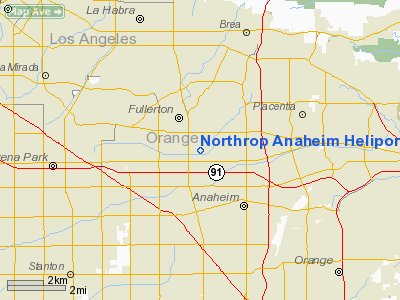
Northrop Anaheim Heliport |
Location
& QuickFacts
|
FAA
Information Effective: |
2006-09-28 |
|
Airport
Identifier: |
CN22 |
|
Longitude/Latitude: |
117-55-01.2150W/33-51-54.0530N
-117.917004/33.865015 (Estimated) |
|
Elevation: |
160 ft / 48.77 m (Estimated) |
|
Land: |
0 acres |
|
From
nearest city: |
0 nautical miles N of Anaheim, CA |
|
Location: |
Orange County, CA |
|
Magnetic Variation: |
14E (1985) |
Owner
& Manager
|
Ownership: |
Privately owned |
|
Owner: |
Northrop Corp |
|
Address: |
|
|
Manager: |
Ray Pollok |
|
Address: |
1 Northrop Ave 2860/65
Hawthorne, CA 90250 |
|
Phone number: |
310-332-5151 |
Airport
Operations and Facilities
|
Airport Use: |
Private |
|
Wind indicator: |
Yes |
|
Segmented Circle: |
Yes |
|
Control Tower: |
No |
|
Attendance Schedule: |
ALL/MON-FRI/0800-1700 |
|
Landing fee charge: |
No |
|
Sectional chart: |
Los Angeles |
|
Region: |
AWP - Western-Pacific |
|
Boundary ARTCC: |
ZLA - Los Angeles |
|
Tie-in FSS: |
RAL - Riverside |
|
FSS on Airport: |
No |
|
FSS Phone: |
951-351-3020 |
|
FSS Toll Free: |
1-800-WX-BRIEF |
Airport
Services
|
Airframe
Repair: |
NONE |
|
Power
Plant Repair: |
NONE |
|
Runway Information
Helipad H1
|
Dimension: |
80 x 50 ft / 24.4 x 15.2 m |
|
Surface: |
CONC, |
|
|
Runway H1 |
Runway |
|
Traffic
Pattern: |
Left |
Left |
|
Radio Navigation
Aids
|
ID |
Type |
Name |
Ch |
Freq |
Var |
Dist |
|
EMT |
NDB |
El Monte |
|
359.00 |
15E |
14.6 nm |
|
CPM |
NDB |
Compton |
|
378.00 |
15E |
16.5 nm |
|
SB |
NDB |
Petis |
|
397.00 |
14E |
29.8 nm |
|
PAI |
NDB |
Pacoima |
|
370.00 |
15E |
34.3 nm |
|
SJY |
NDB |
San Jacinto |
|
227.00 |
14E |
46.0 nm |
|
RIV |
TACAN |
March |
077X |
|
14E |
32.2 nm |
|
NFG |
TACAN |
Camp Pendleton |
055X |
|
13E |
44.3 nm |
|
RAL |
VOR |
Riverside |
|
112.40 |
15E |
23.9 nm |
|
HDF |
VOR |
Homeland |
|
113.40 |
14E |
36.9 nm |
|
ELB |
VOR/DME |
El Toro |
119X |
117.20 |
14E |
14.7 nm |
|
SMO |
VOR/DME |
Santa Monica |
045X |
110.80 |
15E |
28.3 nm |
|
VNY |
VOR/DME |
Van Nuys |
078X |
113.10 |
15E |
35.8 nm |
|
SLI |
VORTAC |
Seal Beach |
104X |
115.70 |
15E |
8.5 nm |
|
POM |
VORTAC |
Pomona |
041X |
110.40 |
15E |
14.4 nm |
|
PDZ |
VORTAC |
Paradise |
059X |
112.20 |
15E |
19.6 nm |
|
LAX |
VORTAC |
Los Angeles |
083X |
113.60 |
15E |
26.0 nm |
|
SXC |
VORTAC |
Santa Catalina |
051X |
111.40 |
15E |
38.7 nm |
|
OCN |
VORTAC |
Oceanside |
100X |
115.30 |
15E |
45.1 nm |
|
PMD |
VORTAC |
Palmdale |
092X |
114.50 |
15E |
46.6 nm |
|
SNA |
VOT |
Santa Ana |
|
110.00 |
|
11.6 nm |
|
LAX |
VOT |
San Pedro Hill |
|
113.90 |
|
22.1 nm |
Remarks
Based Aircraft
|
Aircraft
based on field: |
1 |
|
Helicopters: |
1 |
Northrop Anaheim Heliport
Address:
Orange County, CA
Tel:
310-332-5151
Images
and information placed above are from
http://www.airport-data.com/airport/CN22/
We
thank them for the data!
| General
Info |
| Country |
United
States |
| State |
CALIFORNIA
|
| FAA ID |
CN22
|
| Latitude |
33-51-54.053N
|
| Longitude |
117-55-01.215W
|
| Elevation |
160 feet
|
| Near City |
ANAHEIM
|
We don't guarantee the information is fresh and accurate. The data may
be wrong or outdated.
For more up-to-date information please refer to other sources.
|


